Just as the growing season ends along Interstate 95 from Monday morning’s sub-freezing temperatures, Mother Nature has tricks up her sleeves on Tuesday.
Low pressure pushing across the southern Plains will sweep into the D.C area just in time for the Tuesday evening commute. While the storm will be all rain for the Washington area, it’ll be a different story along and west of the Blue Ridge, where cold air will hang on as the moisture pushes into the region.
- Listen to WTOP online and on the radio at 103.5 FM or 107.7 FM.
- Weather forecast
- Closings and Delays
- Sign up for WTOP alerts
Snow accumulation will be entirely elevation-dependent with the storm. While pavement temperatures will be too warm for accumulation, the colder ridgetops along and west of the Blue Ridge, including Skyline Drive, Myersville, Camp David, Thurmont and Smithsburg, will see a quick half-inch to inch of snow on colder surfaces like the grass, cars, trees and sidewalks. Snow will change to freezing drizzle later in the evening and could create a thin layer of ice on colder surfaces.
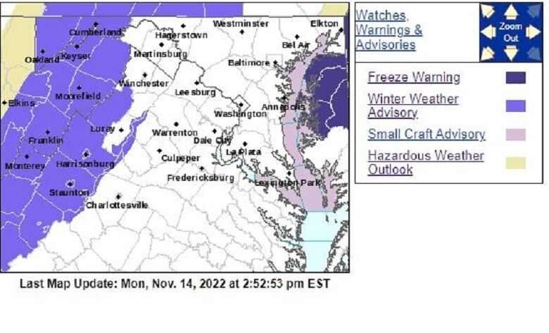
Winter Weather Advisories have been issued for the Virginia Blue Ridge and could be expanded north to include the Blue Ridge in Maryland later Monday. The snow accumulation will occur for a few hours centered around sunset in the mountains, before changing to freezing drizzle later Tuesday evening and ending by midnight. Fog could follow in the Blue Ridge through daybreak Wednesday.
The storm doesn’t look to be a repeat of the surprise snow that walloped the region exactly four years ago Monday. Northern Frederick County was buried under 8 to 9.5 inches of snow with light accumulation reported in Baltimore and Dulles International Airport.
Far western Maryland and Pennsylvania’s Laurel Highlands will accumulate a few inches of wet snow and even a glaze of ice Tuesday evening. D.C. motorists heading to places like Pittsburgh and Morgantown, West Virginia, should use extra caution and factor more time into travel plans.
Cloudy skies will linger into the Wednesday morning commute, but there won’t be any concern for the moisture on the roads to refreeze into black ice anywhere across the WTOP listening area.
The first inch of snow along the Blue Ridge historically accumulates in late November or early December.
Stay with WTOP for the latest information on the Tuesday storm.