While the recent weather pattern favors a mild streak of days across the D.C. area, a big hiccup will drive in the first real major chill and possibly even snow to areas more than 100 miles west of the region.
How unusual is snow in October in the Alleghenies and Great Lakes?
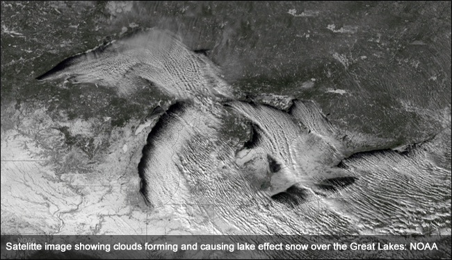
A sharp cold front on Monday will drive in gusty winds and falling temperatures with a real chill sweeping south from Canada into the Great Lakes and Mid-Atlantic to follow Tuesday and Wednesday. The cold air pushing across the warm Great Lakes, where water temperatures are in the upper 50s, helps fuel these bursts of snow.
The larger the temperature difference between the cold air mass and Great Lakes water temperature, the heavier the snow and longer the snow bands. By Wednesday, that temperature difference will be 36 degrees with air temperatures 5,000 feet up in the atmosphere cooling into the lower 20s.
While Washington will only see breezy, gusty winds behind the front Tuesday and Wednesday, the lake-effect snow will be cranking up in the Great Lakes.
The wind trajectory has to be just perfect for these snow bands to be carried into far Western Maryland. A northwest breeze does this trick and by Wednesday the atmosphere’s winds will have this alignment, so places like Oakland, Maryland, and even Pittsburgh will see the first snow of the season.
The heart of the lake-effect snow season is in November into December, but it’s definitely not unusual to see snow before Halloween.
In the northern Appalachians, October can be downright snowy. Elkins, West Virginia, had a whopping 18 inches in October just 10 years ago. Hurricane Sandy combined with a very cold air mass coming in from the Great Lakes to produce these historical October snowfall totals.
Just one year prior in 2011, a southern tracking storm had just enough cold air on its western fringe to accumulate an inch or two of snow in the Alleghenies.
Next week, Oct. 19 is looking the most likely for snow well west of Washington. Record snow accumulation for that particular day in the Alleghenies is 2.2 inches in 1972 with 3.2 inches on Oct. 19, 1930 for Erie, Pennsylvania.
The cold pattern won’t stick around. The snow will quickly melt next weekend with another pattern shift returning quite mild temperatures.