D.C.’s high temperatures haven’t passed the 100-degree mark in nearly six years. That may change this week.
Wednesday debuts what could be a five-day streak with heat indexes above 100 degrees. This rise in temperature follows on a heat wave that’s been creeping across the interior U.S. catches up with the East Coast.
According to the National Weather Service, Heat Warnings and Heat Advisories were in place Wednesday for parts or all of 28 states.
Excessive Heat Warnings and Heat Advisories are in effect this morning throughout 28 states, stretching from California to New Hampshire. High temperatures into the 90s and 100s will increase the risk of heat related illnesses. For heat safety tips, visit: https://t.co/L4FyvSS6lj pic.twitter.com/rFmVCKxDSV
— NWS Weather Prediction Center (@NWSWPC) July 20, 2022
It’ll feel oppressively hot, even without the humidity factor. With afternoon air temperature highs easily hitting the mid-to-upper 90s, there’s a chance we may pass 100 degrees, this week.
The last time that happened? Aug. 15, 2016.
“We haven’t had temperatures like this in years. In fact, the last time D.C. hit 100 degrees was mid-August of 2016. We could be close by this weekend,” said StormTeam4 meteorologist Lauryn Ricketts.
Even if it’s not the worst we’ve felt, Wednesday’s heat is serious and can be dangerous to some.
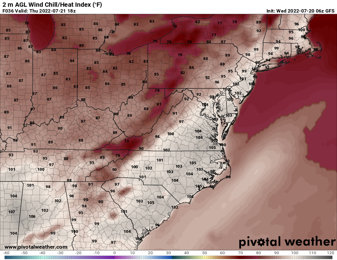
What we do know is that Wednesday’s heat index — a measure of what the temperature actually feels like when combined with humidity — will pass the 100-degree mark.
Believe it or not, it gets worse from there: Saturday and Sunday will likely be even more treacherous, with heat indexes approaching 110 in urban areas.
By Wednesday morning, the D.C. and Baltimore suburbs were already feeling temperatures in the low to mid 80s, so you can expect that by 3 p.m. (the hottest time of day during the summer), it will be really hot.
As of 11 AM, a number of locations have already reached the upper 80s. With the humidity, it feels more like the low/mid 90s. Today’s highs top out in the low/mid 90s. Hot weather continues into the weekend and early next week! #MDwx #VAwx #DCwx #WVwx pic.twitter.com/qg8CB1nj2p
— NWS Baltimore-Washington (@NWS_BaltWash) July 20, 2022
The outlook for the region is intense heat, humidity and dry weather. The region likely won’t get any cooling from rain until Thursday evening, but even then, it’ll be sporadic.
Dangerous heat continues to grip parts of the U.S. this week. With heat being the leading cause of weather-related fatalities, take a listen to some essential heat safety tips. Visit https://t.co/GxTrMXxNnT to learn more and help spread the word! pic.twitter.com/XLudM6H7Q2
— NWS Director (@NWSDirector) July 19, 2022
DC activates heat emergency
D.C. activates its Heat Emergency plan at 3 p.m. to help residents deal with the coming heat wave.
As a part of D.C.’s Heat Emergency order, cooling stations will open in the District. The centers come in the form of spray parks, pool centers, shelters and recreation centers. Person in need of transportation to cooling centers should call 202-399-7093 or dial 311.
Forecast:
Wednesday: Mostly sunny, hot and humid. Heat index around 100. Winds out of the southwest at 5 mph to 10 mph. Highs: 90 to 95.
Wednesday night: Mainly clear. Muggy. Fog in rural areas. Winds out of the southwest at 5 mph to 10 mph. Lows: 70 to 78.
Thursday: Hot and humid. Heat index of 98 to 102. Widely scattered afternoon storms. Chance of rain: 20%. Highs: 92 to 98.
Friday: Mostly sunny. Slightly less humidity. Hot and sunny, with highs in the mid 90s and heat indexes near 100.
Saturday: Sunny, and very hot. A stray storm possible. Highs in the mid to upper 90s. Heat indexes near 105.
Sunday: Dangerously hot and humid with a pop-up thunderstorm possible. Highs in the mid to upper 90s. Heat indexes 105 to near 110.
Current conditions:
WTOP’s Alejandro Alvarez contributed to this report.