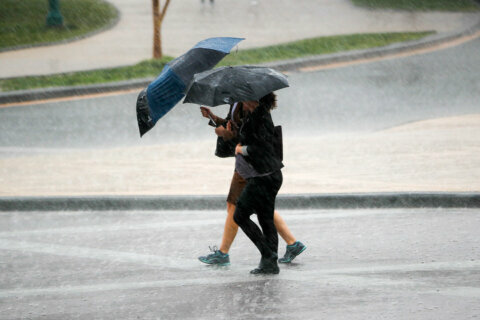
The D.C. region is facing wet and windy conditions Thursday, and temperatures are expected to plummet overnight into early Friday.
That could mean some areas seeing passing flurries Christmas Day.
A flash flood watch is in effect until 4 a.m. Friday.
Flooding will continue to be an issue Thursday night as rain continues. Storm Team4 Meteorologist Mike Stinneford said the atmosphere over the region is “unstable,” and the severe weather threat will continue until the cold front moves through the area after midnight.
Here’s what you need to know:
- Powerful gusts. With gusts potentially going over 50 mph at times overnight, Anne Arundel, Calvert and St. Mary’s counties in Maryland are under a wind advisory until 2 a.m. Friday.
- Possible tornado threat further south. Along with the stormy weather, Storm Team 4 meteorologist Chuck Bell said there is a tornado threat from Norfolk, Virginia, into the eastern half of North Carolina.
- Falling temperatures. Temperatures will be steady or falling throughout Christmas Day, going down well below freezing Friday night.
Bell said you may need to prepare your home as well before windy conditions really hit the area.
“This will be problematic for any holiday decorations on your home or lawn,” Bell said. “Secure loose items early today, or risk losing them to the wind.”
- Listen to WTOP online and on the radio at 103.5 FM or 107.7 FM.
- Current traffic conditions
- Weather forecast
- Closings and Delays
- Sign up for WTOP alerts
A powerful storm system and an arctic front are coming together, bringing rain throughout the evening with a risk of “strong to severe thunderstorms” until early Christmas morning, Stinneford said.
The strong front will start passing through the D.C. area, and as it goes through the region, temperatures will plummet through early Friday morning.
Radar loop showing rain moving into the region from the south. Bright colors show moderate to locally heavy rain. Flooding will be possible in rivers, streams, and low lying areas. pic.twitter.com/I0JAU6wo6J
— NWS Baltimore-Washington (@NWS_BaltWash) December 24, 2020
The region will see some relief over the weekend with sunny conditions but low temperatures in the 30s and 40s.
Forecast
Thursday evening until midnight — Rain, heavy at times with a possible thunderstorm. Windy and unseasonably warm. Temperatures in the upper 50s to near 60.
Overnight — Rain ending. Windy and turning sharply colder and drier. Scattered flurries.
Temperatures falling into the 40s.
Christmas Day/Friday — Mix of clouds and sun. Blustery and much colder. Passing flurries, especially in the morning. Temperatures gradually falling into the 30s.
Saturday — Mostly sunny. Brisk and cold. Highs in the mid- to upper 30s.
Sunday — Partly sunny. Brisk and chilly. Increased clouds in the afternoon. Highs in the mid-30s to low 40s.
Monday — Mostly cloudy. Highs in the upper 40s.