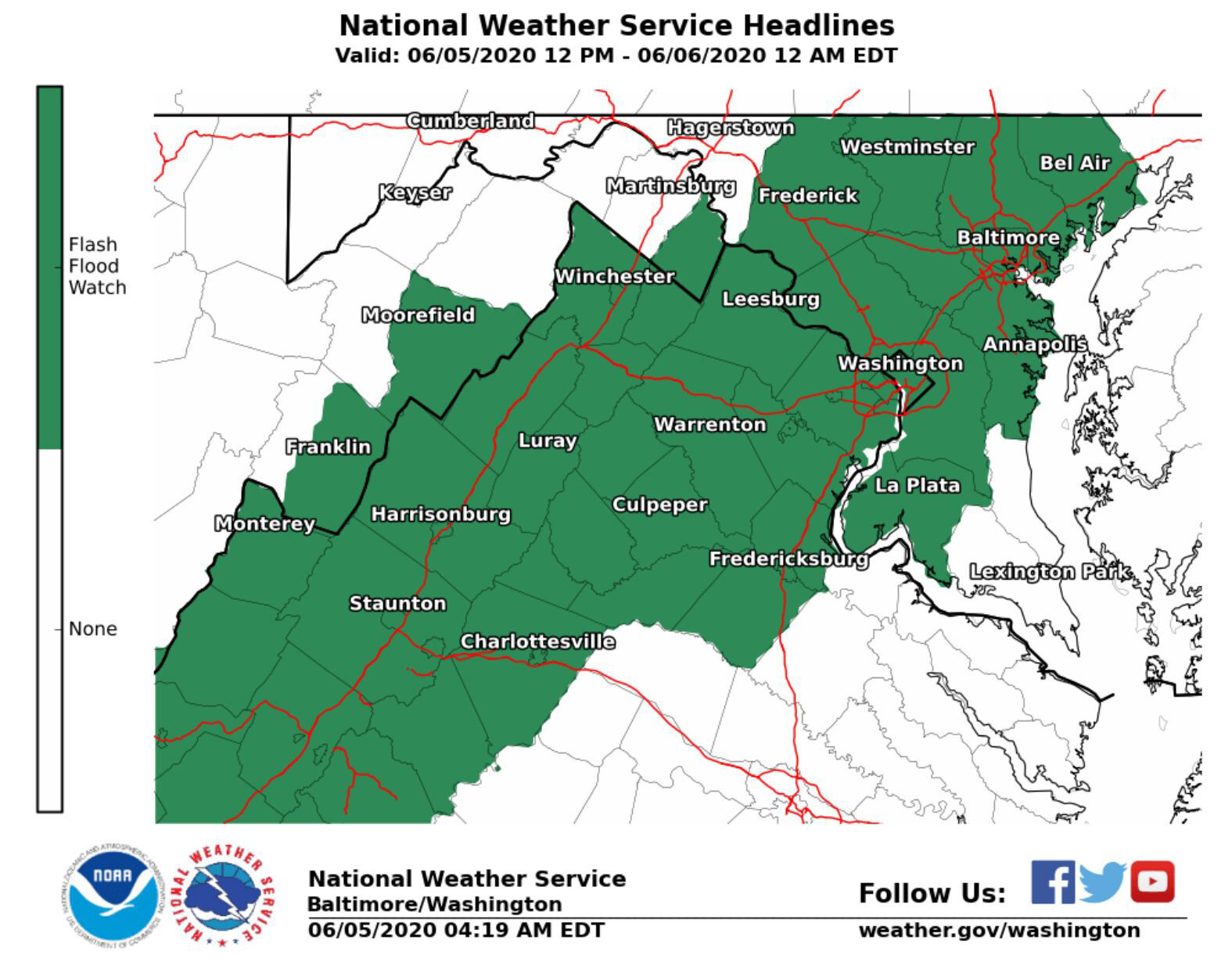
The National Weather Service’s Flash Flood Watch has been canceled early due to rain moving east out of the D.C. region, Storm Team4 meteorologist Mike Stinneford reported shortly after 9 p.m on Friday.
The Flash Flood Watch — which means conditions that can lead to flash flooding and create dangerous situations — was originally expected to go until midnight Friday for the D.C. area.
The region could see an additional 1 to 3 inches of rain, which could result in flooding.
Stinneford reported around 8 p.m. that the heaviest rain and wind was sweeping through southern Maryland, primarily from Prince George’s County to Calvert County, as well as portions of Charles and St. Mary’s counties, before heading out further east.
Parts of NW are also under watch, with Stinneford reporting that Rock Creek is rising out of its banks and could affect travel on the Rock Creek and Potomac Parkway.
Sligo Creek, right outside of D.C’s NE border in Maryland, may also stay in the flood stage for a more hours, Stinneford reported.
The National Weather Service said that Seneca Creek near Dawsonville, Maryland in Montgomery County is under flood watch as well.
However, Stinneford said the downpour is tapering off elsewhere in the region.
Heavy rain had been expected Friday afternoon and evening, according to Storm Team4 meteorologist Matt Ritter.
Storm Team4 meteorologist Mike Stinneford warned earlier that there could be a rapid intensification of thunderstorms, with highs winds and flooding rains over D.C.
Strong storms pushed through the region Thursday night, bringing down tree limbs and power lines and leaving thousands of people without power Friday morning.
- Listen to WTOP online and on the radio at 103.5 FM or 107.7 FM.
- Current traffic conditions
- Weather forecast
- Sign up for WTOP alerts
Thursday’s storms came as protesters marched through D.C. streets for the seventh straight day.
Two members of the military were struck by lightning by the Lafayette Square Park perimeter near the White House shortly after midnight, according to D.C. Fire and EMS’ Twitter account.
Both were transported to the hospital with non life threatening injuries.
Shortly after midnight, #DCsBravest received a call for a report of 2 military personnel suffering the effects of a nearby lighting strike within the Lafayette Park perimeter. Both were transported with non life threatening injuries. pic.twitter.com/JvwRIHk74k
— DC Fire and EMS #StayHomeDC (@dcfireems) June 5, 2020
Winds broke off several tree branches near the National Mall and a fallen tree in Annandale brought down several power wires, WTOP Dave Dildine’s reports.
The road between the Capital Beltway and Queensberry Avenue was closed for about an hour.
Several traffic issues persisted throughout the night, including a truck overturned on Interstate 270 near Urbana, Maryland.
Northbound lanes between Maryland Routes 109 and 80 were closed due to the crash.
Forecast
FRIDAY: Mostly cloudy. Warm and humid. Scattered thunderstorms developing in the late afternoon into the evening. Some storms could have some torrential downpours.
Highs: low to mid 80s.
FRIDAY NIGHT: Scattered thunderstorms ending. Warm and muggy. Patchy fog.
Lows: upper 60s to low 70s.
SATURDAY: Mostly cloudy early. Gradual clearing. Unseasonably hot but becoming breezy with lowering humidity.
Highs: upper 80s to low 90s.
SUNDAY: Mostly sunny. More seasonable and much more comfortable.
Highs: upper 70s to low 80s.
MONDAY: Mostly sunny. Seasonable, pleasant, and comfortable.
Highs: low 80s.
WTOP’s Dave Dildine and Matthew Delaney contributed to this report.