
Showers and thunderstorms will sweep across the D.C. region on Wednesday evening and into the early morning hours of Thursday, with a potential for ice to cause more problems in the overnight.
Forecasters say much of the region can expect showers and some thunderstorms until around 1 a.m. Thursday. A cold front sweeping in from the interior could spark strong thunderstorms with damaging winds and heavy rainfall.
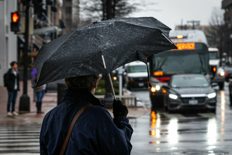
If you’re out on the road and encounter low visibility from rain or fog, remember: Use low-beam headlights, reduce your speed and increase following distances.
Stay weather-aware this evening pic.twitter.com/uM1NkhQcKP
— NWS DC/Baltimore (@NWS_BaltWash) February 26, 2020
Here’s what you need to know:
- Severe storms (yes, in February) — A line of storms may bring damaging winds this evening, reaching Interstate 95 between 8 p.m. and 11 p.m.
- Temperatures will dive — A cold front will bring winter back into the region Wednesday night, with wind chills at or below freezing Thursday.
- Tough time on the roads — On Wednesday, drivers will face fog and rain. On Thursday morning, it’ll be black ice and new potholes.
- Listen to WTOP online and on the radio at 103.5 FM or 107.7 FM.
- Current traffic conditions
- Weather forecast
- Closings and Delays
- Sign up for WTOP email alerts
- Get custom alerts with the WTOP app for Apple and Android phones
Severe storms will be moving east in a line from Interstate 81 from 6 p.m. to the Baltimore-Washington corridor around 9 p.m.
“A powerful storm moving though the Ohio Valley today and heading into New England tomorrow will bring us a very active weather day,” Storm Team4 meteorologist Chuck Bell said. “Once you are home this evening, be sure to secure any loose items outside, like trash cans, because the wind will be blowing hard for the rest of the night and all day tomorrow.”
Forecast models called for a line of storms to bring potentially damaging, straight-line winds over portions of Southern Maryland to Central Virginia.
Heavy rain and plummeting temperatures on Wednesday night might lead to a different set of problems for Thursday’s commute. Bell said an icy wind could contribute to patches of black ice from Thursday all the way through the weekend. Thursday’s high temperature will occur before sunrise, with winds of between 20 and 30 mph making for a more typical winter feel.
Forecast
Wednesday: Cloudy and mild. Intermittent showers, then steadier rain after dark. Highs in the mid to upper 50s.
Wednesday night: Heavy rain before midnight, tapering off before sunrise. Locally strong storms possible. Temperatures fall to the low 40s.
Thursday: Partly cloudy and blustery. Turning cooler, with wind chills near freezing. Highs in the low to mid 40s.
Friday: Partly to mostly cloudy. Breezy and cold. Highs in the upper 30s to low 40s.
Saturday: Partly to mostly sunny. Breezy at times. Highs in the mid 30s to low 40s.
Current conditions
WTOP’s Zeke Hartner contributed to this report.


