We’re used to layering up during the winter months in the Washington area — but an outlook report from the National Oceanic and Atmospheric Administration says it won’t be as frigid overall this year.
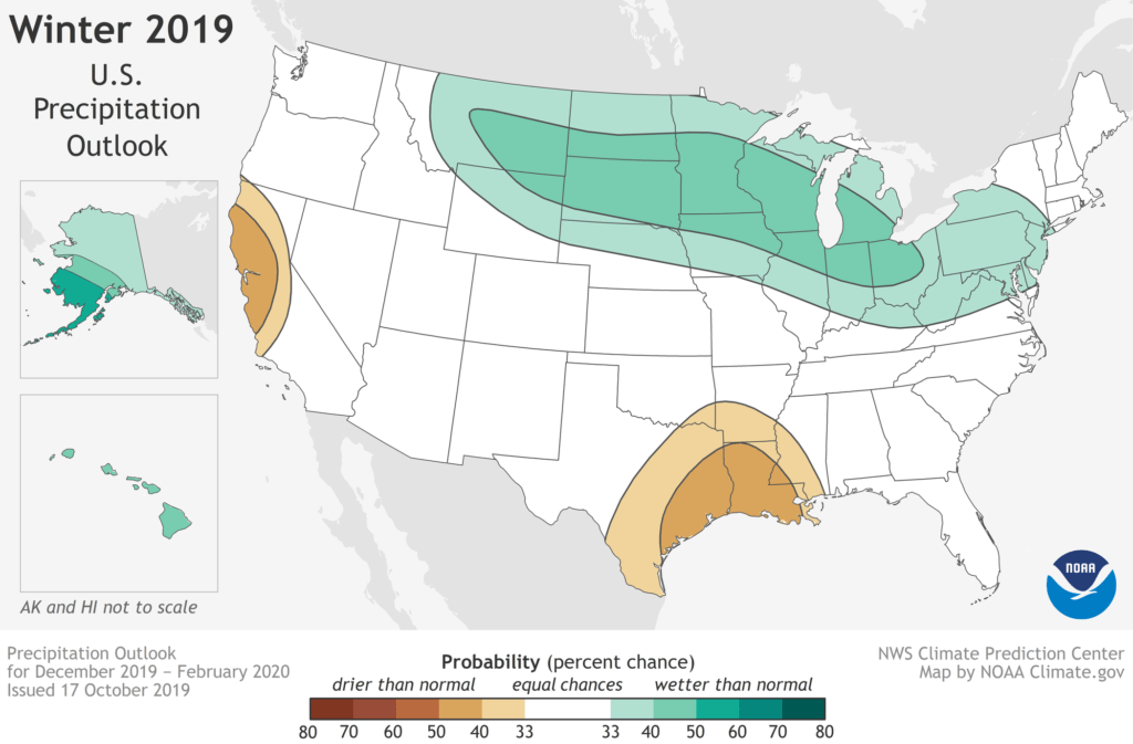
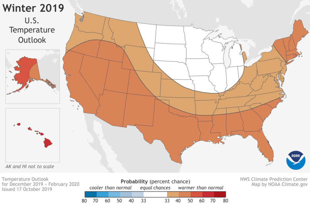
NOAA’s Climate Prediction Center is expecting warmer-than-average temperatures across most of the U.S. from December to February. It’s also going to be wetter through the start of spring.
While more neutral weather conditions are expected, there’s still a chance for some wild swings.
“Without either El Nino or La Nina conditions, short-term climate patterns like the Arctic Oscillation will drive winter weather and could result in large swings in temperature and precipitation,” Mike Halpert, deputy director of NOAA’s Climate Prediction Center, said in the report.
The report notes that wetter-than-average conditions are likely for the Mid-Atlantic, covering the WTOP listening area, as well as the Northeast, portions of the Northern Plains, Upper Mississippi Valley, the Great Lakes, Alaska and Hawaii.
The increased precipitation should help ease the drought conditions that roughly 20% of the U.S. is facing.

At the same time, a huge swath of the country will likely see warmer-than-average conditions.
And not a single section of the U.S. is favored to have below average temperatures this winter, according to the outlook report.

If you’re wondering about projected snow totals, well, time will tell.
“The outlook does not project seasonal snowfall accumulations as snow forecasts are generally not predictable more than a week in advance,” the report reads. “Even during a warmer-than-average winter, periods of cold temperatures and snowfall are expected.”
Stay on top of the latest at the WTOP Weather Center.
NOAA’s seasonal outlooks, updated every month, are designed to help communities prepare far ahead of time for whatever weather conditions they may face. The next update is scheduled for Nov. 21.


