
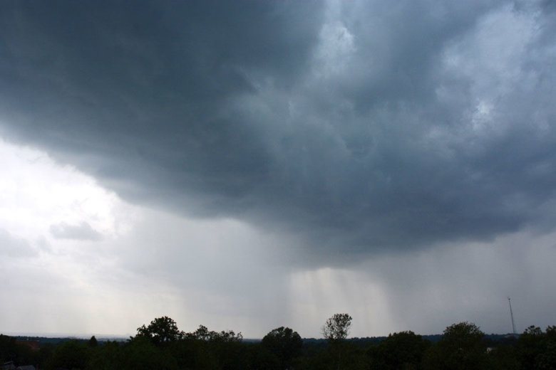
After a weekend of thundershowers, strong storms will make another pass through the D.C. area Monday afternoon, bringing with them the risk of flash flooding, small hail and damaging winds.
What forecasters are calling a tropical air mass means Monday’s storms have a chance for torrential downpours. Northern and central Maryland have the greatest risk for flash flooding.
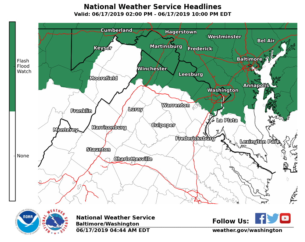
Rain is expected to start between 1 p.m. and 4 p.m. with a chance for multiple rounds of slow-moving thunderstorms. A flash flood watch is in effect for most of Northern Virginia, Maryland and D.C. from 2 p.m. to 10 p.m. Monday.
- Listen to WTOP online and on the radio at 103.5 FM or 107.7 FM.
- Current traffic conditions
- Weather forecast
- Sign up for WTOP alerts
“There have been thunderstorms overnight in West Virginia so our chances for storms will come a bit earlier in the day than you might expect,” NBC Washington Storm Team4 Meteorologist Chuck Bell said.
“Our latest forecast models indicate storms possibly as early as 1 p.m. and hanging around into the evening.”
The National Weather Service’s Storm Prediction Center has the entire D.C. area under what it calls a slight risk for severe thunderstorms — the second of five ranks for severe weather threats, from marginal to high.
A stalled front and a passing disturbance, combined with a tropical air mass, will result in a risk of severe storms and flooding rains today. A slight risk of severe weather exists across much of the region, and flash flood watches are also in effect. pic.twitter.com/1JZdFLwvtv
— NWS DC/Baltimore (@NWS_BaltWash) June 17, 2019
Flooding will be the biggest threat from these storms, especially given the potential for multiple cells to pass over the same areas in a matter of hours.

“There is potential for showers to move repeatedly over the same areas and to produce intense rainfall rates in a short period of time that may lead to flash flooding,” the National Weather Service said in its Monday forecast discussion.
“The greatest risk of flash flooding is along the Mason Dixon line, but could extend far enough south into the highly urbanized areas.”
Aside from flooding, the atmosphere is primed for damaging winds and isolated hail in the some of the stronger storm cells that could pop up this afternoon.
Rain will stay in the forecast through Tuesday well into Wednesday, with thunder and otherwise muggy conditions expected both days in the afternoon hours.
Forecast:
Monday: Becoming mostly cloudy through the morning. Stormy afternoon, severe risk. Highs in the upper 80s to low 90s. Chance of rain: 70%
Monday night: Mostly cloudy and muggy, with lingering showers tapering off. Lows in the mid 60s. Chance of rain: 30%
Tuesday: Mostly cloudy, warm and humid. Afternoon storms expected. Highs in the mid to upper 80s. Chance of rain: 70%
Wednesday: Mostly cloudy, warm and humid. Rain and thunder still likely. Highs in the upper 70s to mid 80s. Chance of rain: 60%
Thursday: Mostly cloudy. Afternoon storms expected. Highs in the low to mid 80s. Chance of rain: 50%