WASHINGTON — While the D.C. area doesn’t have to worry about additional snowfall (for a few days at least), subfreezing temperatures after dark will make for dicey travel overnight and into Tuesday morning’s commute.
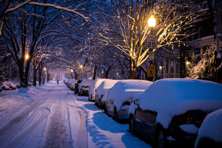
The winter storm that swept through the D.C. area over the weekend wreaked havoc on roadways and spurred rounds of cancellations, closures and delays. In some parts of the region, the storm’s impact will even stretch into Tuesday.
- Listen to WTOP online and on the radio at 103.5 FM
- Current traffic conditions
- Weather forecast
- Closings and delays
- Sign up for WTOP alerts
Thankfully, the area has had a chance Monday to dig out a bit with a little help from Mother Nature: Daytime temperatures climbed into the mid- to upper 30s, melting away some snow. However, Monday’s sunset will push temperatures back into the 20s — and everything that melted will freeze again.
In other words: Look out for black ice.
“That additional slush will refreeze as temperatures dip down into the low to mid-20s overnight tonight,” Storm Team4 Meteorologist Matt Ritter said, “and that means more problems for first thing Tuesday morning.”
Be wary of bridges, overpasses, ramps and shaded areas. Secondary roads might be rough, too. If it looks wet, it could be dangerous.
“Slick road conditions will be possible, especially on secondary routes carrying less traffic, and on hills and curves,” the Virginia Department of Transportation said in a statement Monday afternoon.
Temperatures will continue to fluctuate above and below freezing the next few days, Ritter said.
“More sunshine on Tuesday means back up to near 40 degrees,” Ritter said. “Even more melting but below freezing Tuesday night means another refreeze. Back into the low 40s on Wednesday, with lots more sunshine so even more melting, but Wednesday night will probably stay above freezing.”
More on the way
The D.C. region hasn’t seen the last of the snow, either. More wintry weather is on the horizon for Thursday, Friday and the weekend.
This week could see impacts from two more storm systems — Acts 2 and 3 of what Ritter called an “active pattern” of low-pressure systems moving through a freezing air mass descending from subarctic Canada.
The first, due to arrive on Thursday night into Friday morning, will most likely start as rain and transition to snow. Ritter noted that any rain that falls could easily freeze and cause problems on roadways.
Yet another weekend storm is looking to be the larger of the two. Timing and snow totals are still unclear this far out, but Monday morning’s run of the GFS forecast model suggested that Maryland, D.C. and northern Virginia could see several more inches of snow or a wintry mix from Saturday night through Sunday. Stay tuned.
Digging out
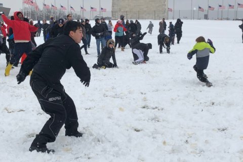
D.C.-area residents spent Monday digging out after the record-setting winter storm, which dropped nearly a foot of snow.
See the latest snow totals in the D.C. area.
Both Reagan National and Dulles International airports saw daily snowfall records broken on Sunday, with Reagan’s 8.3 inches beating the old record of 6.4 inches set in 1982. Dulles saw 7.7 inches, beating its own record of 6 inches set in 1964.
Anybody tuning into weather forecasts early Friday might have been surprised to find around a foot on the ground Monday morning. Late Friday, impact forecasts quickly trended higher once it became obvious the atmosphere would be more unstable than first thought.
“The least likely but still possible scenario ended up happening,” Ritter said. “It did become apparent Friday night into Saturday morning that’s what was going to occur, so Storm Team4 upped the accumulation forecast and impacts for the weekend.”
Related Gallery
Road conditions
All that snow, plus a drop in temperature, contributed to icy conditions Monday morning. But crews were doing their part to improve things.
“We’re making great progress,” VDOT’s Ellen Kamilakis told WTOP’s Dimitri Sotis and Shawn Anderson late Monday afternoon.
“The roads are really in great condition. … We are working pretty ahead of schedule. The interstates are great. The primaries are great, even our high-volume secondaries. The crews have been focusing on subdivisions today, and they will continue throughout the night and into the day tomorrow as needed.”
That includes mitigating the effects of the refreeze on a bridge or overpass, which don’t have the heat of the earth to keep ward off slick conditions.
“If we know something is a trouble spot … crews — even if we consider it done — are going to go back out there and either put more salt down or are going to put sand in certain areas for traction,” Kamilakis said.
John Schofield of the Maryland State Highway Administration said drivers need to do their part by driving defensively. Go slow, he told WTOP listeners — and clean off all the snow and ice before you start moving.
“If you haven’t been out in a couple of days, you’ve got a pretty good layer of snow on the top of your car,” he said. “That’ll become a projectile if you don’t brush it off.”
Earlier Monday, more accidents related to poor road conditions occurred in Maryland than Virginia. WTOP reporter Melissa Howell noted slippery surfaces and slush on parts of I-270 and I-495 in Montgomery County.
Schofield noted that neighborhood roads were more likely to ice over than the region’s larger highways. “It’s a good thing that a lot of schools are canceled,” he said. “It has given us a little more time to make the network as safe as it can be.”
According to Maryland State Police, snow emergency plans remained in effect for the following counties as of 12:45 p.m.: Allegany, Frederick, Calvert, Charles, Howard, Montgomery, Prince George’s and Worcester.
Monday mass-transit impacts
WMATA offered limited Metrobus service Monday (but will resume full Metrobus service on Tuesday). Metrorail service Monday was not impacted by the weather. MetroAccess ran as usual but with delays.
Fairfax Connector operated on a Saturday schedule. Virginia Railway Express Service was suspended for the day. MARC Trains ran Monday on an R schedule. Virginia Regional Transit service began after 12 p.m. PRTC OmniRide commuter bus service was suspended.
As of late Monday afternoon, no transit agencies had announced any further service changes for Tuesday.
Forecast
Temperatures are expected to warm by midweek, melting down the snow.
MONDAY NIGHT: Mainly clear and cold with icy spots. Refreeze on the roads and sidewalks.
Lows: low to mid-20s in suburbs; upper 20s in D.C.
TUESDAY: Mostly sunny but cold.
Highs: around 40.
WEDNESDAY: Partly sunny and seasonable.
Highs: low to mid-40s.
THURSDAY: Mostly cloudy but still cold. Chance of wintry mix late in the day.
Highs: mid- to upper 30s.
FRIDAY: Chance for some rain or snow very early. Mostly cloudy and not as cold.
Highs: low to mid-40s
Current conditions
WTOP’s Tiffany Arnold and Dick Uliano contributed to this report.