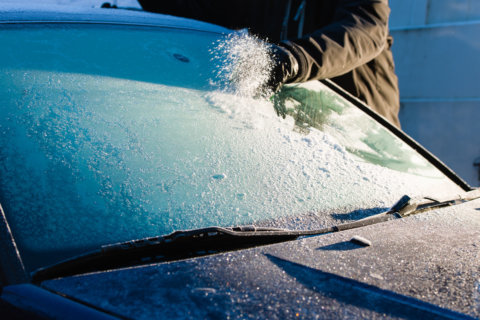

WASHINGTON — It might not be winter quite yet, but frost and freeze conditions are slowly creeping into the capital region, with some areas likely to see their first frost early Friday.
The National Weather Service has placed the entire D.C. region under a Frost Advisory until 9 a.m. Friday. Forecasters said much of Virginia and Maryland can expected temperatures to dive into the 30s — enough to threaten sensitive plants, which can be killed if left uncovered or not brought indoors.
The culprit: Clear skies, light winds and a growing region of high pressure parked over southeastern Canada. Larger cities could stick to the low 40s, but there’s a good chance most suburbs and rural areas are in for a frosty start to Friday.
“Frost is likely overnight for most areas with exceptions being in downtown Washington and Baltimore, along open ridge tops and along the shore of the Bay,” forecasters said on Thursday. “Some sheltered valleys or rural areas may drop below freezing as well, especially west of the Blue Ridge Mountains.”
Areas farther west along the Interstate 81 corridor can expect a deeper freeze. For those regions, a Freeze Warning is in effect, meaning that damaging conditions for crops and tender plants are a virtual certainty.
Frost and freeze conditions are expected across much of the area tonight. Lows will be in the 30s, except some lower 40s in the urban centers and near the bayshore. Protect any tender vegetation. pic.twitter.com/zHV3js68Cw
— NWS DC/Baltimore (@NWS_BaltWash) October 18, 2018
The cold won’t last long at all, though, with a quick snap back to warmer temperatures through Friday morning. Friday will see temperatures in the mid to upper 60s for much of the area, and this weekend will generally see milder daytime temperatures, giving way to cooler lows overnight.
“Saturday will likely be the better day for the pumpkin patch, but grab the raincoat just in case,” NBC Washington meteorologist Amelia Draper said. “If you’re heading to the Redskins game, I’d grab the puffy coat, with temperatures in the 40s and 50s. If you’re heading out to the mountains this weekend, expect low to moderate fall foliage colors.”
Forecast:
Friday: Mostly sunny, pleasantly cool. Chance of showers in the evening. Highs: Low to mid 60s.
Friday night: Lows 47 to 54.
Saturday: Light rain in the morning. Passing showers in the evening. Highs: Mid 60s.
Sunday: Mostly sunny, windy. Winds out of the Northwest 15 mph to 30 mph. Frost possible overnight. Highs: 45 to 53.
Monday: Mostly sunny and pleasant after a chilly start. Highs: 52 to 58.


