WASHINGTON — There won’t be any fun in the sun this Labor Day weekend.
Storm Team4 meteorologists are predicting mostly cloudy skies for the next several days along with oppressive humidity and heat. For Friday and Saturday, storms are popping up around the region and the tropical moisture will stay in place well into next week with rain chances gradually decreasing as Sunday and Monday arrive.
The National Weather Service issued a flash flood warning for areas in the City of Alexandria and Fairfax County until 3 a.m.
Flood warnings are in effect for areas in Arlington and Fairfax counties and the City of Falls Church in Virginia until 3:45 a.m.
A flash flood warning had been issued until midnight for areas in Anne Arundel County, Baltimore County and the City of Baltimore but was canceled early just after 10:30 p.m.
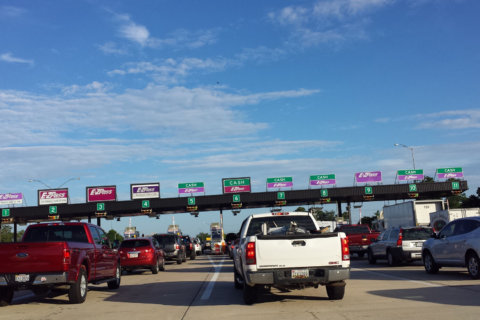
On Interstate 395 in Virginia, traffic was stopped on the southbound HOV and main lanes due to deep water and flooding.
I-395 DUKE ST TO EDSALL ROAD
HOV & Main Lanes Stopped by
DEEP WATER!#dctraffic #vatraffic— WTOP Traffic (@WTOPtraffic) September 1, 2018
The added cloud cover will keep afternoon highs in the mid-80s on Saturday, and though rain will be possible in the D.C. area at any time, it will be most likely in the afternoon and early evening hours.
In addition to the heat and humidity, the National Weather Service has issued a Flash Flood Watch in effect for the greater D.C. area until midnight.
Nearly stationary storms dropping lots of rain on the region, especially in Howard County where there have been reports of several road closures. PLEASE do NOT drive across flooded roads. Many more possible heading into the afternoon/evening pic.twitter.com/U8rCqqvYI5
— Lauryn Ricketts (@laurynricketts) August 31, 2018
Labor Day is expected to be the best weather day of the weekend with mostly sunny skies, highs in the 90s and only a small chance of showers at night.
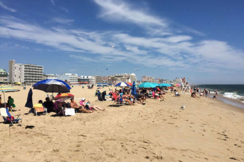
If you are heading to the beaches, there’s a 60 percent chance of rain from Ocean City to Rehoboth with highs in the upper 70s. It will be somewhat showery on Saturday with highs near 80 and mainly dry and sunny for Sunday and Monday with highs in the low 80s and overnight lows in the mid 70s each night.
If you are heading to the mountains for the weekend, rain chances will be highest Friday and Saturday with afternoon highs in the upper 70s. Sunday and Monday will be warmer and dryer with highs in the low 80s and overnight lows in the mid 60s.
Current conditions:
Forecast:
- Friday night: Mostly cloudy, warm and muggy with scattered showers possible. Lows: 68- 73
- Saturday: Mostly cloudy, warm and humid with some showers in the morning. Highs: 84- 88
- Sunday: Partly cloudy, hot and humid with scattered thundershowers later in the day. Highs: 85 – 90
- Monday/Labor Day: Partly cloudy, hot and humid with isolated showers possible. Highs: 86 – 91
Get the latest from the WTOP Weather Center.
Get the latest on road conditions from the WTOP Traffic Center