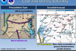
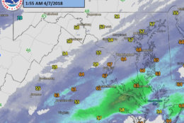
Some light snow is likely falling over the higher elevations (i.e. Blue Ridge & Appalachians) with temperatures in the mid to upper 30s. Any accumulation will only be on grassy surfaces. pic.twitter.com/6TapxKBVAu
— NWS DC/Baltimore (@NWS_BaltWash) April 7, 2018
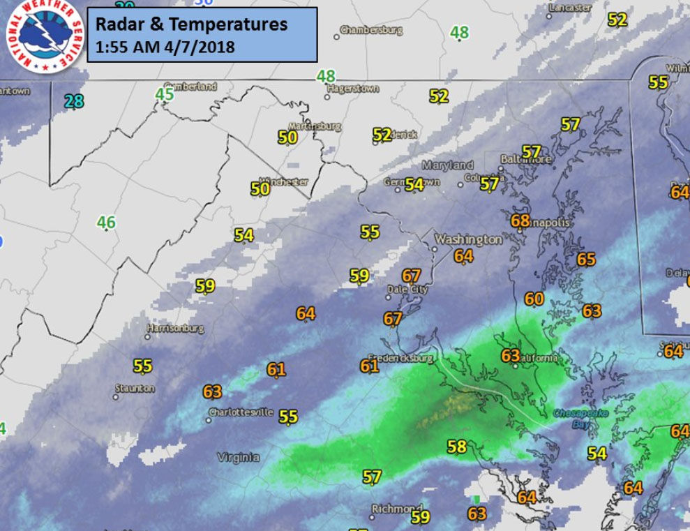
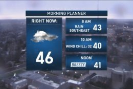
Rain around DC and points to the southeast this morning. A little breezy through the day meaning wind chills in the lower 30s as temperatures fall throughout the morning hours. The latest on the rain/wet snow through 9:30 on @nbcwashington & @WTOP pic.twitter.com/UxNEci3lxW
— Lauryn Ricketts (@laurynricketts) April 7, 2018
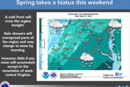

WASHINGTON — April showers brought some snowflakes to the D.C. area Saturday afternoon, as a cold front crosses the region.
But the National Weather Service said the little snowfall is “evaporating before reaching the ground.”
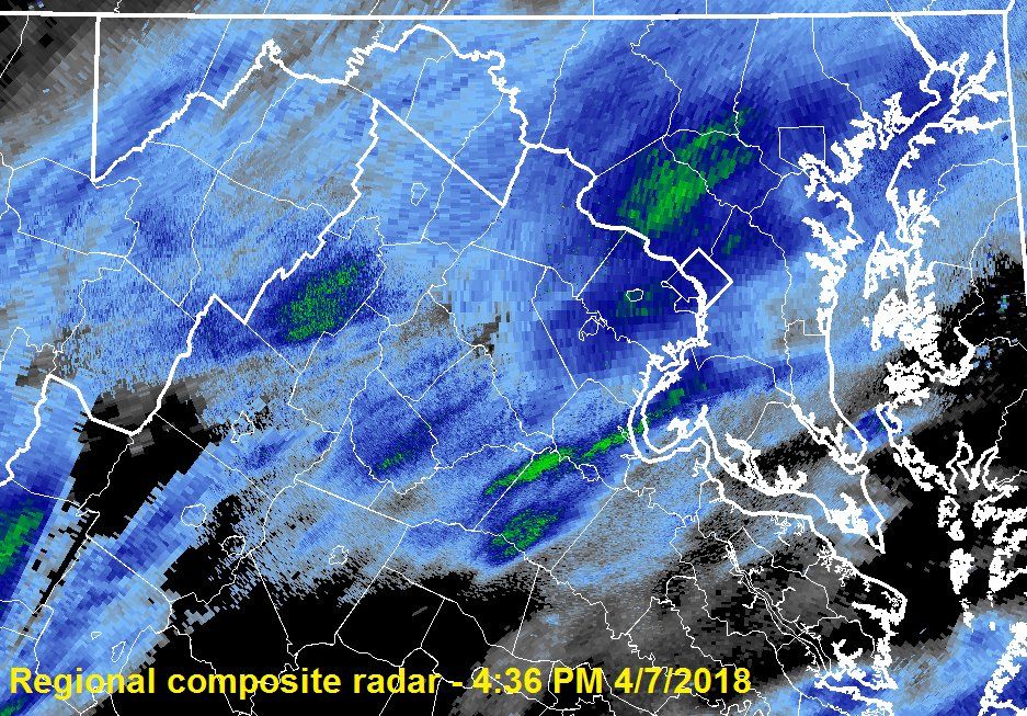
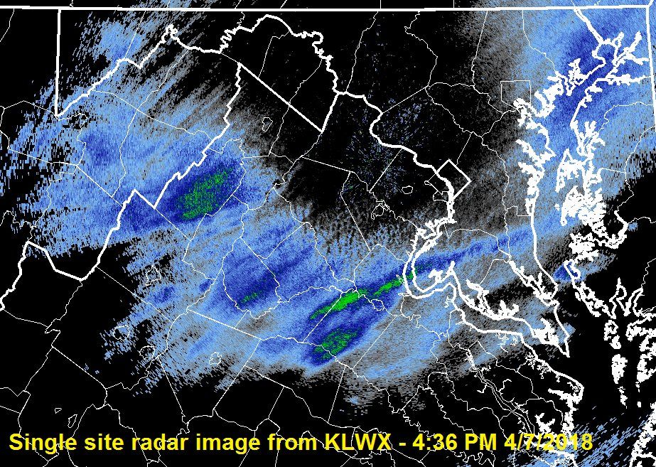
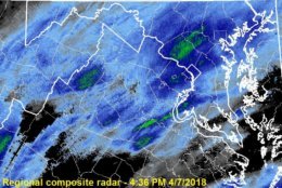
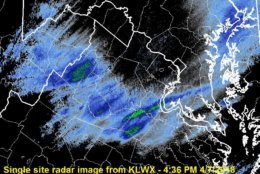
Does the sky look “heavy”, as if something may be falling from the clouds? There is! Regional composite shows snow falling over the metro, but the local radar at our office shows it evaporating before reaching the ground – “Virga” pic.twitter.com/20611exQch
— NWS DC/Baltimore (@NWS_BaltWash) April 7, 2018
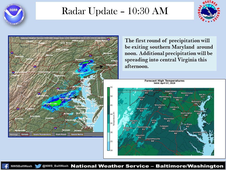
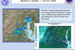
Saturday morning saw a first round of rain and snow that exited the area at around 10:30 a.m., according to the National Weather Service.
Most afternoon precipitation was in Central Virginia to southern Maryland.
The region could still see a few flakes, flurries and raindrops during the rest of the day, but Storm Team 4’s Somara Theodore said it should start to clear up as we enter the overnight hours.
The biggest “threat” of the weekend will be the odds of a hard freeze Sunday morning. Cherry Blossoms do not fare well below freezing and most areas will be in the upper 20s to 30s overnight and Sunday morning, said Theodore.
Here is the forecast for the next few days
- Sunday: Mostly sunny. Highs in the mid to upper 40s.
- Monday: Cloudy and wet. Rain in the morning with chance of snow. Highs in the mid to upper 40s.
Current conditions
The D.C. area has seen snow in April before but it is relatively rare.
Measurable snow has only been recorded three times in the last 50 years at Reagan National Airport, most recently on April 7, 2007. The area also had previous bouts of April snow in 1990 and 1972.
The latest major snowfall of the year, meaning 4 inches or more, for the D.C. region happened during the April Fools’ Day Storm in 1924.
D.C. got 5 inches of snow. Baltimore got more than 9 inches.
The National Weather Service said the latest snow has fallen in the year for the D.C. area was on April 28, 1898 when half an inch fell in D.C. and .1 inches fell in Baltimore.
The latest snow was seen in D.C. was on May 10, 1906 when a trace fell.