Marooned motorists, transport woes after morning floods in DC area

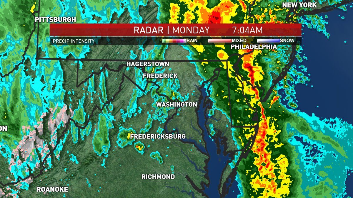
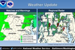
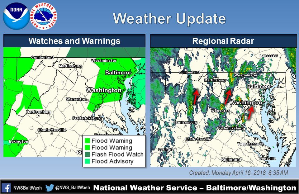
Flood watches and warnings updated by the National Weather Service Baltimore/Washington.
Emergency management officials reported flooding in several locations in Northwest D.C. and eastern Montgomery County. More moderate to heavy rain is moving into this same area which could prolong the flood concerns, according to the National Weather Service. (WTOP/Neal Augenstein)
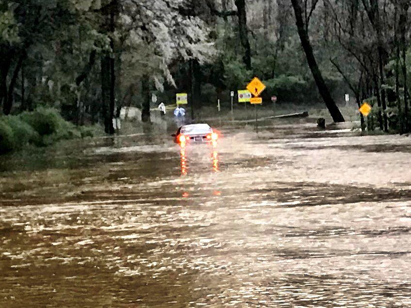
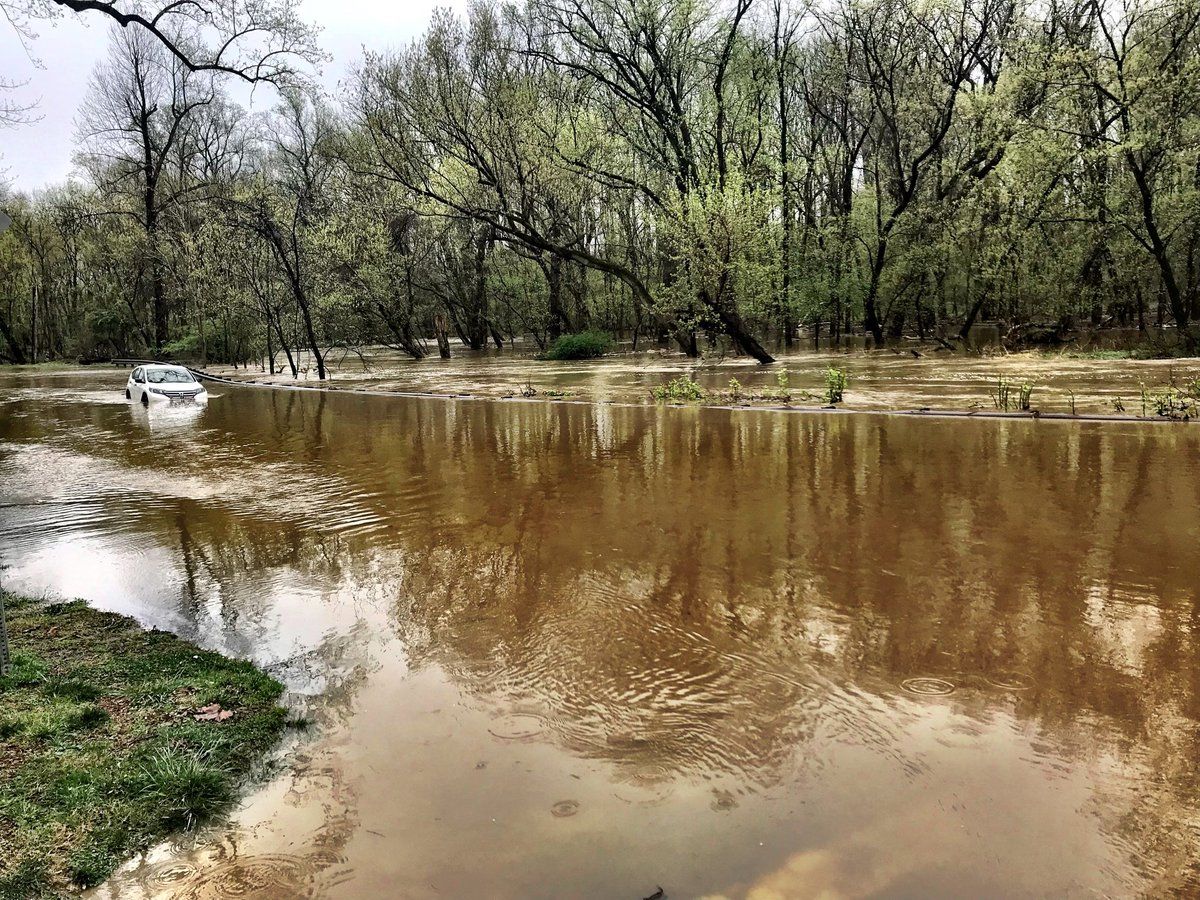
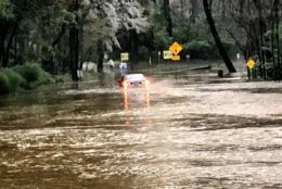
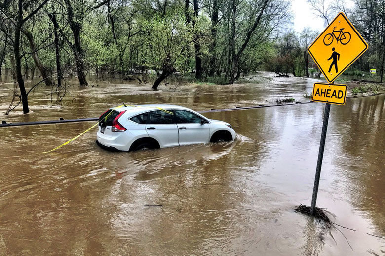
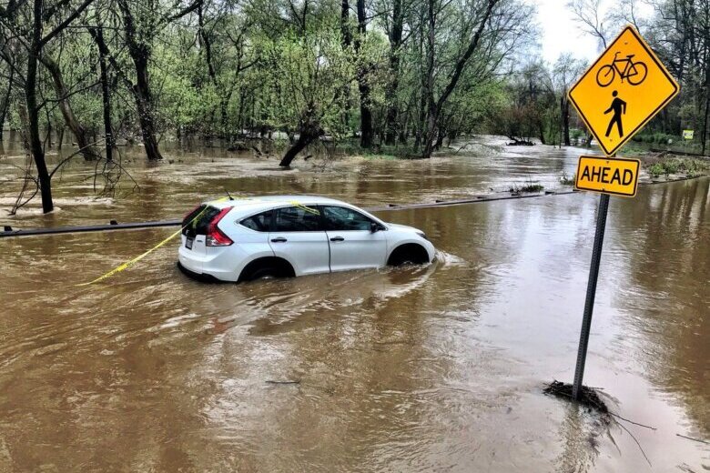
Showers moving into the greater Washington area could prolong flood concerns, according to the National Weather Service. This driver ended up with their car half-submerged on Beach Drive in Kensington. (WTOP/Neal Augenstein)
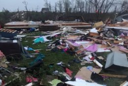
The storm caused widespread damage across Virginia. (Twitter/VA State Police) (WTOP/Neal Augenstein)
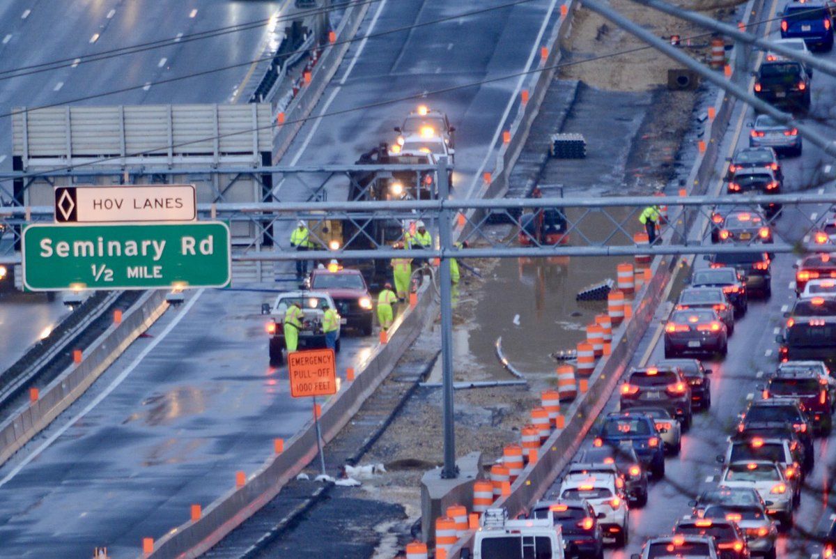
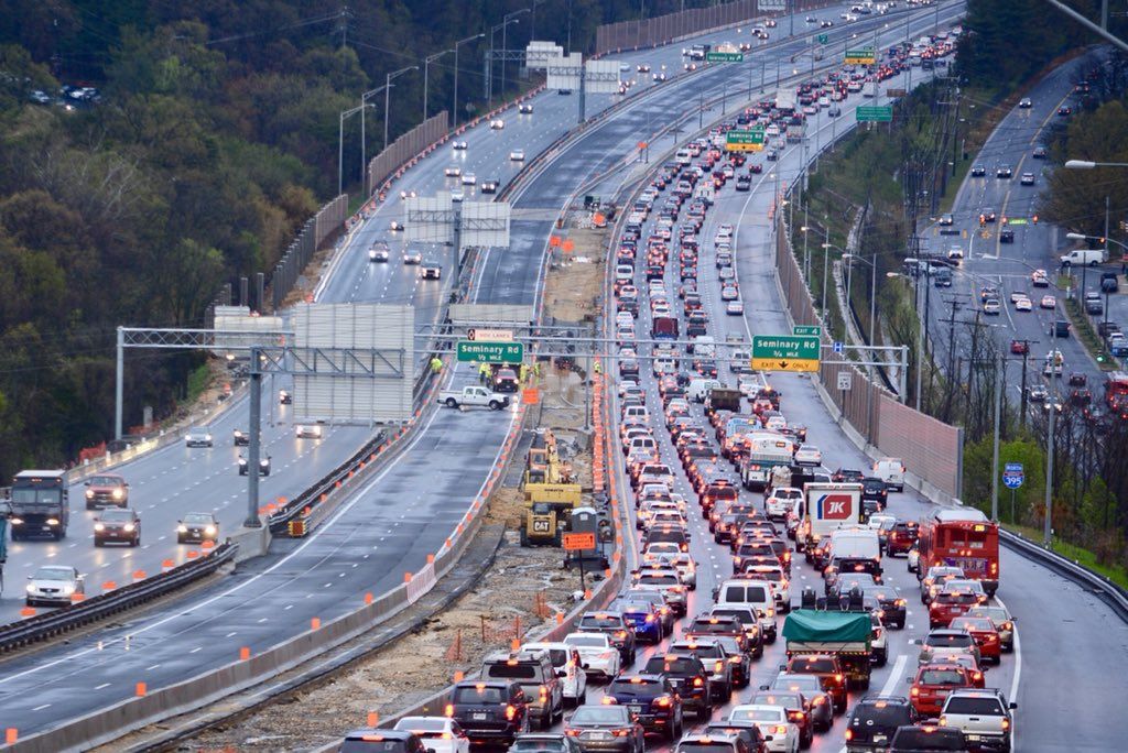
Crews still pumping water out of the Virginia Express Lanes work zone. (WTOP/Dave Dildine)
Crews pumping water out of the Va. express lanes work zone. (WTOP/Dave Dildine)
Painful delays for NB I-95 and I-395 with closure of I-395 HOV Lanes due to high water. (WTOP/Dave Dildine)
There were painful delays for NB I-95 and I-395 with closure of I-395 HOV Lanes due to high water. (WTOP/Dave Dildine)
A driver was rescued from a car stuck in high flood water in Kensington, Maryland. (WTOP/Neal Augenstein)
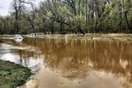
Rock Creek overflowed its banks in Kensington. (WTOP/Neal Augenstein) (WTOP/Neal Augenstein)
Another car half-submerged on Beach Drive in Kensington. The driver got out, with help from Montgomery Co Fire & Rescue. (WTOP/Neal Augenstein)
Drivers are being urged by law enforcement agencies to turn around if they see standing water on the roadway. (WTOP/Neal Augenstein)
1" - 3 inches + of rain has fallen across the region. Clouds, winds and falling temps on tap. (Twitter/Lauryn Ricketts)
1 – 3 inches + of rain has fallen across the region. Clouds, winds and falling temps on tap. (Twitter/Lauryn Ricketts)
There were several roads closed or partially closed due to flooding in Montgomery County. (Twitter/MC Highway Services) (Twitter/Lauryn Ricketts)
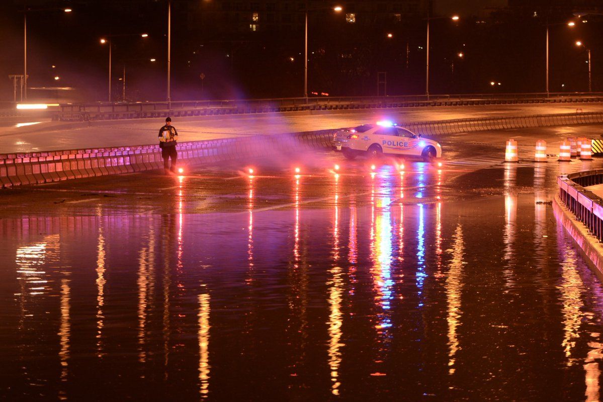
Early Monday morning the I-66 WB  was diverted off Roosevelt Bridge toward US-50 or NB GW Pkwy due to flooding in Arlington. Now getting by without major problems. (WTOP/Dave Dildine)
Early Monday morning the I-66 WB was diverted off Roosevelt Bridge toward US-50 or NB GW Pkwy due to flooding in Arlington. Now getting by without major problems. (WTOP/Dave Dildine)
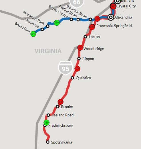
There will be delays, due to flooding, on Virginia Railway Express Fredericksburg line.
There were delays due to flooding on the Virginia Railway Express Fredericksburg line.
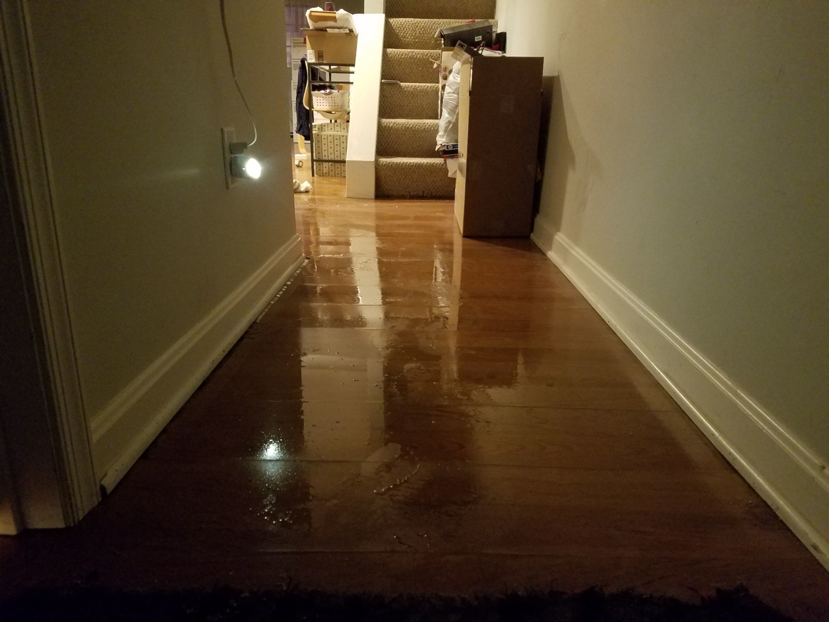
Basement apartments in the District are flooding. (WTOP/Will Vitka)
Basement apartments in the District flooded. (WTOP/Will Vitka)
Water seeped into some basement apartments in the District. (WTOP/Will Vitka)
(1/15)
Flood watches and warnings updated by the National Weather Service Baltimore/Washington.
Emergency management officials reported flooding in several locations in Northwest D.C. and eastern Montgomery County. More moderate to heavy rain is moving into this same area which could prolong the flood concerns, according to the National Weather Service. (WTOP/Neal Augenstein)
Crews still pumping water out of the Virginia Express Lanes work zone. (WTOP/Dave Dildine)
Painful delays for NB I-95 and I-395 with closure of I-395 HOV Lanes due to high water. (WTOP/Dave Dildine)
Another car half-submerged on Beach Drive in Kensington. The driver got out, with help from Montgomery Co Fire & Rescue. (WTOP/Neal Augenstein)
1" - 3 inches + of rain has fallen across the region. Clouds, winds and falling temps on tap. (Twitter/Lauryn Ricketts)
Early Monday morning the I-66 WB  was diverted off Roosevelt Bridge toward US-50 or NB GW Pkwy due to flooding in Arlington. Now getting by without major problems. (WTOP/Dave Dildine)
There will be delays, due to flooding, on Virginia Railway Express Fredericksburg line.
Basement apartments in the District are flooding. (WTOP/Will Vitka)
A driver was rescued from a car stuck in high flood water in Kensington, Maryland. (WTOP/Neal Augenstein)

WASHINGTON — A light rain continues to fall across the D.C. region Monday afternoon, and flood warnings are being lifted. But damage and traffic problems remain in some parts of the area after heavy rains hit the region from Sunday night into Monday morning.

The deluge led to marooned motorists, traffic and transport woes and a busy morning for first responders.

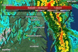
Unofficial numbers from the National Weather Service found that between 1.5 and 3 inches of rain fell over various parts of the region, as rain continues in parts of the area.


Quick Links:


Flash flood warnings were issued early Monday for much of the area; many of them had been lifted as the morning went on.

Virginia Gov. Ralph Northam declared a state of emergency on Monday, tweeting, “This morning I declared a state of emergency to help local and state agencies respond to damage from extreme weather last night.”

Montgomery County Fire and Rescue tweeted it was on the scene at the Radisson Hotel in Rockville. The hotel was evacuated because of flooding.

A number of the water problems were related to runoff and drainage problems, according to WTOP’s Dave Dildine.

Traffic problems

In Maryland, Beach Drive is still closed between Connecticut Avenue and Cedar Lane.

There were painful delays on northbound I-95 and I-395 Monday morning, as more than 20 miles of HOV lanes were flooded near Duke Street before crews managed to get flooding under control. Interstate 66 was also closed in Arlington due to high water before reopening.

The Fairfax County police had been keeping track of road closures through the morning.

MARC and VRE trains reported suspensions and delays of trains.

For the latest power outages see below.

Power outages


WTOP’s Rick Massimo contributed to this report.

Federal News Network Logo
Log in to your WTOP account for notifications and alerts customized for you.

Sign up