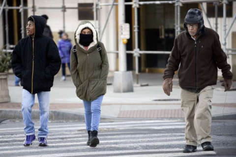
WASHINGTON — If you thought Thursday was a horrible, no-good, very cold day, you’re absolutely in the right — in fact, it tied for the coldest day of the year for the D.C. region.
According to News Team 4 meteorologist Steve Prinzivalli, the official high at Reagan National Airport was only 25 degrees, the coldest since Jan. 8. The chilliest day before that was Feb. 15, 2015, when the area only managed to hit 22 degrees.
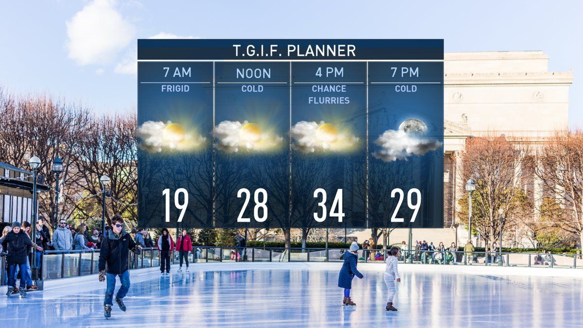
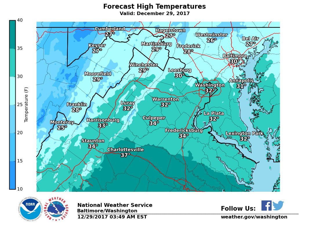
Highs for Friday are expected to be in the mid- to low 30s and the forecast calls for scattered flurries thanks to an Alberta Clipper making its way down from Canada.
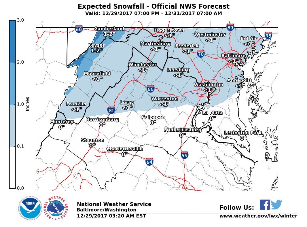
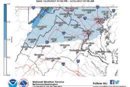
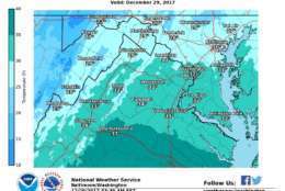
That clipper increases the region’s chances of seeing snow early Saturday, which NBC4’s Sheena Parveen says could result in some minor snowfall — less than 1 inch around D.C., northern Virginia and most of Maryland.
The outlook for 2018 is bitter.
“If you think it’s cold now, just wait,” Parveen said. “Some of the coldest weather this season is following us into the new year, with temperatures in the teens and highs in the 20s, it will be brutal at times.”
Get the latest from the WTOP Weather Center
While snow shouldn’t present much of an issue, ice could become a problem Saturday night on surfaces that haven’t been treated, since temperatures will drop to around 20.

There is a bit more confidence about more bitterly cold temperatures on Sunday and Monday. The highs on New Year’s Eve and New Year’s Day will be in the mid 20s with wind chills near 10 degrees. So if you’re planning on ringing in the New Year, make sure to bundle up.
It should be a bit warmer later in the week, but there are indications that more cold air may arrive late next week.
One model shows the dreaded Polar Vortex making a return the D.C. area, which could bring subzero temperatures with it.
In response to the cold temperatures, the District has activated its Cold Emergency Plan for Thursday starting at 7 p.m. through Tuesday, Jan. 2, 2018.
Under the plan, additional services and supports are provided to protect residents from life-threatening illness and injury that is associated with cold weather.
Friday
Mostly cloudy, flurries, mid- to low 30s.
Saturday
Early light snow chance, cloudy, mid- to low 30s.
Sunday
Mostly sunny. Highs in the low to mid-20s.
Monday
Sunny with highs in the mid-20s.
WTOP’s Patrick Roth contributed to this report.