WASHINGTON — Thursday would be a good day to stay inside and sip some hot chocolate because it will be a brutally cold in the D.C. area.
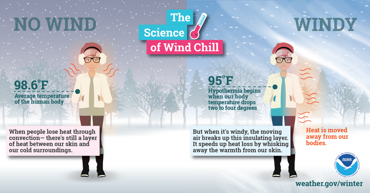
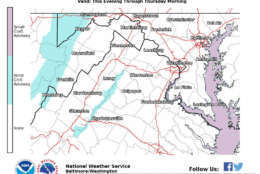
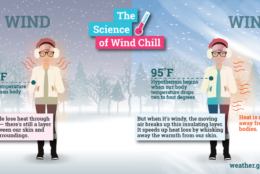
A biting wind will put wind chills near zero for most of the morning with afternoon highs in the mid- to upper 20s.
That’s the coldest it’s been since a three-day stretch between Jan. 7 and Jan. 9 in 2017 that saw lows in the teens.
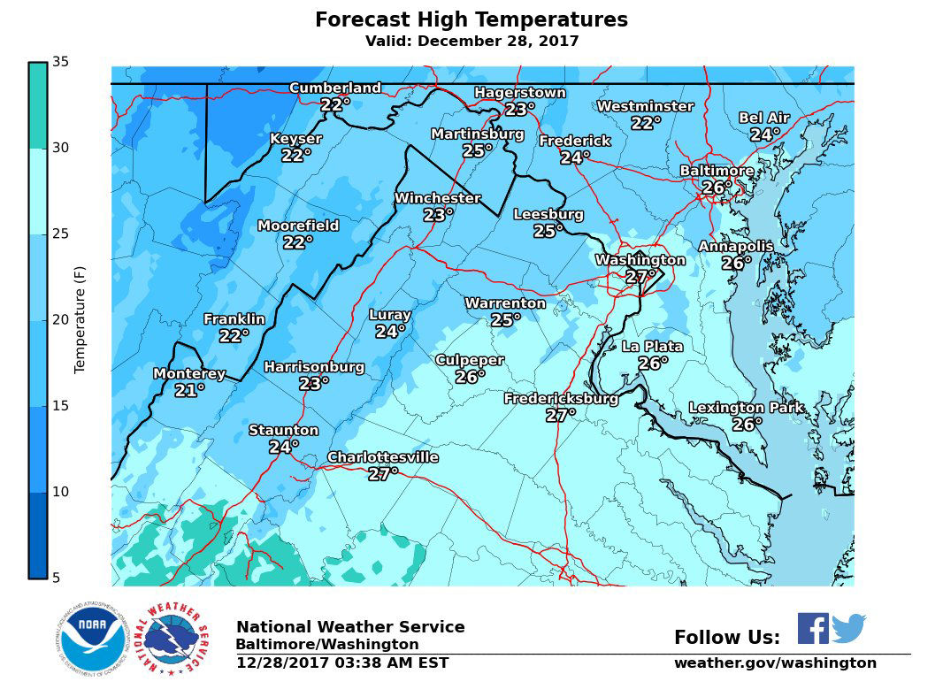
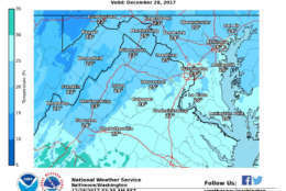
To get an idea of how cold it is, Storm Team 4 meteorologist Matt Ritter said the normal high for Dec. 28 is 44 degrees and the normal low is 30.
Today’s forecast: #COLD! High temperatures won’t get out of the 20s, even in the cities. Factor in the wind, and it will feel like it’s in the single digits and teens all day. Dress in layers! #DCwx #MDwx #VAwx #WVwx pic.twitter.com/tNN6wJ6xTm
— NWS DC/Baltimore (@NWS_BaltWash) December 28, 2017
Not to add insult to injury, but just one year ago, the high was 52 degrees and the low was 37.
The good news is that Friday will be slightly warmer.
The bad news is that Storm Team 4 meteorologist Chuck Bell said that this is only the beginning the of what will be a frigid forecast for the next 10 to 14 days.
The latest European model has DC dropping below 0° January 4-5th. @Reagan_Airport has not been below 0° in 20 years!!! https://t.co/YQi8yX6B9t
— Chuck Bell (@ChuckBell4) December 28, 2017
While highs on Friday will be in the low to mid 30s, the wind chill will be in the 20s. A storm could bring more cold temperatures on Saturday along with a bit of snow.
Get the latest from the WTOP Weather Center
Bell said the storm shouldn’t leave more than an inch or two of snow in some places, but warns that there is a high degree of uncertainty about any snow chances on Saturday.
There is a bit more confidence about more bitterly cold temperatures on Sunday and Monday. The highs on New Year’s Eve and New Year’s Day will be in the mid 20s with wind chills near 10 degrees. So if you’re planning on ringing in the New Year, make sure to bundle up.
It should be a bit warmer later in the week, but Bell said there are indications that more cold air may arrive late next week.
One model shows the dreaded Polar Vortex making a return the D.C. area, which could bring subzero temperatures with it.
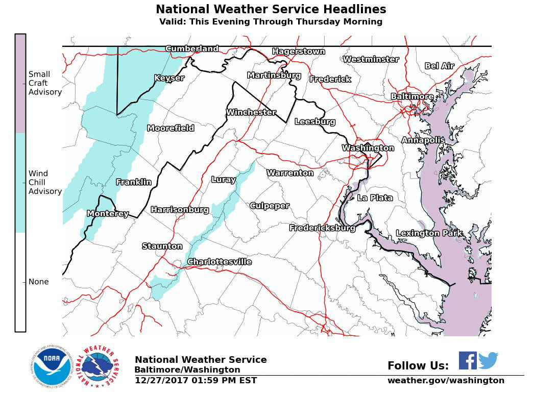
In response to the cold temperatures, the District has activated its Cold Emergency Plan for Thursday starting at 7 p.m. through Tuesday, Jan. 2, 2018. Under the plan, additional services and supports are provided to protect residents from life-threatening illness and injury that is associated with cold weather.
Thursday
Partly to mostly sunny, staying very cold.
Breezy morning with wind chills near zero.
Highs between 24 and 29 degrees.
Increasing clouds on Thursday night with more bitter cold and the chance of an isolated flurry.
Friday
Partly to mostly cloudy.
Still quite cold with wind chills in the 20s.
Highs between 30 and 36 degrees.
Saturday
Cloudy and cold. Light snow likely with some accumulation possible.
Highs between 28 and 34 degrees.
Sunday
Mostly sunny but still cold and blustery. Highs in the low to mid 20s.