Visit our traffic page and weather page for the latest updates, follow us on Twitter @WTOP and @WTOPtraffic, and listen to live traffic and weather reports every 10 minutes on 103.5 FM or via our online stream.
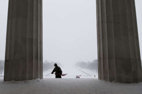
WASHINGTON — A “potential winter commuting hazard” could hit early morning drivers on Thursday, warned the National Weather Service in Sterling, Virginia. Light snow is expected to fall on ice-cold roadways late Wednesday night and early Thursday morning and that, the weather service said, could possibly “lead to hazardous traveling conditions.”
An Alberta clipper is expected to bring a band of light snow showers to the D.C. region late Wednesday night. The weather system will be quick-moving and its snowfall is expected to be light, but since pavement temperatures are below freezing, the snow is expected to swirl around and perhaps stick to some untreated roads.
Should the snowfall coincide with the beginning of morning rush hour, delays could form quickly.
In the special weather statement, the weather service said there is a 40 percent chance of light snow showers with a “potential large impact due to sub-freezing roads.” Less than an inch of snow is expected.
Meteorologist Chris Strong at the weather service said the purpose of the statement is “to emphasize that if conditions are right, very small amounts of snow can cause very big problems for commuting times, as we’ve seen in many instances over the past many years here in the D.C. metro area.”
Storm Team 4 expects the flurries and snow showers to end well before the morning rush hour, which bodes well for road treatment crews. The most disastrous icy commutes in the past happened when snowfall coincided with peak travel times.
“The timing on this will be late this [Wednesday] evening until just around midnight. The clipper zooms out of here by tomorrow morning and, in its wake, winds pick back up,” said Somara Theodore with Storm Team 4.
The “winter commuting hazard” was created as a call-to-arms for highway crews and emergency management officials in 2016. It was inspired by the traffic nightmare that unfolded during the Jan. 20, 2016 evening rush hour, when less than an inch of snow impeded regional traffic, causing extreme delays and hundreds of accidents.
Several similar commuting catastrophes transpired during D.C. rush hours on Jan. 6, 2015 and Jan. 26, 2011.
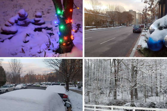
Temperatures on Wednesday were below freezing most of the day. Lows Wednesday night are expected to be in the mid 20s.
“It really is a combination of bridge and road temperatures and any small accumulation of snow combined with all the tires of rush hour causing friction that can make snow change right to ice and cause a nasty commute,” Strong said.
That’s a lot of “ifs” and pinning down a small batch of snow showers spatially and temporarily is a difficult task, Strong said, with the advisory intended to ready drivers for the possibility of slippery conditions.