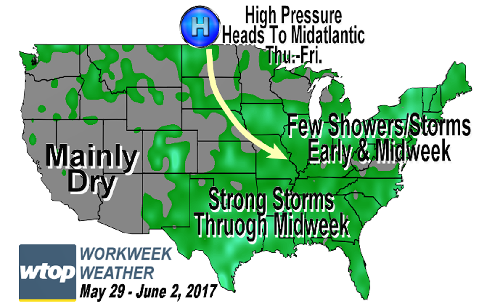
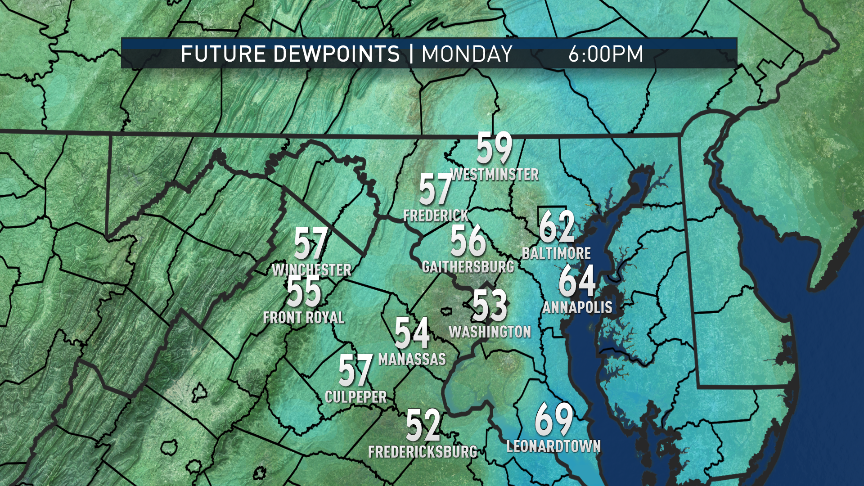
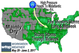
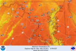
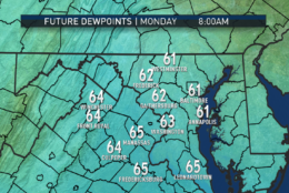
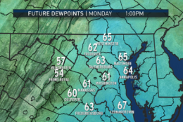
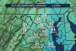
WASHINGTON — On Memorial Day, the showers from Saturday and Sunday have headed out, and a drying trend starts with westerly winds kicking in and sloping down the mountains. Monday ends up being the driest day of the extended holiday weekend, complete with a break in the sticky humidity levels in the D.C. area.
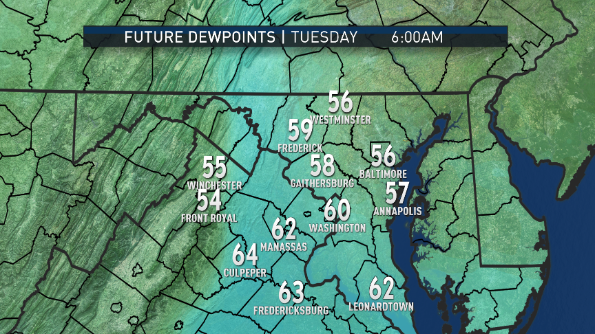
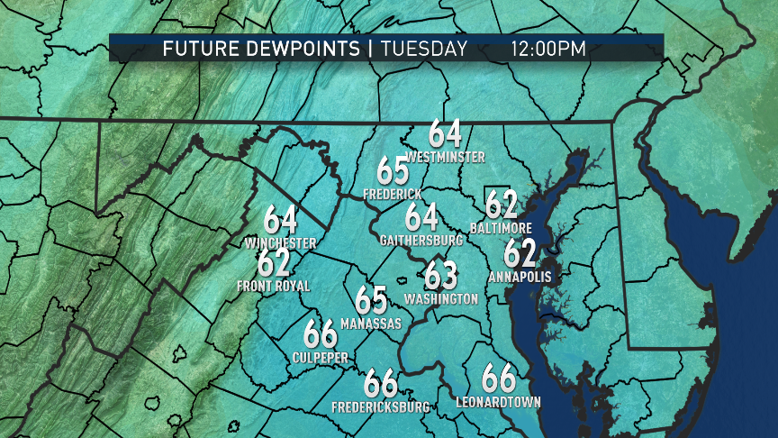
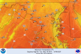
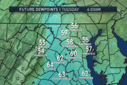
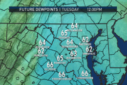
But by the time most start heading back to work Tuesday, the humidity will return with only a slight chance for a few showers and thunderstorms as a weak disturbance moves through. It will send a weak cold front through the area, which will get another break in the humidity temporarily for Tuesday night and early Wednesday.
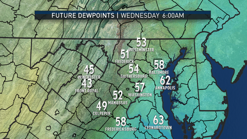
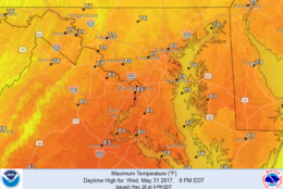
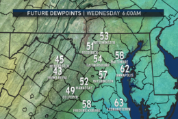
The humidity will return briefly again Wednesday with yet another cold front moving through with a slight chance of a thunderstorm.
Then, high pressure from central Canada will dominate Thursday and Friday with much lower humidity levels.
Daily weather highlights
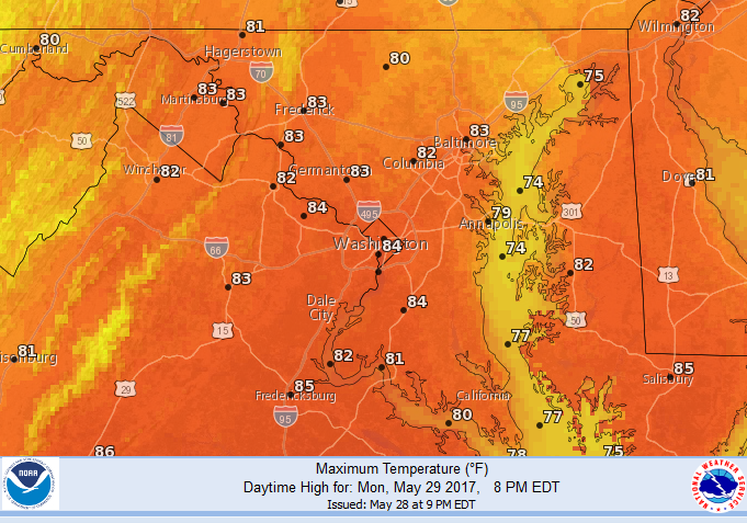
MONDAY
• Morning clouds and areas of fog
• Clearing skies giving way to much more sunshine
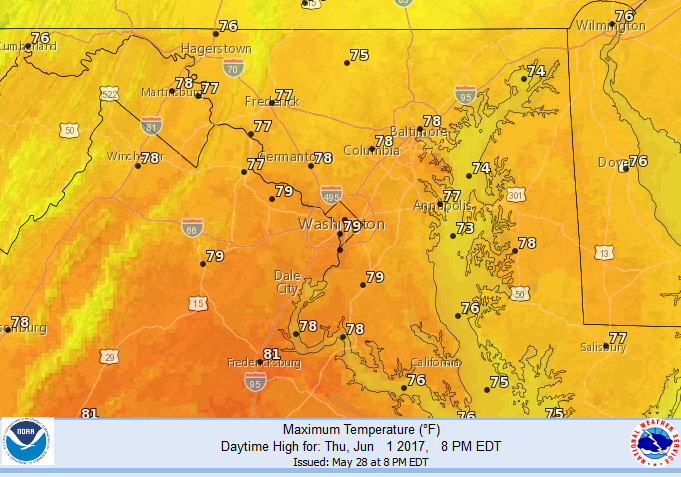
• Much warmer with temperatures several degrees above average (normal for Reagan National Airport: 79 degrees)
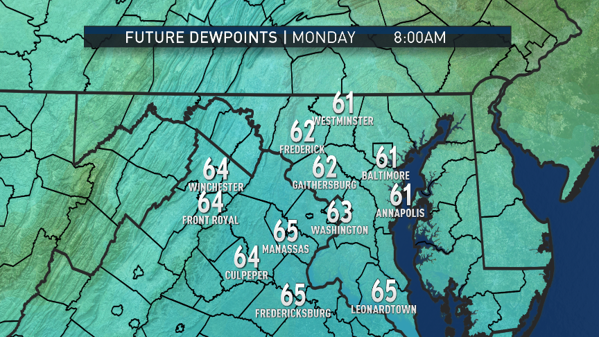
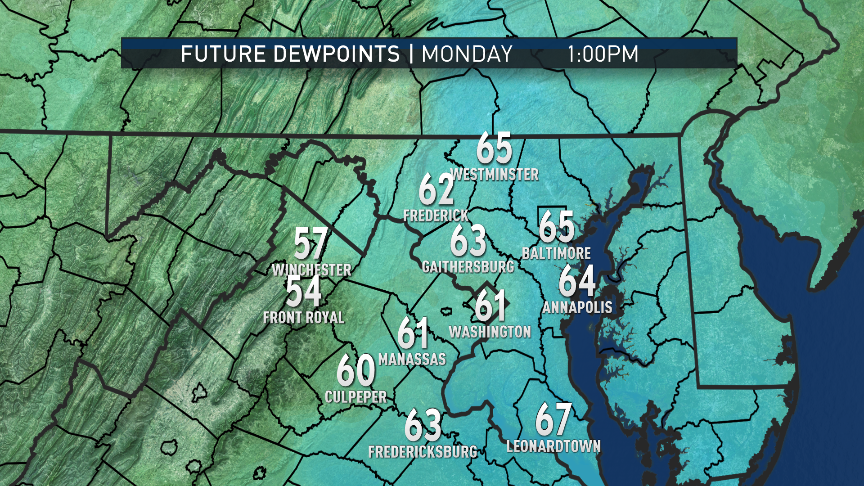
• Damp and muggy in the morning, becoming less humid in the afternoon
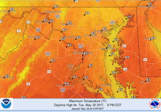
TUESDAY
• Humidity returns early along with cloud cover
• Warm and sticky
• A few scattered showers or thunderstorms pop up randomly during the afternoon and evening
• Becoming less humid with clearing toward evening
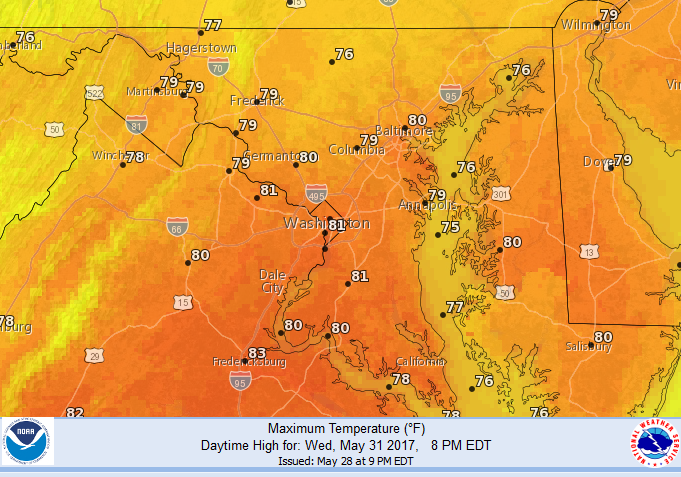
WEDNESDAY
• A few clouds early
• Comfortable humidity levels early, becoming more humid again late
• A few scattered showers or thunderstorms pop up during the afternoon
• Becoming less humid with clearing toward evening
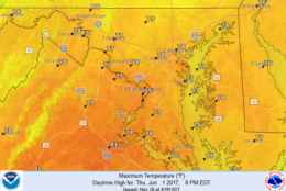
THURSDAY
• Cool, clear and comfortable to start
• Mostly sunny skies all day
• Seasonably warm but the least humid day of the week
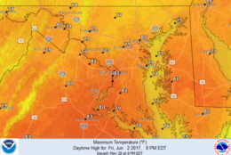
FRIDAY
• Sunshine with increasing clouds
• Very warm and becoming more humid later in the day
Editor’s Note: The WTOP Workweek Weather Blog is intended as an in-depth yet plain language summary of the business week’s weather potential in the D.C. area along with an explanation of the contingencies and uncertainties that exist at the time of publication. For the latest actual Storm Team 4 forecast, check out the main WTOP Weather Page.