Workweek weather: Chilly, damp start shifts to hot, humid finish

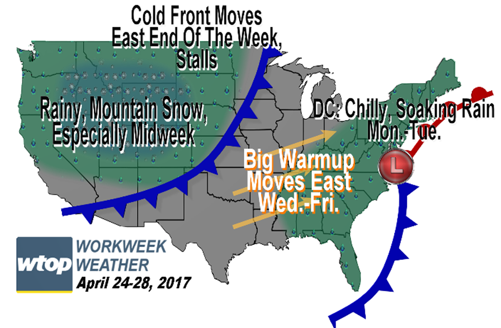
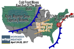
WASHINGTON — In a pattern that would have made snow lovers very happy this past winter, the greater D.C. area is poised to get two straight days of beneficial rain.

With a blocked pattern over the Atlantic and North America, several disturbances in the jet stream will carve out a deep trough (or dip) of low pressure in the east, sending two waves of low pressure up the seaboard before heading out to sea. Combined with all the rain will be a stiff, unseasonably chilly northeast wind, so indeed, this qualifies as a nor’easter. After all, it’s that northeasterly wind that gives those storms that term. It just so happens most of them produce winter weather, but not this time.

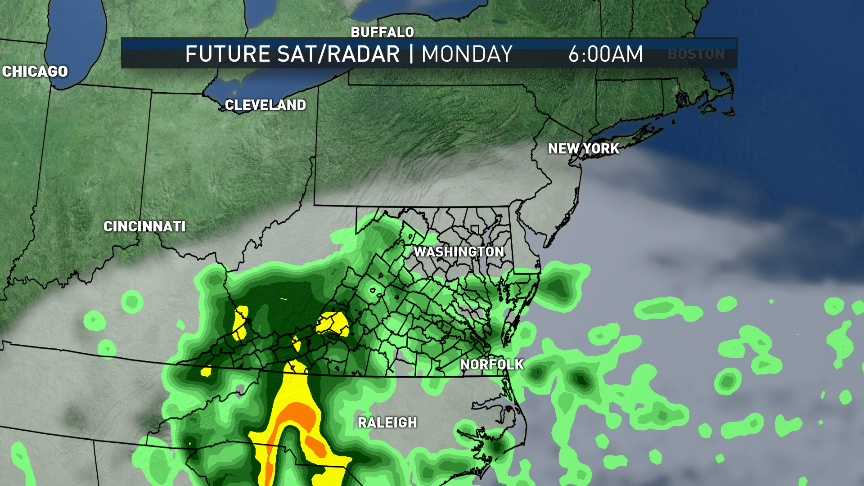
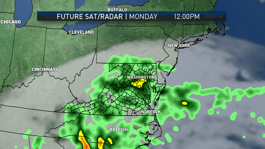
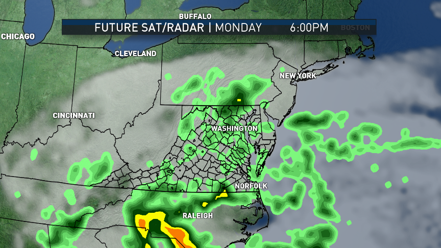
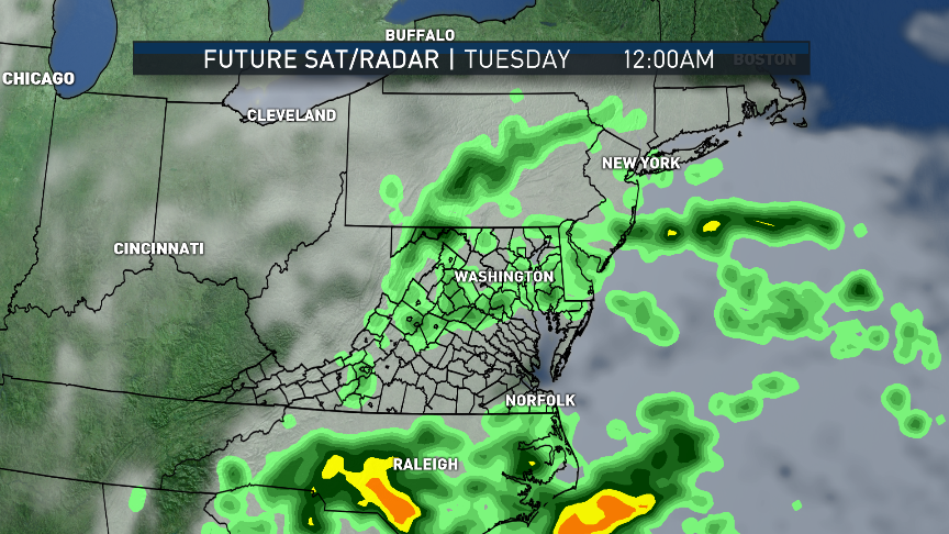
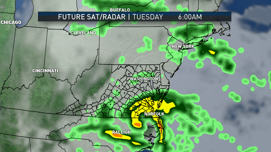
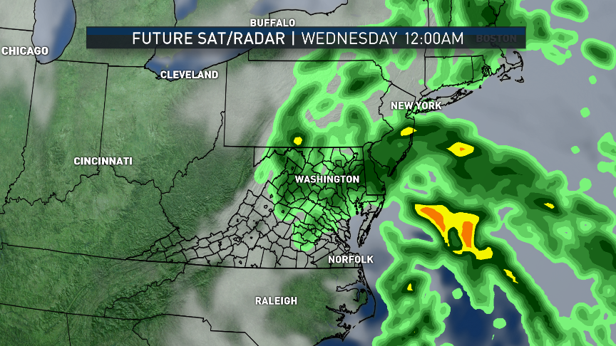
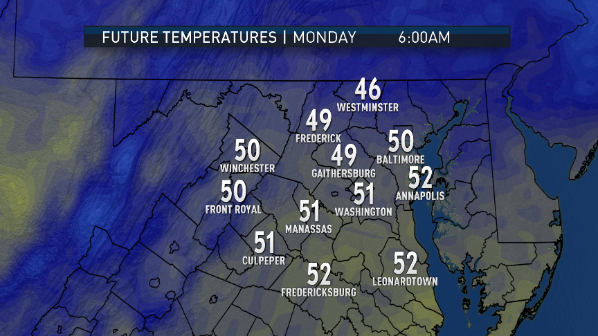
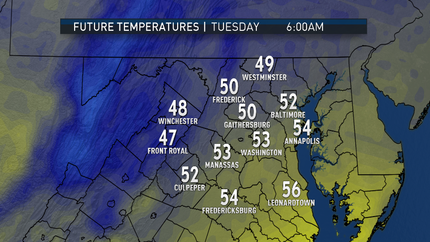
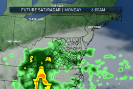
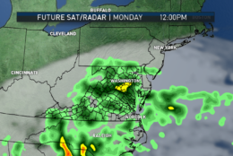
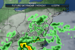
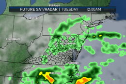
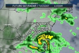
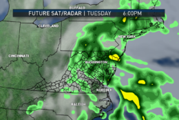
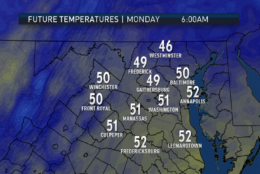
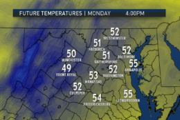
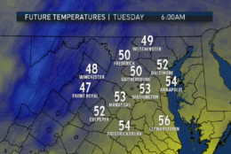
It’s really going to be two areas of low pressure moving up the coast. The first low was already in existence on Sunday, increasing the cloud cover in the afternoon and bringing lots of rain to southern Virginia and the Carolinas. Rain will be overspreading the area in time for the Monday morning commute while temperatures will have fallen to the morning lows. The rain from the first system will taper to drizzle Monday night, when the system basically falls apart, favoring the second system. That’s when more rain will move in for Tuesday. If it’s not pouring for Tuesday morning’s rush, then it will be soon after.

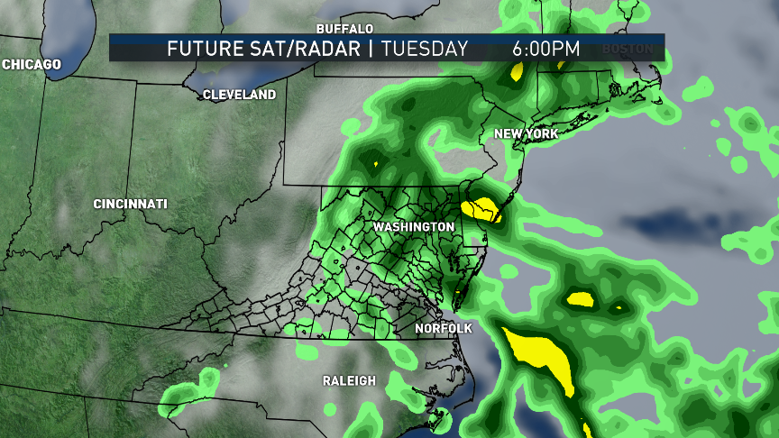
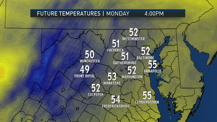
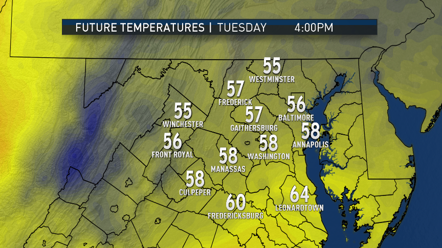
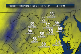
We mentioned the morning lows on Monday: The thermometer will barely move the rest of the day and then temperatures will only drop a little bit Monday night. Just off the surface winds will have more of a southerly component with the second storm, so that could mix in some warmer air with the rain and the thermometer will show some upward movement finally Tuesday night.

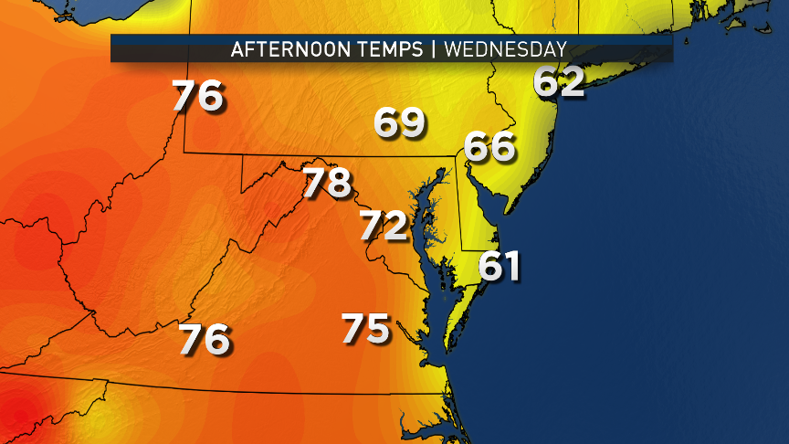
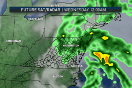
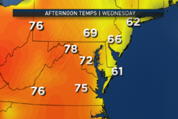
It’s not really until Wednesday when we experience some clearing and westerly winds sloping down the mountains and therefore, some warmer temperatures.

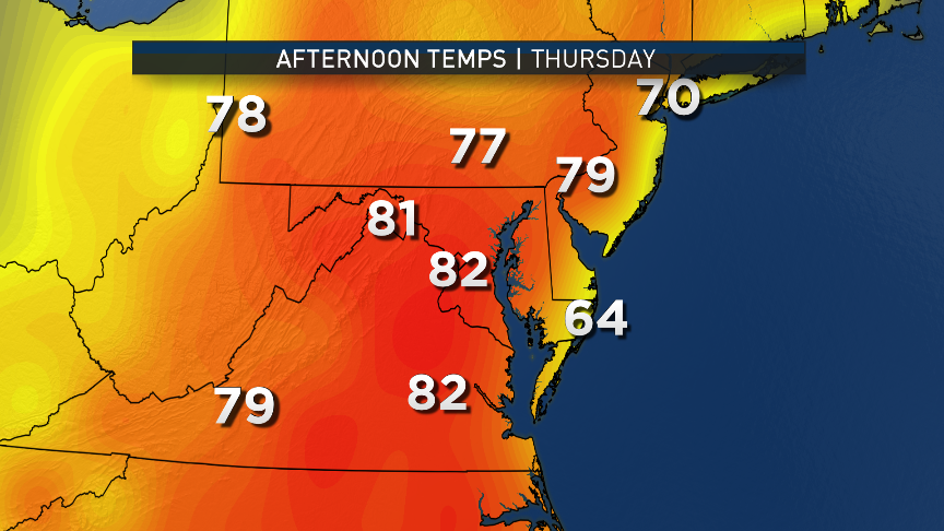
But it’s not going to just stop at “warm.” In the wake of these storms, storminess will return to the western part of the country. Summer-like heat in a ridge of high pressure will build in the nation’s midsection and that will shift east toward us.

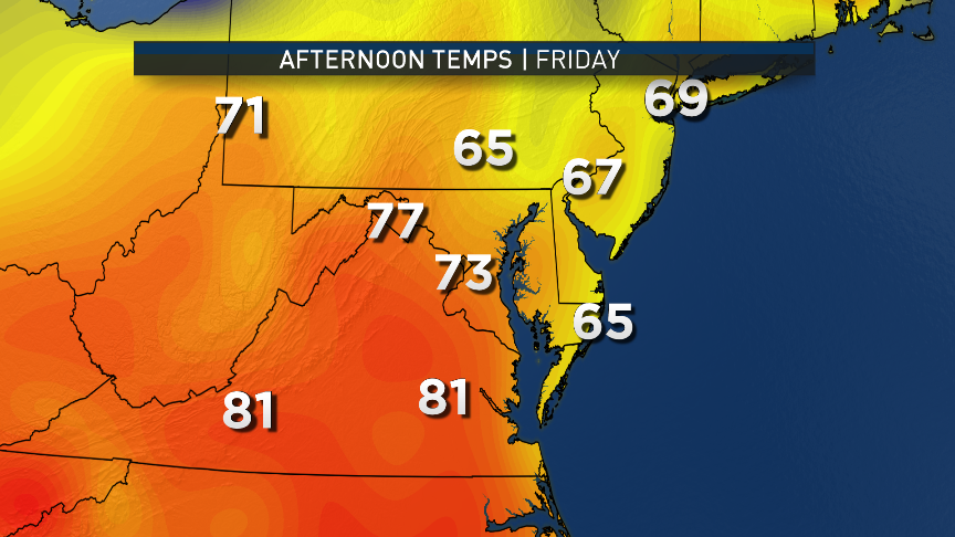
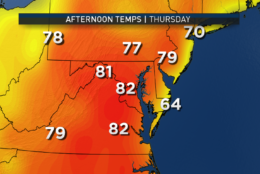
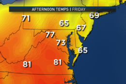
At that time, all the low-level moisture leftover from the rain will turn into somewhat uncomfortable humidity levels. So Thursday will look and feel like summer. A weak cold front will try to move through on Friday with a chance for a brief shower or a thunderstorm, but it may not have much success considering the strength of this ridge of high pressure.

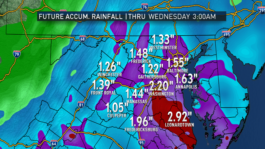
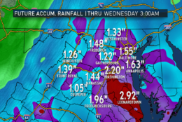
At any rate, these rains will definitely help the pollen situation and the short-term drought. (Undoubtedly, we’ll get a plant-life growth spurt and more pollen later on.) But we still need two to three times as much rainfall if we’re going to get to totally wipe out the multiyear, long-term drought conditions. So we can’t really call this a “drought buster.”

In a pattern that would have made snow lovers very happy this past winter, the greater D.C. area is poised to get two straight days of beneficial rain. (WTOP/Storm Team 4)
The RPM computer model looks like it has a very good handle on the scenario. It and most other available models depict a two-day washout starting Monday morning and not ending until Tuesday night. This data is from the computer run from Sunday afternoon. The relative lull in the action is depicted in the Tuesday midnight frame when we should just be having light showers and drizzle.
(Data: The Weather Company | Graphics: Storm Team 4)
The same computer model-run estimates between 1 inch and 3 inches of rainfall for the period. But as Storm Team 4 has pointed out, we need 6 to 9 inches of rainfall over a month’s time to get rid of our drought completely. (Data: The Weather Company | Graphics: Storm Team 4)
As far as temperatures for these storms go, note the barely changing numbers for Monday and Tuesday. It’s not until late Tuesday that some warmer air may mix in with the rain, when the rain bands have more of a connection to the waters off the southeast coast instead of northeast. (Data: The Weather Company | Graphics: Storm Team 4)
After the rain ends, warmth will shift east from the middle of the country, depicted by the lower resolution American GFS computer model. On Wednesday, we should start climbing into the 70s, 80s for Thursday easily, and Friday has some uncertainties because of the cold front. The cooler weather for Pennsylvania seems likely, but the front may not make it all the way to D.C. If not, then we will be just as warm – and humid – as Thursday. (Data: Environmental Modeling Center, NOAA | Graphics: Storm Team 4)
(1/17)
In a pattern that would have made snow lovers very happy this past winter, the greater D.C. area is poised to get two straight days of beneficial rain. (WTOP/Storm Team 4)

Daily weather highlights

MONDAY
— Rain on-and-off
— Brisk, chilly wind out of the northeast
— Rain occasionally heavy at times, especially later in the day
— Temperatures not rising much above the morning lows

TUESDAY
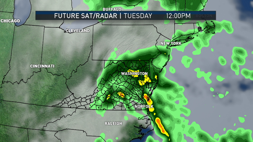
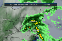
— More rain, heavy at times; if not first thing in the morning, arriving again during the day
— Brisk, chilly wind most of the day
— Heavier rain late in the day will coincide with possibly rising temperatures in the evening

WEDNESDAY
— Gradual clearing skies
— Westerly winds drying us out
— Much warmer temperatures climbing above average

THURSDAY
— Lots of sunshine
— Feeling like summer in terms of temperature and humidity

FRIDAY
— Sun with increasing clouds
— A few showers or thunderstorms possible
— Likely not as warm as Thursday, but there is uncertainty regarding how far south the cold front makes it
— Nationals back in town but game not necessarily affected by storms


Editor’s Note: The WTOP Workweek Weather Blog is intended as an in-depth yet plain language summary of the business week’s weather potential in the D.C. area along with an explanation of the contingencies and uncertainties that exist at the time of publication. For the latest actual Storm Team 4 forecast, check out the main WTOP Weather Page.

Federal News Network Logo
Log in to your WTOP account for notifications and alerts customized for you.

Sign up