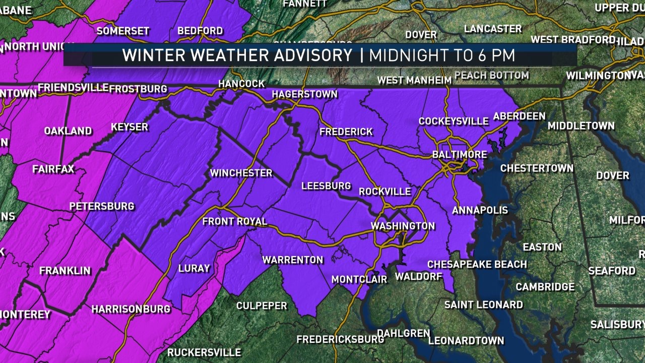
WASHINGTON — A Winter Weather Advisory is in effect until 6 p.m. Saturday due to expected snow, sleet and freezing rain throughout the region.
What Is Happening in the Atmosphere?
A cold front will stall south of the area and an area of low pressure will push out of the Tennessee Valley, spreading precipitation into the WTOP region Saturday morning.
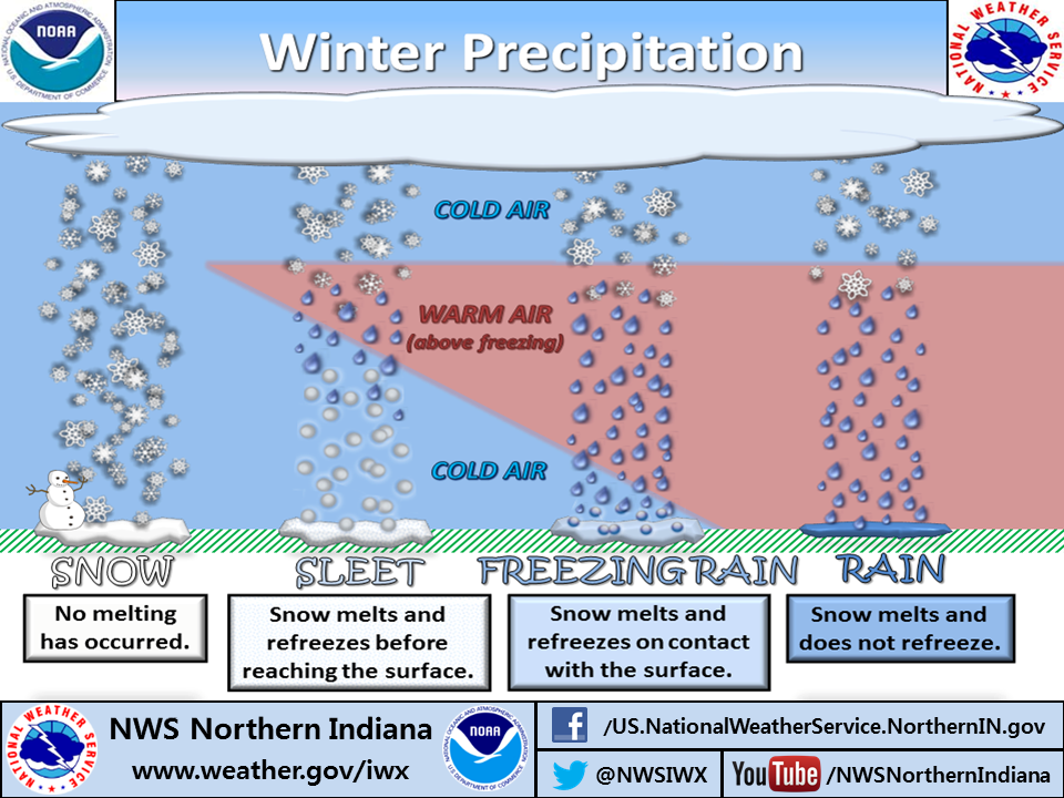
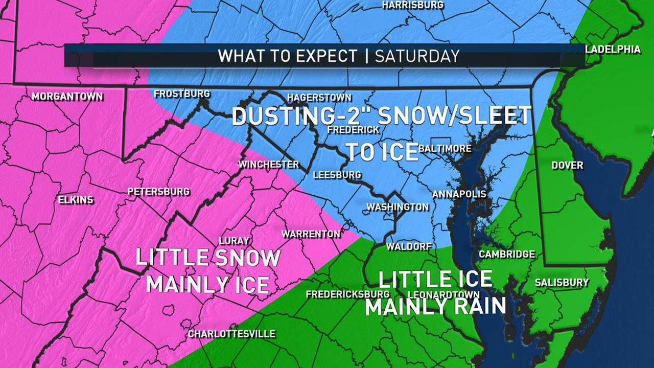
For the mountains, freezing rain will be the primary hazard, while the D.C. metro area will likely have sleet and rain through lunchtime Saturday, before changing to plain rain showers late Saturday, as temperatures creep up a degree or two into the middle 30s. The northern suburbs, however, will stay the coldest the longest and may have pockets of freezing rain.
Timing
Wintry weather moved into the region early Saturday and will continue through daybreak, spreading from the southwest to the northeast.
It could start out as a little bit of wet snow/rain in some parts of the region while others may see some freezing rain to start. It looks like Southern Maryland will be affected the least with it turning into a rain event with some isolated spots of freezing rain, unlike the Shenandoah Valley, which will see most of the freezing rain.
Most of the precipitation will move out as we head into Saturday evening, with a transition to possibly just plain rain for a majority of the region.
Amounts
While this will last for much of the day, amounts look like they’ll be on the lighter side.
However, there will still be issues on the roads, especially untreated surfaces, porches, driveways, sidewalks, car windshields, railings, etc. We all know too well that just minimal amounts of ice and snow are enough to wreak havoc throughout the D.C. region.
Wet snow accumulation should be less than one inch in most of the region. There could be some areas that received slightly more, but most areas that do get snow will be one inch or less before the transition to freezing rain and sleet take over.
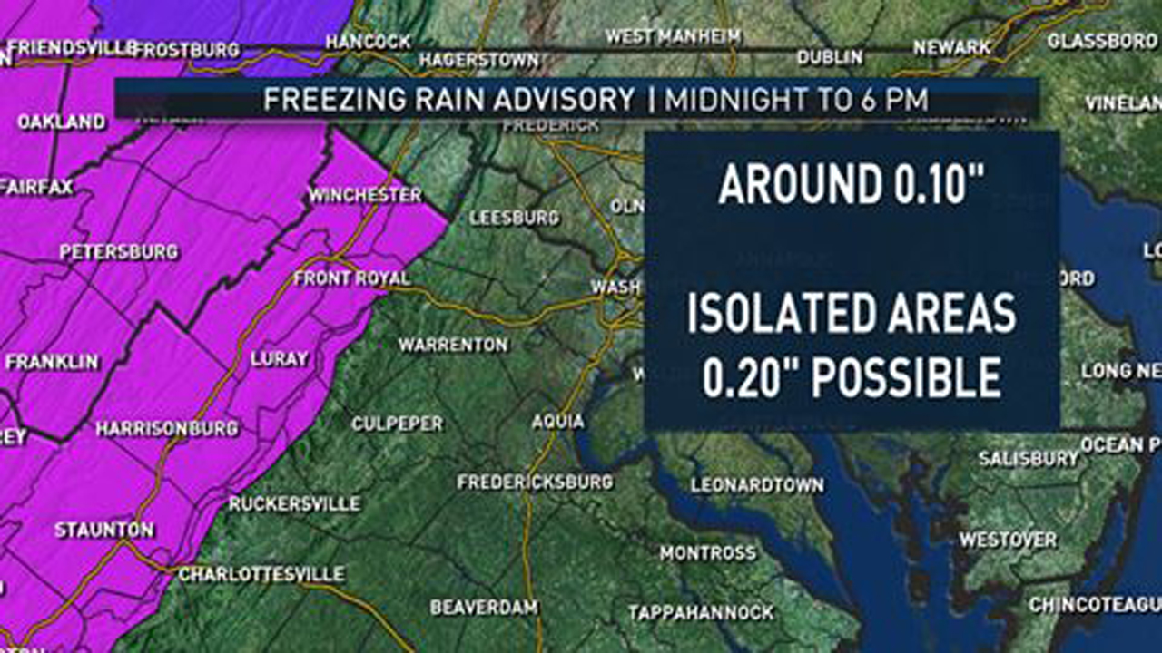
The ice accumulation will also be on the lighter side, but possibly create some lasting impacts around the region. We are thinking a glaze to 0.10 inches with isolated spots up to 0.2 inches.
Even though the snow and ice will be light as it falls through the day, it would just be best to limit your time out and about.
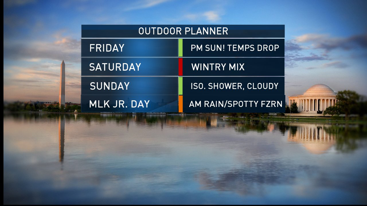
Once this moves out of our region, there could be a quick transition over to just plain rain as temperatures try to move up a few degrees. We are keeping a few very isolated showers on Sunday but for now, Sunday looks mainly dry as temperatures move back to around 40 degrees.
Martin Luther King Jr. Day could bring some showers with spotty freezing rain in the morning. It will begin to taper off during the afternoon but temperatures will remain around 40, still below normal for this time of year.
Unfortunately, it is not looking like the best holiday weekend. But hopefully the rain can clear out for Monday parades in honor of Martin Luther King, Jr. If you are headed to any of the local ski resorts, it will be fairly icy on Saturday, Sunday and Monday. Not the best conditions.
We warm up as we head through next week with some rain possible on Inauguration Day. That will be the next problem we tackle as we move through the next workweek.