This article was written by WTOP’s news partner InsideNoVa.com and republished with permission. Sign up for InsideNoVa.com’s free email subscription today.
The PW Digital Gateway has seen its first public review by Prince William County officials, but its fate remains murky as some officials keep their opinions close to the chest.
The Planning Commission on Wednesday held a work session on the proposal, the first for the application.
Last summer, landowners along Pageland Lane submitted a request to change the land designation of their properties in the Comprehensive Plan from agricultural zoning to technology zoning for the PW Digital Gateway.
The Board of Supervisors later expanded the request to cover 2,100 acres, which could pave the way for 27.6 million square feet of data centers, nearly as much data center space as is currently in use or under construction in neighboring Loudoun County, the world’s largest concentration of such facilities.
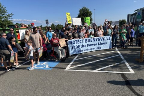
The project has quickly become the most controversial and contentious local land-use proposal in decades. Opponents and proponents have launched personal attacks against each other, and it has spawned recall efforts against Gainesville Supervisor Pete Candland and Board Chair Ann Wheeler.
Supporters of the PW Digital Gateway say it will provide a huge economic boom to the county in an area that’s no longer rural. Opponents say such large developments would decimate the character of the county’s rural area; they have raised concerns about the availability of power, effects on water quality and the potential the buildings could quickly become obsolete as technology continues to improve.
Earlier this month, county staff released a plan for regulating the project but stopped short of providing a recommendation. The draft plan calls for stricter regulations than those proposed by developers.
The staff plan calls for a hard limit of 27 million square feet of data centers in the entire area and discourages any other heavy industrial uses.
County officials have emphasized a need to split certain regulations between the northern end and the southern end, which is near Manassas National Battlefield Park and Conway Robinson State Forest.
Gainesville Commissioner Richard Berry, whose district includes the proposal, said the review “has been a very frustrating process for me, and I know for many constituents.”
The county is moving forward with the digital gateway while simultaneously updating its Comprehensive Plan and reviewing a potential expansion of the Data Center Opportunity Zone Overlay District.
“My preference is that we complete the Comprehensive Plan update first,” Berry said. “I think we are considering these things in a backward manner.”
Berry had “significant concerns” with allowing development in the southern part of the proposal.
“I do not think that it represents good planning to be planning development in an area where there is cultural, environmental and historic sensitivity, such as the southern section of this plan,” he said. “I personally don’t think it’s a suitable area for development — commercial or residential.”
On the northern end, building height would be limited to 85 feet with limited exceptions. Staff recommends limiting height, with narrow exceptions, to 45 feet in the southern end, with less floor area density.
The developers have proposed 100 feet in the north and 65 feet in the south.
Brentsville Commissioner Tom Gordy said the height restrictions could be ignored, noting that some developers are already returning to the county to get approved for taller buildings.
“The pursuit will be for something higher, and they’ve already demonstrated it even after it’s been approved at a lower height,” he said. “I think the best thing for us to do is avoid that problem.”
The county’s proposed guidelines were based on tests for what could be seen from certain areas of Manassas National Battlefield Park.
“It’s important to preserve those views to the extent that you can, because those views tell you how battles unfolded from the vantage point from which you’re standing,” said county archaeologist Justin Patton. “When you walk out to a battlefield, or a historic site for that matter, you feel like you’re there.”
Neabsco Commissioner Qwendolyn Brown pressed questions about the view shed impact and implied that existing transmission lines already hurt the views.
“I’m not sure how there can be anything worse than those,” she said.
Patton said the lines “create a visual impact” but the county is “proposing that we still need to do mitigation strategies to save what we can.”
Throughout the corridor, the plan recommends 150-foot buffers on all sides of the development, although Gordy said the northern portion should have larger buffers to further protect the battlefield view shed.
The plan says the companies should be encouraged to use minimum water and implement sustainability initiatives.
At-Large Commissioner Patty Kuntz said runoff would be less from data centers than it is from existing farmland. She also repeated a talking point of supporters who say the facilities would use less water than the Heritage Hunt golf course.
“As of now, farmers can water as much as they want and put as much fertilizer as they want,” she said. “When and if the data centers come in, they will have to work under the laws of the environmental impact … So the runoff should be much less”
Kuntz also questioned if the regulations could “deter” developers from “creating the area they need to actually have a quality working data center.”
Deputy Planning Director Meika Daus said the industry has voiced “concerns about that limitation.”
Many residents have worried about the potential noise impacts from the industry, although Berry said, “There are two data centers right next to the Freedom Center at George Mason [University] that I go by every day and I can’t hear anything.”
Berry said the county needs to “make sure we do everything we possibly can to make sure that’s minimized.”
Gordy and Berry requested more information about the potential power needs for the proposal and if it would require additional infrastructure.
County staff will use feedback from the work session to create a second draft plan. Officials will not provide a recommendation until the application goes for a public hearing.
Compass data centers and QTS Realty Trust Inc. have filed rezoning requests for the development. Their combined projects cover 1,636 acres and 18.42 million square feet of data centers, substantially less than the 27.6 million square feet touted by the initial application.
The county has not scheduled a public hearing on the Comprehensive Plan amendment or the rezonings.
The Planning Commission did not take any public comment at its Wednesday meeting because it was strictly a work session.