Scientists trying to learn more about what fish are up to in the Chesapeake Bay are getting new help from a system that’s similar to the electronic tolling technology behind E‑ZPass.
“The goal here is to help manage these fish species … that are really important to the bay ecosystem and the economy,” said Kevin Schabow, deputy director of the National Oceanic and Atmospheric Administration’s Chesapeake Bay office.
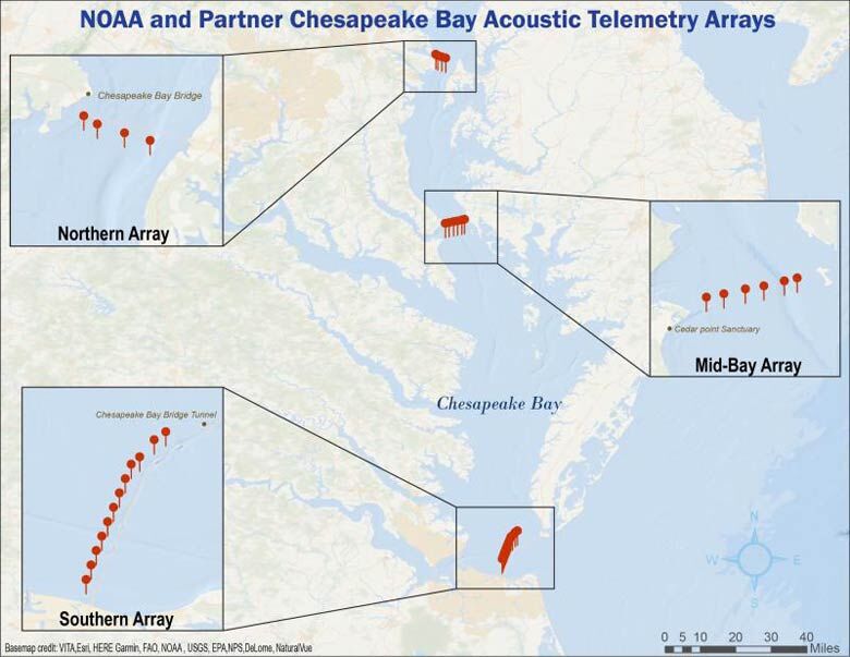
From the middle of last year through early this year, groups of acoustic receivers were installed in three areas of the Chesapeake Bay.
The northern array near Maryland’s Chesapeake Bay Bridge includes four receivers. The mid-bay array of six receivers is located near the mouth of the Patuxent River, and the southern array near Virginia Beach has a dozen.

There are three receivers in the Choptank River near oyster restoration projects and five special buoys in the bay that provide real-time monitoring of weather conditions and water quality fitted with receivers as well.
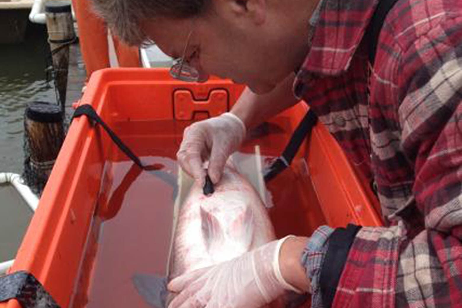
The receivers listen for fish that have been tagged with transmitters. “When a fish gets within a few hundred meters of a receiver, it will pick up that transmitter and store that data,” Schabow said.
Some receivers are near the surface of the water, while others are anchored to the bottom.
“Endangered sturgeon, some of the biggest fish in the bay, they like these deep channels. That’s where they’re spending their time and acoustic telemetry data is telling us that,” said Schabow.
“By putting the receivers down there, you’re probably getting better data and more hits than if you had something up at the surface.”
Once collected, the information ends up in a database called the Mid-Atlantic Acoustic Telemetry Observation System (MATOS), where scientists can access it.
It can help researchers figure out where and when fish are in the bay. One key question, according to Schabow: “Are we going to see species shifting in response to climate change?”

The receivers haven’t been in the bay very long, but they’ve already collected interesting data.
Between March and October of last year, the southern array alone detected 3,824 identifiable tagged fish belonging to six different species.
“One of the things that’s interesting that we’re starting to see is a fish species called cobia show up more in the central bay,” said Schabow.
About 20 years ago, cobia were more commonly found along the coast of the Carolinas. Last summer, there was what Schabow called a “shocking” report that someone caught a cobia in the northern bay. That has him wondering if cobia will begin to be detected by the northern array of receivers.
“That would be something that’s pretty interesting and might be signaling that that species is moving north,” he said.
For now, the plan is to keep the receivers in the water for five years, although that could be extended.


