D.C. is expanding the “Slow Streets” program that’s expected to grow to include 22 miles of speed restricted roadways by next month.
The new initiative implementing 15 mph speed limits will build upon an effort to promote safer use of streets by pedestrians that has been underway since early June that began with seven initial areas.
“By the end of the summer … we will have also changed the default speed limit on our local roadways across the District to 20 mph,” said District Department of Transportation Director Jeff Marootian. “Safety is our priority, and driving slowly helps keep everybody safe.”
D.C. “Slow Streets” is among several initiatives that Mayor Muriel Bowser launched in response to the pandemic to re-imagine the use of public space, including the build out of “streateries” and other expanded outdoor dining.
“And we’re also creating car-free lanes across the District, where buses and people who are using active transportation modes like bicycling can use those spaces,” Marootian said.
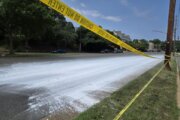
All Slow Streets are installed on local streets that typically don’t have a marked centerline.
No bus routes are included. Many are linked to parks or other areas where people enjoy cycling or taking a stroll.
“We know that more people are walking and biking and — certainly with the need to be social distancing — there’s an added sense of urgency to make sure that cars are driving slower on our roads,” Marootian said.
Installation of Slow Streets signage will begin the week of Aug. 10.
All the new speed restrictions are expected to be in place by Sept. 1 in the following locations:
Ward 1
- 6th Street NW between Lamont Street NW and Keefer Place NW
- Girard Street NW between 14th Street NW and Georgia Avenue NW
- Keefer Place NW between Georgia Avenue and 6th Street NW
- Lamont Street NW between 13th Street NW and Park Place NW
Ward 2
- S Street NW between Massachusetts Avenue and New Jersey Avenue NW (also crosses Wards 1 and 6)
Ward 3
- 39th Street NW between Massachusetts Avenue and Fulton Street NW
- Davenport Street NW between Nebraska Avenue and Linnean Street NW
- Yuma Street NW between Massachusetts Avenue NW and Connecticut Avenue NW
Ward 4
- 8th Street NW between Missouri Avenue and New Hampshire Avenue NW
- Van Buren Street NW between 16th Street NW and North Capitol Street NW
Ward 5
- 10th Street NE between Otis Street NE and Rhode Island Avenue NE
- 17th Street NE between Randolph Street and Bryant Street/Montana Avenue NE
- K Street NE between Bladensburg Road to 18th Street NE/Maryland Avenue NE
- Oates Street NE between West Virginia Avenue to Bladensburg Road NE
Ward 6
- 3rd Street NE/SE between M Street NE to E Street SE
- E Street SE between 4th Street SE to 11th Street SE/Pennsylvania Avenue SE
- G Street NE between 2nd Street NE and 15h Street NE/Gales Street NE
- Gales Street NE between 15th Street NE and 21st Street NE (crosses Wards 6 and 7)
Ward 7
- B Street SE between Benning Road and 54th Street SE (Wards 6/7)
- Fairlawn Avenue SE between K Street SE and Pennsylvania Avenue SE
- K Street SE between Fairlawn Avenue SE and Randle Circle SE
To cut down the traffic volume, drivers are encouraged not to use those roads unless their destination is within two blocks of one of them.
- Sign up for WTOP alerts
- Latest coronavirus test results in DC, Maryland and Virginia
- COVID-19 positive test rate hits new low in Md., on rise around Ocean City
- Virginia first to roll out pandemic app from Apple, Google
- Science not yet certain about COVID-19 risks for moms-to-be
Looking for more information? D.C., Maryland and Virginia are each releasing more data every day. Visit their official sites here: Virginia | Maryland | D.C.