Transportation officials have narrowed down ideas on where to build a new crossing over the Chesapeake Bay in Maryland, and the public can see the proposals for review, which include an option to not build anything.
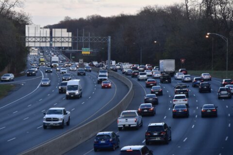
“It’s about performance and what reduces the most congestion and gives the most traffic relief,” Maryland Transportation Authority Executive Director Jim Ports said about the corridors under consideration.
MDTA and the Federal Highway Administration conducted a bay crossing study, which included a no-build alternative and these preliminary “Corridor Alternatives Retained for Analysis”:
- A path north of the current bridge, extending roughly from Maryland Route 100 in Pasadena (Anne Arundel County) across the water to Rock Hall (Kent and Queen Anne’s counties);
- A path south of the current bridge, extending roughly from Crofton (Anne Arundel County) across the water to Easton (Talbot County);
- Or, a path close to the existing bridge corridor along U.S. 50-Md. 301 between Crofton (Anne Arundel County) and Queenstown (Queen Anne’s County).
The federal review process begins with suggested corridors that are about 2 miles wide. Eventually, the focus will be narrowed and more specific paths will be considered.
Chesapeake Bay Crossing Study by wtopweb on Scribd
Environmental studies will evaluate potential impact on everything from the ecosystem to jobs, historic properties, land use and, of course, the potential for reducing traffic.
“We’re trying to put all that in together to come up with the best solution,” Ports said, emphasizing that decisions will not be made based on politics or opinions. “That’s why the federal process is so important, because at the end of the day, it’s data-driven … it’s based on data.”
But who would pay for a new bridge to get built?
One group, the Maryland Transit Opportunities Coalition, thinks drivers will. In a news release stating that a new bridge could easily cost $5 billion to $10 billion, coalition Chair Ben Ross called the idea an exercise in financial fantasy that would cause Bay Bridge tolls to triple.
“If you triple the tolls, commuter traffic is sure to decline,” Ross said. “Once you do that, will there be any point to building the bridge?”
Ports said that it is far too early in the process to discuss financing. “We’ll have to identify the funding sources after we know all the environmental impact and what the real cost is,” he said.
The Maryland Transportation Authority is in charge of tolled facilities in the state.
“So, we’ll be a major player in that and MDOT (the Maryland Department of Transportation) will also be a major player, and we would hope the feds would be, too,” Ports said. “Hopefully, we can partner, but until we know the specifics and what’s actually needed, we can’t answer that question (on who will pay).”
The Eastern Shore Land Conservancy is another group opposing a new bridge span. The group said a new span would “dramatically degrade” what it called “the rural character of the region.”
The group is located in Easton, an area included in one of the MDTA’s proposed routes to address the current congestion of bay traffic.
Instead of a new bridge span, ESLC wants to “make the most of the existing infrastructure” by suggesting off-peak toll reductions, commuter ride-share apps, incentives for high-occupancy vehicles and more.
The group says it wants to support local farming and local economies.
Six open houses in September and October will give residents opportunities to get more information and offer comments:
- Tuesday, Sept. 24, 6-8 p.m. — Kent County High School, 25301 Lambs Meadow Road, Worton
- Wednesday, Sept. 25, 6-8 p.m. — Queen Anne’s County High School, 125 Ruthsburg Road, Centreville
- Thursday, Sept. 26, 6-8 p.m. — Calvert High School, 600 Dares Beach Road, Prince Frederick
- Tuesday, Oct. 1, 6-8 p.m. — Middle River Middle School, 800 Middle River Road, Middle River
- Wednesday, Oct. 2, 6-8 p.m. — Anne Arundel Community College, 101 College Pkwy, Arnold
- Thursday, Oct. 3, 6-8 p.m. — Talbot County Community Center, 10028 Ocean Gateway, Easton
You can find the open house display boards and maps of corridors being considered for further study on the MDTA website. The current Tier 1 portion of the bay crossing study began in 2016.
Officials pointed to data that indicated the three construction proposals are the only ones that sufficiently meet the purpose and need in accordance with the National Environmental Policy Act. The proposals narrow the possibilities from 14 that were first considered.
Anne Arundel County Executive Steuart Pittman, a Democrat, tweeted Tuesday that he was surprised to learn the narrowed down options all involved crossing through his county.
Anne Arundel up in arms as Md. narrows options for new Chesapeake Bay crossing
“Any of the three options will be severely disruptive to existing communities and sensitive environmental areas, and could destroy parks along the Chesapeake Bay at a time when we are trying to expand public water access,” Pittman tweeted Tuesday afternoon.
If we haven’t figured out how to get cars off the road by the time this bridge gets built, we’ll have much bigger problems to confront than traffic. Let’s not build yesterday’s bridge tomorrow.
— County Executive Steuart Pittman (@AACoExec) August 27, 2019
Michael Ricci, a spokesman for Republican Gov. Larry Hogan, told The Associated Press that the governor considers adding a span to the current bridge “the only serious option he supports.”
Public hearings on a draft environmental impact statement will be held in fall 2020. It is expected that a final environmental impact statement will be published and a preferred corridor chosen in collaboration with the Federal Highway Administration in summer 2021.
The Bay Bridge opened in 1952 and is named for former Maryland Governor William Preston Lane, Jr., who, according to the Maryland Transportation Authority, was instrumental in obtaining approval and starting of the bridge’s construction.
Preliminary studies to build a bridge over the Chesapeake started in the 1880s. After several starts and stops due to the 1929 stock market crash and the U.S.’s involvement in World War II, the General Assembly passed legislation to begin bridge construction in 1947.
The eastbound span is 4.35 miles long; the westbound span is 4.33 miles long. Both are 186 feet tall at their highest points.
And that curve near the western side of the bridge is there so that the main spans cross the bay’s shipping channels at 90 degrees, a requirement of the United States Army Corps of Engineers.
WTOP’s Kate Ryan, Teta Alim and Will Vitka contributed to this report. The Associated Press also contributed to this report.