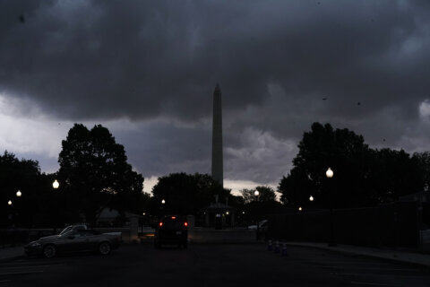
Storms packing strong winds and heavy rain knocked out power to thousands of homes and businesses and prompted a string of severe weather alerts in the D.C. region Monday evening.
The National Weather Service canceled a tornado warning in northwestern Charles County, Maryland, but said a severe thunderstorm watch would remain in effect until 9 p.m. in southern and central Maryland.
The rest of the D.C. region was also placed under a severe thunderstorm watch until 9 p.m.
Previously, the weather service placed D.C., parts of Northern Virginia and central and southern Maryland under a severe thunderstorm warning that expired at 7 p.m.
“Large hail, damaging wind, and continuous cloud to ground lightning are occurring with these storms,” the weather service said, and warned of flash flooding from torrential rain.
Shortly after 5 p.m., the National Weather Service said a thunderstorm a few miles west of Centreville, Virginia, was producing 60 mph wind gusts and dropping hail the size of a quarter. Around 6 p.m., wind speeds reached 70 mph in Quantico, Virginia.
WTOP Meteorologist Mike Stinneford said severe thunderstorms passed through Warrenton and Manassas in Virginia, with heavy cells spotted near Fairfax and stretching up to Rockville, Maryland.
“The Storm Prediction Center just issued an update saying that there is a potential for wind damage, and that that potential will increase over the next one to three hours over some of our suburbs, especially just to the west of the metro area,” said Stinneford, adding that there could be gusts of up to 70 mph.
7News First Alert Meteorologist Mark Peña said that heavy rainfall could bring “anywhere from around a half to over an inch” in some neighborhoods.
Peña said the sudden and heavy rain would alleviate the region’s drought conditions over several days, but everything happening at once could inundate roads, adding that motorists should “turn around, don’t drown.”
Before the storms, conditions were hot and muggy, with afternoon temperatures in the low 90s. The threat will drop into the evening hours, and showers are expected to linger overnight. Tuesday will bring cooler conditions with highs in the 80s.
- Listen to WTOP online and on the radio at 103.5 FM or 107.7 FM.
- Current traffic conditions
- Weather forecast
- Closings and Delays
- Sign up for WTOP email alerts
- Get custom alerts with the WTOP app for Apple and Android phones
FORECAST
MONDAY EVENING:
Tracking Storms, Showers
Temperatures: 80s to 70s
Winds: Southwest 10-15, Gusts 20 mph
The threat for severe thunderstorms will continue through approximately 8 p.m., especially along and east of I-95. Damaging winds remain the primary concern, although localized flooding may develop where the heaviest rain occurs. The National Weather Service has posted a ‘severe thunderstorm watch’ until 9 p.m. Storms will be moving at a decent pace, but the atmosphere contains abundant moisture and any storm will be capable of producing very heavy rainfall. Showers and a few thunderstorms may linger well into the evening before gradually weakening. Sunset is at 8:37 p.m.
Lingering Showers End
Patchy Fog
Lows: 67-73
Winds: Northwest 5 mph
Showers and storms will gradually wind down overnight, with most activity ending by around 1 a.m. Skies remain mostly cloudy for a while, but the trend will be quieter and less humid toward daybreak. Any leftover wet roads or areas of poor drainage may take a little longer to improve along with a bit of patchy fog.
Mostly Cloudy
AM Showers Possible
Highs: 75-80
Winds: Northwest 5-15 mph
Tuesday turns calmer behind the front. A few clouds may linger early, but the day should feature improving conditions, lower humidity and seasonable temperatures in the middle 70s to around 80 degrees. It will feel noticeably more comfortable compared to the muggy setup that helped fuel Monday’s storms.
Mostly Sunny
Highs: 82-87
Winds: Northwest 5-10 mph
Wednesday looks like the nicest day of the week. Expect dry weather, lower humidity and comfortable temperatures with highs in the low to mid 80s. This will be the best opportunity for outdoor plans before humidity and storm chances begin to build again late week.
Partly Cloudy, Chance for Storms
Highs: 85-90
Winds: South 5-10 mph
The dry stretch begins to break down as winds turn more southerly and humidity gradually increases. While much of the day may remain dry, scattered showers and thunderstorms could develop later in the afternoon and evening. High temperatures will climb into the middle to upper 80s to near 90.FRIDAY:
Mostly Cloudy
Storm Chances
Highs: 85-90
Winds: South 5-10 mph
An approaching weather system from the Great Lakes will bring another opportunity for showers and thunderstorms. While details on timing remain uncertain, Friday currently appears to offer the best chance for more widespread storm activity late this week. High temperatures will reach the middle to upper 80s with increasing humidity. Any thunderstorms that develop will be capable of producing heavy downpours and gusty winds.
CURRENT CONDITIONS
Get breaking news and daily headlines delivered to your email inbox by signing up here.
© 2026 WTOP. All Rights Reserved. This website is not intended for users located within the European Economic Area.