WASHINGTON — Technology is making it a lot easier to determine where snow plows are, whether they’ve missed your street or whether they’re on the way to clear your road.
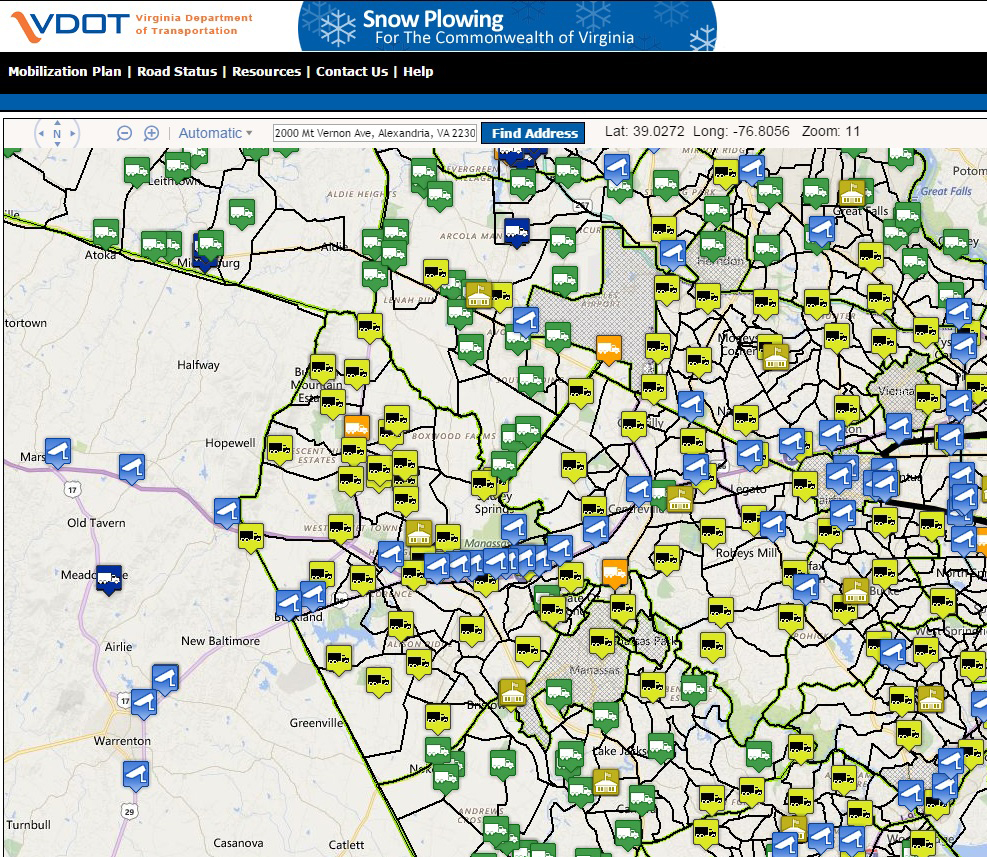
Virginia’s snow plow tracker system gives users access to road conditions via live traffic cameras. It shows the locations of trucks depicted in various colors to denote whether they’re actively plowing.
Streets are shown in various colors that reflect whether plowing is complete, in progress, or not yet started.
When plowing is underway, plow truck locations are updated every two minutes and neighborhood color codes reflect their stage of completion.
You can report unplowed roads to novainfo@vdot.virginia.gov or 800-367-7623.
In Maryland, roads with numbers such as Md. Route 355 are cleared by the State Highway Administration. You can view live traffic cameras of traffic conditions here.
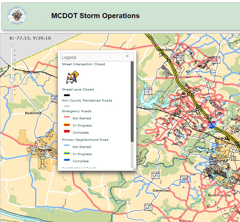
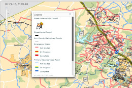
Montgomery County’s snow map uses color codes to reflect the status of plowing on streets and in neighborhoods.
Residents can call 311 to report if they believe their street has been missed.
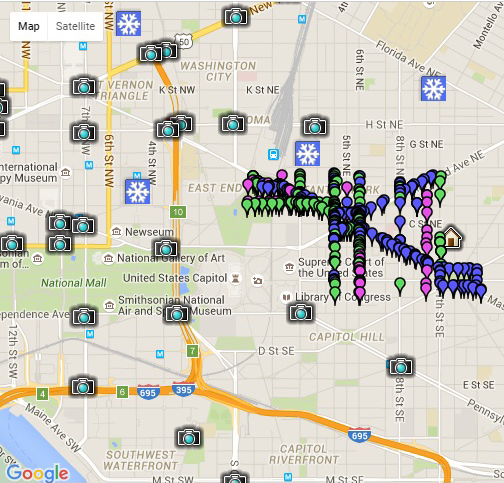
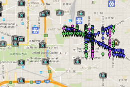
In the District, the Snow Response Reporting System allows users to look at live road conditions by clicking on traffic cameras. The map also provides a multi-hour, animated depiction of travel by salt trucks and snowplows in the vicinity of a specific address the user provides.
Respect and patience are universal messages all road crews share in times of heavy snow storms.
People who must be on the road during bad weather should respect plows and salt trucks and give them ample space to do their jobs. Also, realize it may take crews awhile to get to every street that needs to be plowed.
As for who is responsible for clearing away snow, WTOP Traffic reporter Bob Marbourg says in Virginia, VDOT is responsible for all interstates, highways and neighborhood streets. The exception is within the independent cities (Alexandria, Vienna, Falls Church, Manassas, etc.) and Arlington County.
Marbourg says in Maryland, the State Highway Administration is responsible for the interstates, U.S. routes, and numbered state roads.
Simultaneously, Marbourg says the counties are responsible for the roads without numbers, except within the incorporated towns and cities (Rockville, Gaithersburg, Laurel, Hyattsville, Bowie, Waldorf, etc).
The Maryland Transportation Authority (MDTA) is responsible for the toll facilities (Bay Bridge, MD200 ICC, Kennedy Highway I-95 north of Baltimore).
Editor’s note: Prince George’s County snow plow-tracking website information has been removed from this story after its system seems to have been taken offline. WTOP has reached out to county officials.