Workweek weather: Nor’easter brings wintry mix, needed moisture

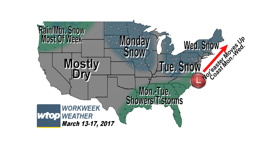
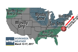
WASHINGTON — A large nor’easter arrives this week, bringing heavy late-season snow to the listening area. The impact will last for days after the storm is over.

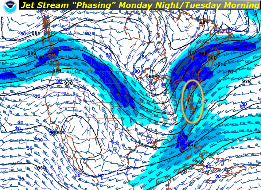
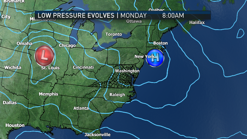
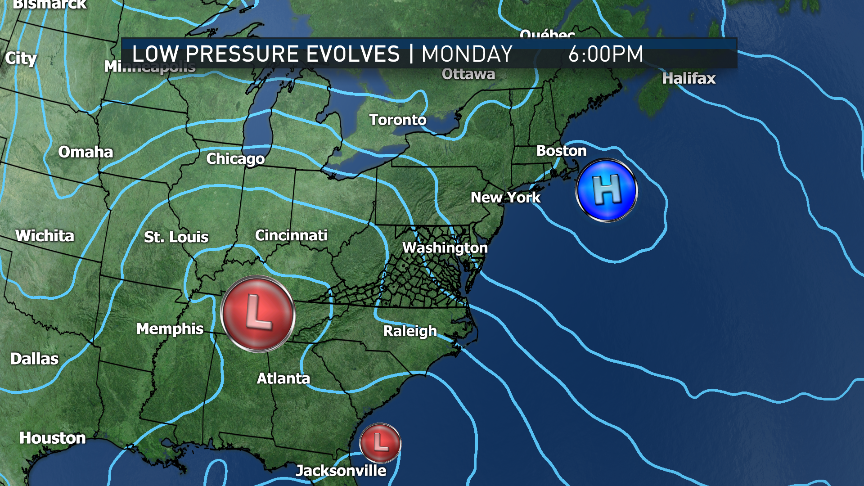
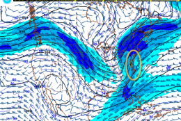
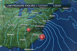
A system associated with the northern branch of the jet stream winds aloft will be transferring its energy to form a new low pressure system off the East Coast in a classic fashion, resulting in a large storm. It will bring heavy rain to the Southeast and heavy, wet snow to the D.C. area, all the way up through Pennsylvania and into New England. Some areas will end up with double digit accumulations, but others will have the apparent accumulations knocked down by sleet and rain.


A very “sticky” snow on the trees and power lines could lead to power outages as strong winds pick up. However, an indirectly positive impact of this storm — aside from snow for snow lovers — will be how much moisture this snow will contain. Since most surrounding areas are in “severe drought” status right now (some even recently dealing with brush fires), all this moisture will help mitigate the drought.

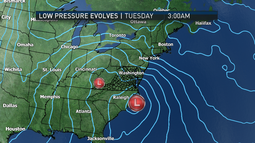
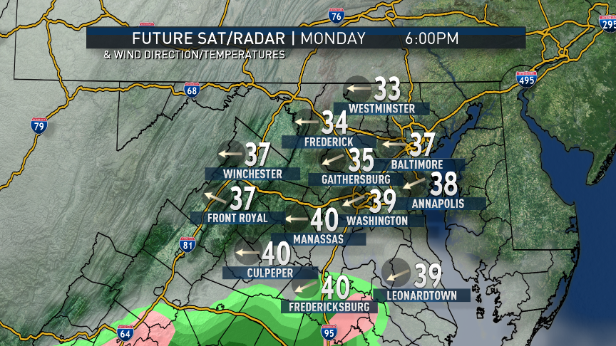
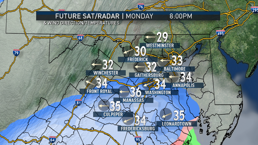
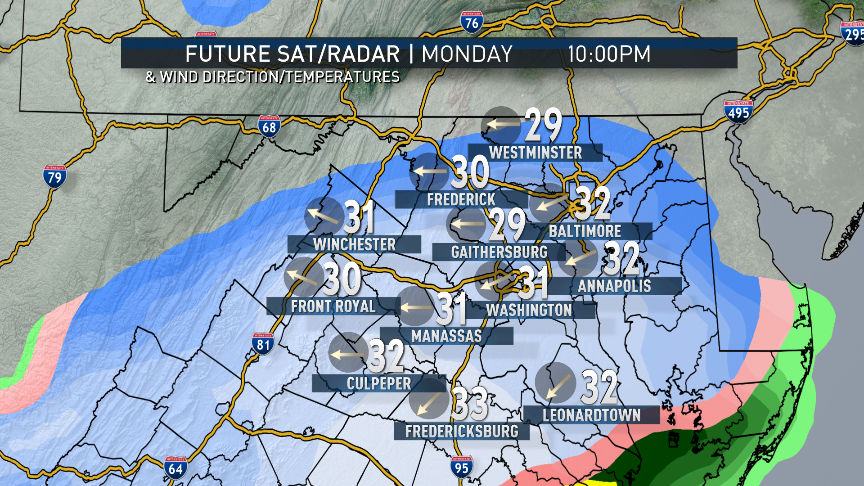
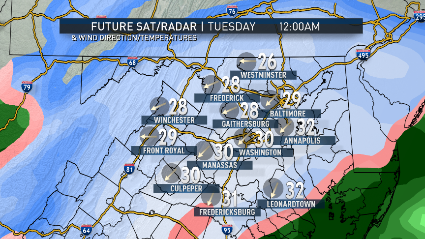
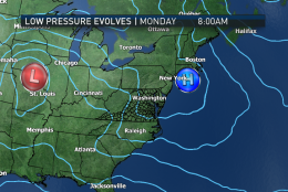
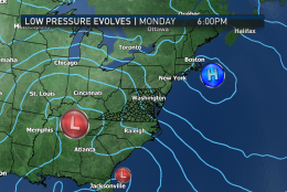
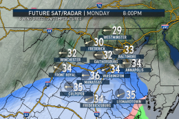
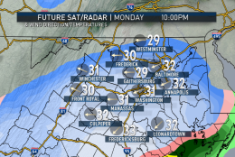
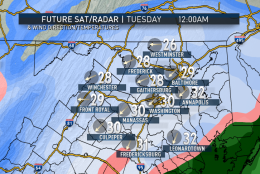
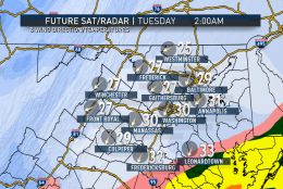
As the storm develops off the southeast coast on Monday, rain will move up from the Carolinas. But by the time the moisture gets to D.C., it will be nightfall with cold, dry air in place. That ensures it starting as snow in the D.C. area with heavy snowfall rates picking up as the storm energizes Monday night. Travel overnight Monday will be especially hazardous, and we will be picking up most of our snowfall totals during that time frame and into midmorning Tuesday. That’s when the winds will really become a factor, as the storm deepens even more heading for New England.

A large nor’easter arrives this week, bringing heavy late-season snow to the listening area. The impact will last for days after the storm is over. (WTOP/Storm Team 4)
Here’s the snowfall forecast from Storm Team 4 issued on Sunday evening (may have changed early Monday). This is a sizable, high-impact storm for the D.C. area any time of year, so especially for mid-March. It’s anticipated to be heavy, wet and compacted snow, especially for northern Maryland and the higher elevations. Remember these are ranges, which means those numbers and everything in between are possible within those areas. But forecasters are leaning toward the higher end of the ranges for most. (Storm Team 4)
So, what’s causing the storm? As mentioned earlier, it’s a classic east coast “phasing” of systems, with a former low losing its identity at the gain of a new low off the coast. It can be exemplified in this jet stream computer model graphic. The shaded areas are “streaks” of the highest wind speeds aloft. Within these streaks are areas of rising and sinking motions. When the areas of rising motions overlap, it’s like an airlock gets opened in the atmosphere and a low pressure system deepens strongly and rapidly (meteorologists call it “bombing”). In this graphic from the North American Mesoscale (NAM) model, the circled area shows where this will occur: along the southeast coast. (Environmental Modeling Center, NOAA. Annotations: WTOP/Storm Team 4)
In this series of images, sea level pressure lines (isobars) are shown from the RPM computer model. In time it shows high pressure, which brought the sunshine to the area on Sunday, moving away; the old low in the Midwest dying out and the new one forming rapidly off the coast. The closer the lines, the more pressure changes over a given area. That means stronger winds. The worst of the winds from the storm will be over New York and the rest of New England. We will be windy enough in the area, however, to give us some problems. Our wind direction will go from southerly Monday afternoon to suddenly northeasterly (where nor’easters get their name), then northwesterly as the storm pulls away. (Data: The Weather Company; Graphics: Storm Team 4)
(Data: The Weather Company; Graphics: Storm Team 4)
This series of images is broken down into more time frames to show the likely progression of the system. Again, it’s the RPM model. Note that briefly to our south, it starts as rain. By the time it’s in the D.C. area, it’s snow. The heaviest snowfall rates are overnight Monday into Tuesday morning, then the snow bands will start to break up. Wind directions will change. Temperatures are cold, but note that they are not that cold. That’s one reason we believe the snow will be “low ratio,” very heavy and wet. The peach colors in the future radar are indicative of snow mixing with sleet and rain. The yellows and oranges indicate heavy rain over the Delmarva (and close to the WTOP listening area). Green colors are light rain. Do note, however, that very cold temperatures will move in on the backside of the storm, causing a freeze of all the slush and any standing water Tuesday evening into Wednesday morning. (Data: The Weather Company; Graphics: Storm Team 4)
(Data: The Weather Company; Graphics: Storm Team 4)
(1/23)

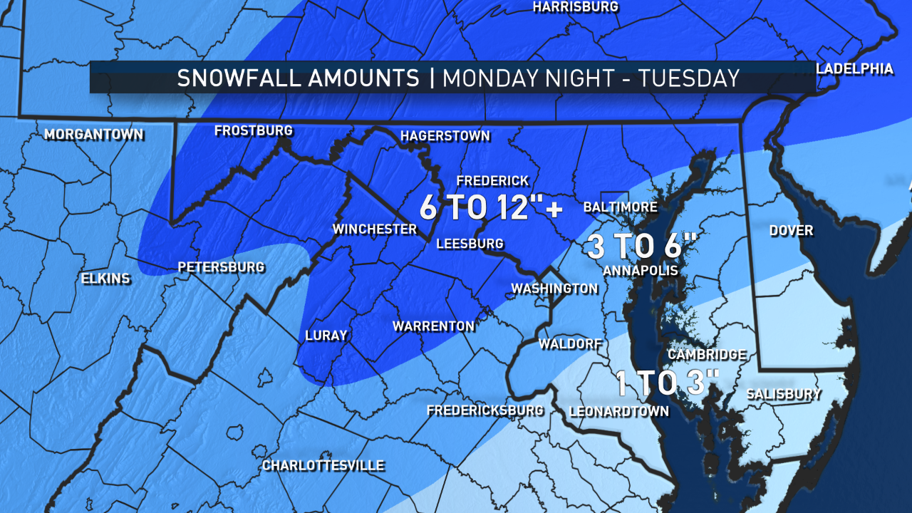
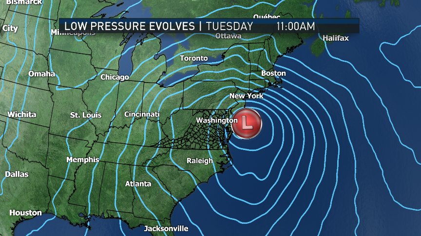
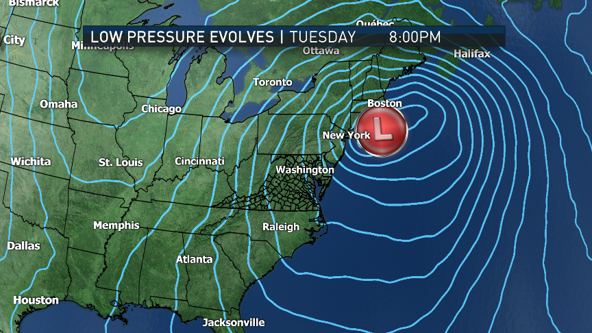
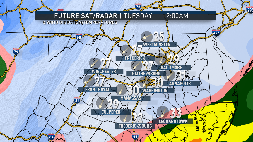
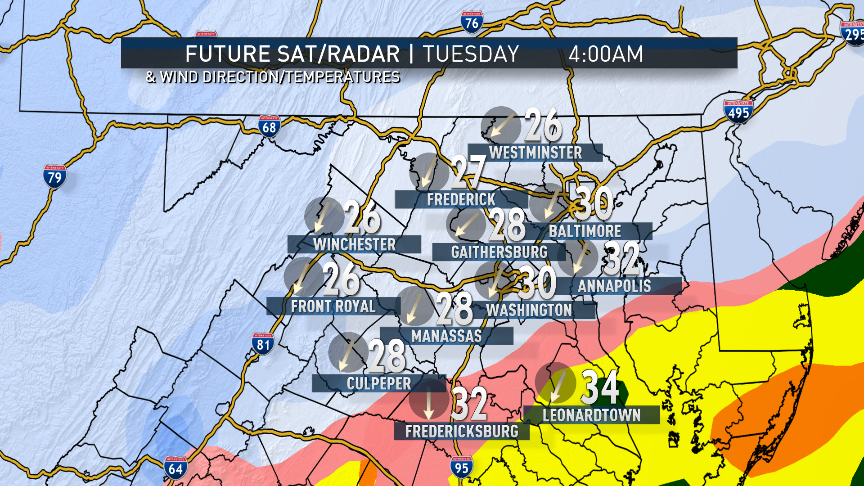
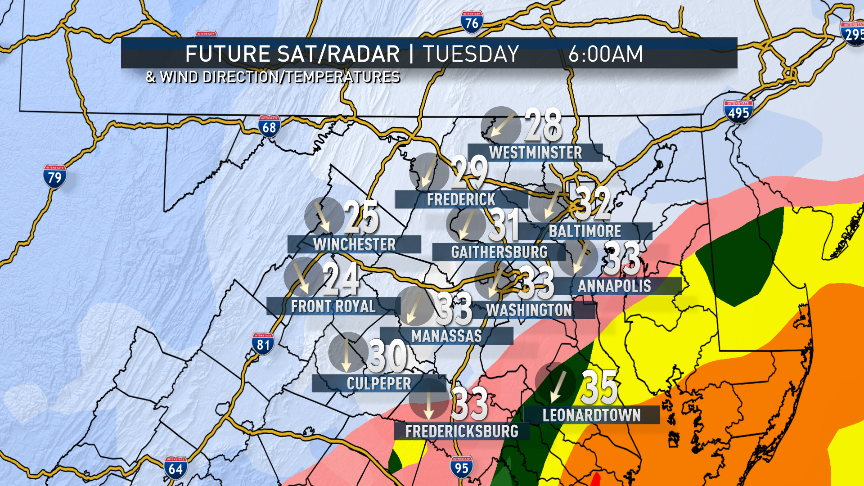
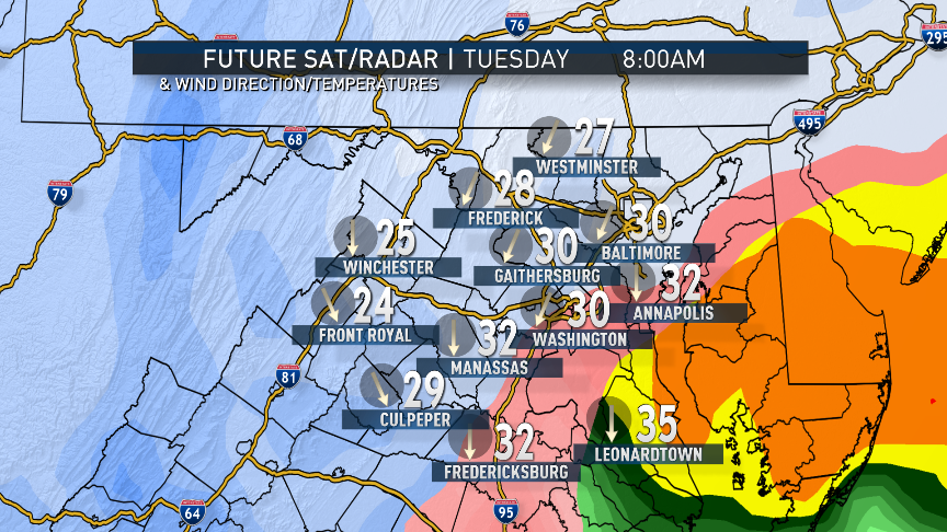
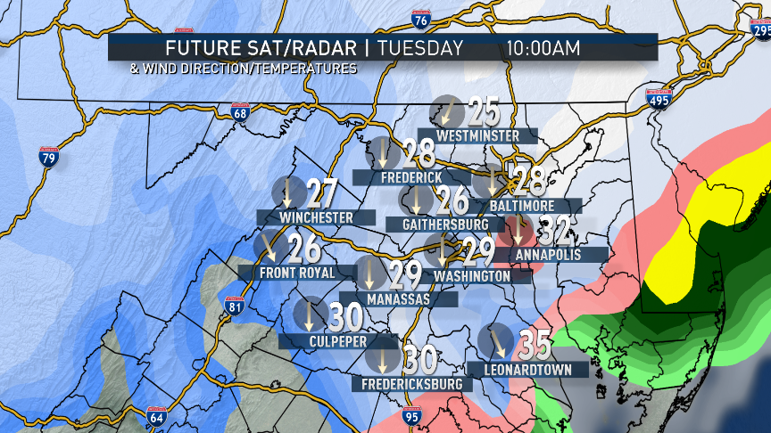
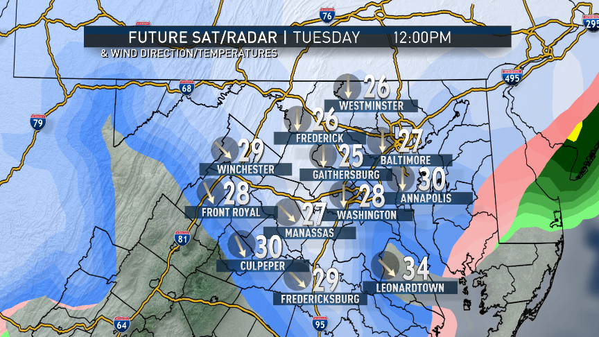
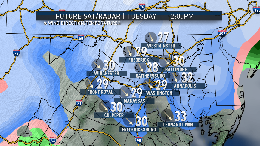
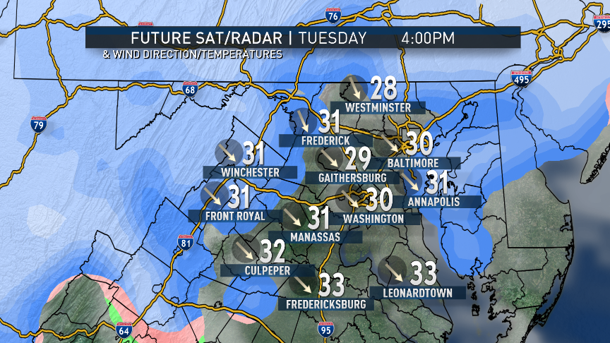
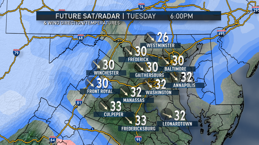
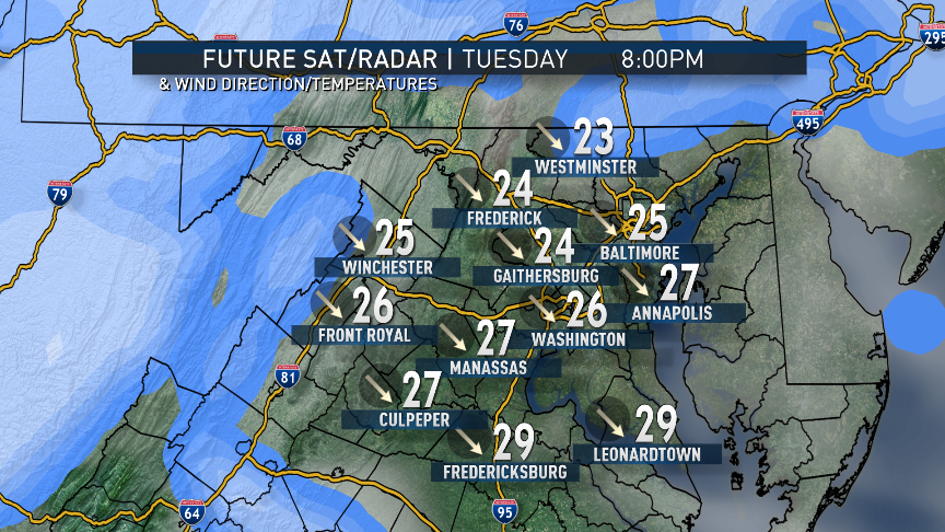
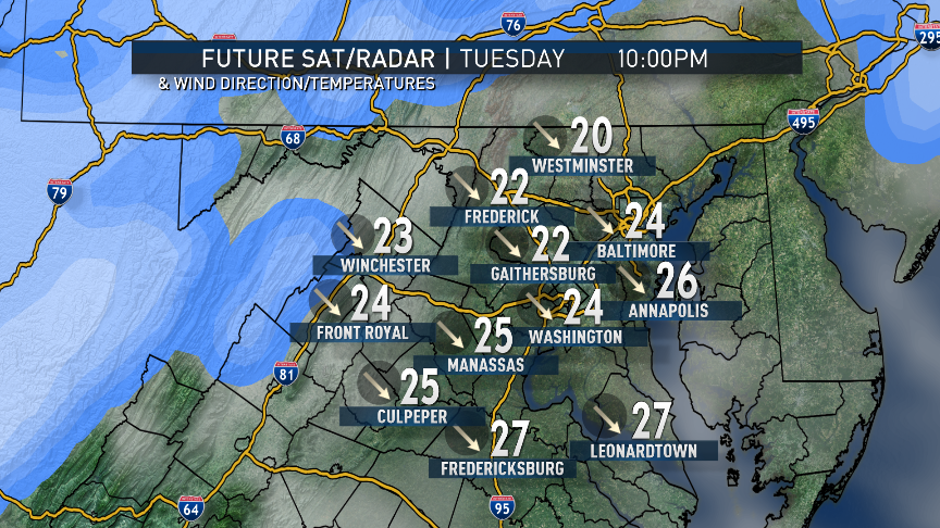
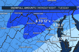
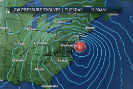
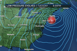
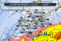
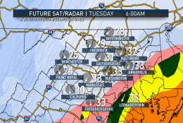
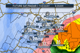
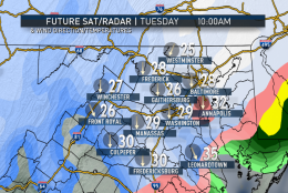
Only snow showers will be left here Tuesday afternoon and evening, but some blowing and drifting could occur. The strength of the storm also indicates that southeast of D.C., the rain/snow line as well as some sleet will be in play, cutting down amounts. But they will still benefit from the heavy rain. When it’s all over, the entire area will have received on the order of the equivalent of 1-2 inches of rainfall.

So except for the aftermath on Wednesday, there are no large scale significant weather events heading for our area the rest of the week.

Find the latest about the nor’easter on the NBC Washington weather page.

Daily weather highlights

MONDAY
• Cold start
• Some sun early, then clouding over
• “Warmest” day of the week — still below average
• Snow arrives just after the evening rush, heavy at times overnight
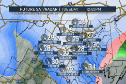
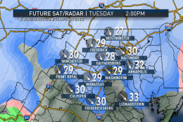
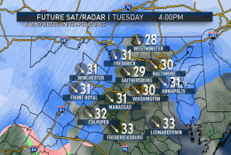
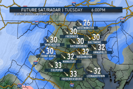
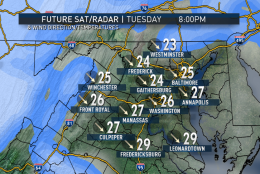
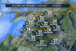
TUESDAY
• Heaviest of the snow ending in the morning, lighter snow on and off through afternoon and evening
• Southeast of D.C.: Wintry mix comes in
• Becoming windy, blustery and cold
• Some blowing and drifting, especially in mountains, away from the mixed precipitation influence
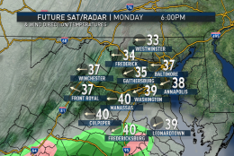
WEDNESDAY
• Hard freeze of all slush in the morning
• Very windy, blustery and cold
• Scattered flurries
• Mostly cloudy skies
• Highs close to freezing

THURSDAY
• Another hard refreeze of all slush and snowmelt in the morning
• Not as windy
• Temperatures still well below average, very chilly

FRIDAY
• Lots of sunshine
• Back to near 40; lots of snowmelt


Editor’s Note: The WTOP Workweek Weather Blog is intended as an in-depth yet plain language summary of the business week’s weather potential in the D.C. area along with an explanation of the contingencies and uncertainties that exist at the time of publication. For the latest actual Storm Team 4 forecast, check out the main WTOP Weather Page.

Federal News Network Logo
Log in to your WTOP account for notifications and alerts customized for you.

Sign up