EDITOR’S NOTE: The WTOP Workweek Weather Blog is intended as an in-depth yet plain language summary of the business week’s weather potential in the D.C. area along with an explanation of the contingencies and uncertainties that exist at the time of publication. For the latest actual Storm Team 4 Forecast, check out the main WTOP Weather Page.
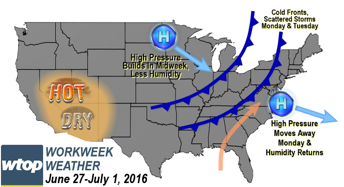
WASHINGTON — Not a lot has changed in the overall pattern across North America since last week. That means, like last week, we’ll have fluctuations in heat and humidity, and a few chances for thunderstorms with the passage of a few cold fronts, especially in the beginning of the week.
But unlike last week, it doesn’t look like there will be chances for widespread severe weather. Even so, the ones on Monday will have to be monitored through the day.
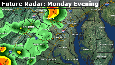
The high-pressure system that provided the nice weekend will be heading out first thing on Monday, and southerly winds at the surface will start pumping in more humidity. That and a well-heated atmosphere will mean instability. Add in an approaching cold front and some storms will form first in the higher elevations, then move over the rest of the area during the late afternoon through the evening rush.
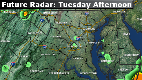
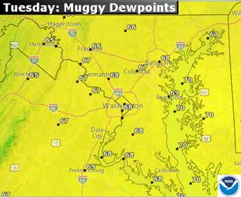
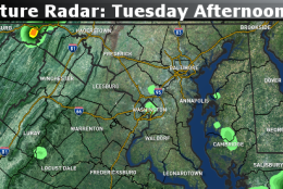
The front is not that strong, so the humidity will still be around Tuesday, a day that will feature another cold front. This front is a little stronger, but right now it appears like most of the dynamics — or energy aloft — will be farther north in Pennsylvania and the Great Lakes. So it appears that we won’t get as many storms out of its passage and they won’t be too strong, at least not in many locations.
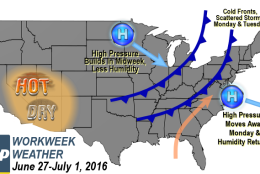
On Wednesday, a new high pressure system like we had over the weekend will take over, and we’ll repeat the process: a day and a half of warm, but pleasant conditions, followed by more humidity and hotter temperatures for the end of the workweek. And, yet, another cold front will touch off some scattered thunderstorms on Friday. If the trend continues, we may end up with a nice holiday weekend.
Of course, the Nationals are back in town this week, playing every evening. Monday, especially, they will have to keep an eye to the sky during game time because there could be some storm delays. Storms are possible Tuesday, but less likely than Monday. Friday could also have some delays from thunderstorms.
This pattern continues to be maintained by the self-perpetuating heatwave in the southwest that keeps cooler weather flowing into eastern Canada and New England. We are close enough to keep getting all these Canadian high-pressure systems that bring us breaks in the humidity.
Daily weather highlights
Monday
- Humidity back up to sticky levels, making it feel much more uncomfortable
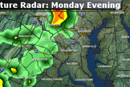
- Thunderstorms form in the early afternoon in the mountains
- Storms slowly move through most of the area during late afternoon and evening rush
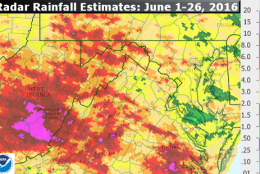
- Some locally heavy downpours
- Stays muggy at night with patchy fog
Tuesday
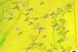
- Hot and very humid
- Another chance for storms mid-afternoon through evening
- Storms even more scattered than Monday’s
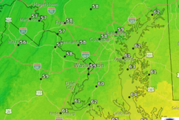
- Turning cooler and less humid at night
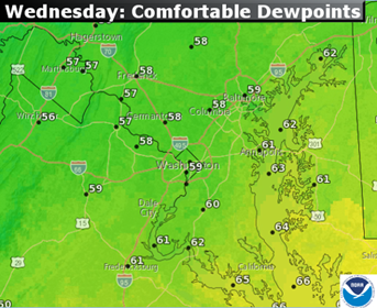
Wednesday
- Return of mostly sunny skies during the day
- Dew points back down into the 50s, so feeling much more comfortable
- Not as hot; more seasonably warm temperatures
- Great sleeping weather at night
Thursday
- Starts out nice and comfortable
- Humidity will creep up late in the day
Friday
- Hot and humid
- Chance for scattered late-day thunderstorms