WASHINGTON — As we enter meteorological summer, we’ll see summer-type downpours Monday before we start to cool down midweek. But all that rain will bring the chance for flash flooding.
The Setup
A cold front is situated just to the north of the region Monday. A trough to the west will help slowly push the front through the WTOP listening area. However, the front will stall just to the south through at least Wednesday afternoon. Ahead of the front, a warm, moist air front to the south and southwest will stream into the region making for a hot and humid Monday.
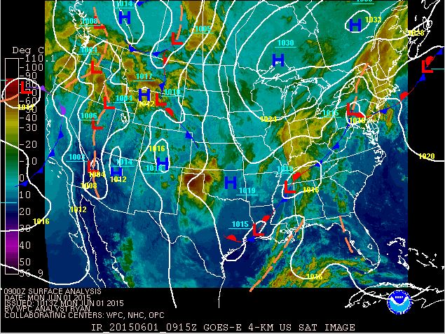
Rain showers and thunderstorms will develop after the noon hour and continue through overnight Monday and into Tuesday as an area of low pressure rides along the front. This will be the case as the front stalls and pieces of energy move along the stalled front. However, we will be on the north side of the front Tuesday and Wednesday bringing us a more northerly flow, which will produce cooler temperatures. High pressure will then build in from the east as we head into the end of this workweek.
Flooding
Flash Flood watch has been expanded to include all of the #DC metro area and beyond! Heavy Rain possible! pic.twitter.com/Qmr8ehYOft
— Lauryn Ricketts (@laurynricketts) June 1, 2015
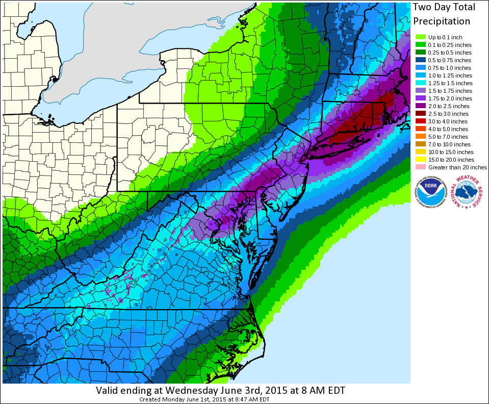
It seems the heaviest rain could fall across the WTOP listening area Monday night and into the overnight. We will have to monitor any flash flooding because of our moisture rich atmosphere. There could be rainfall rates in some storms that run 1 inch to 2 inches per hour! Those areas that received a good dose of rain over the weekend (especially through Maryland) will be more prone to flooding.
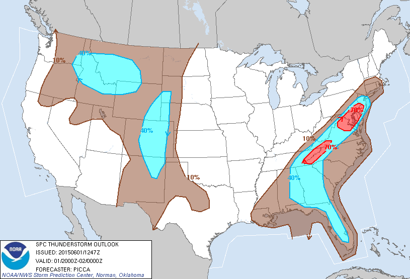
We are not expecting a widespread severe event. But there could be some strong thunderstorms with lots of lightning.
And we could use the rain. No, we are not in drought conditions but you may have noticed your lawn getting a little on the dry side. Only about 1.92 inches of rain fell in the month of May. On average, we get about 3.99 inches of rain in May. That put us about 2.07 inches below our average for total rainfall for the month of May. Therefore, a good rain is needed here in the region.
Also, if you are headed to Nats Park Monday night to see the Nationals take on the Toronto Blue Jays at 7 p.m., remember to pack your patience and pack your rain gear. Fingers crossed the game does not get rained out, but as of Monday morning, the chances for no rain around the D.C. area at game time are looking slim.
Rain chances will continue into the overnight. However much of the rain will decrease in intensity and coverage. So there will be a few rain showers possible through Tuesday morning, but expect much cooler temperatures and stable conditions through the day Tuesday with temperatures only topping out in the lower 70s.
Some rain chances will continue through the end of this week and even through the weekend as another cold front slides through on Saturday. Temperatures creep back into the lower 80s by the week’s end and into the weekend so this tiny cool down will not last long.
One hot May
If you thought it was hotter than a typical May for D.C., you’d be right on target. It was officially the warmest May on record for the D.C. and Baltimore area.
The region saw seven days when temps reached 90 degree or higher and 22 days when temps were at least 80 degrees or warmer. We averaged 73.2 degrees for the month of May in 2015. The previous record average was 73.0 degrees reached in 1991.