Just one week after the bomb cyclone walloped the Great Lakes with blizzard conditions, a developing pattern called an ‘atmospheric river’ is set to bring flooding downpours and heavy mountain snow to the West Coast. How will this upcoming weather pattern change impact D.C.?
- Listen to WTOP online and on the radio at 103.5 FM or 107.7 FM.
- Current traffic conditions
- Weather forecast
- Closings and Delays
- Sign up for WTOP email alerts
- Get custom alerts with the WTOP app for Apple and Android phones
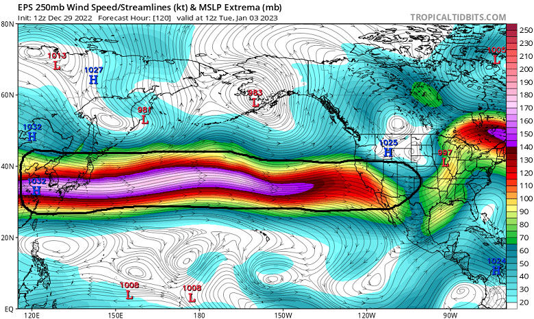
In the atmospheric river, the jet stream (or zone of upper-level winds) will be unusually strong and extend clear across the Pacific from Asia to California. It’ll act as a hose to direct repeated storm systems onto the West Coast. That rain will trigger flooding for coastal and valley locations, while the Sierra gets clobbered with feet of snow.

Historically, atmospheric rivers contribute to 28 to 46% of the West Coast’s precipitation in the winter. Since the end of September, drought coverage in the West has dropped 9.6 to 64.25%. Drought recovery will accelerate in the upcoming pattern for the first two weeks in January.
So, how will the atmospheric river impact D.C’s weather? Let’s examine previous such events. The table below has the details:

The bottom line is, a strong Pacific jet stream is not conducive to a major D.C. snow event and we’ll have to wait until at least mid-January to see the first inch of snow in Washington. Cold blasts will be transient, and we’ll see above-average temperatures through mid-January.
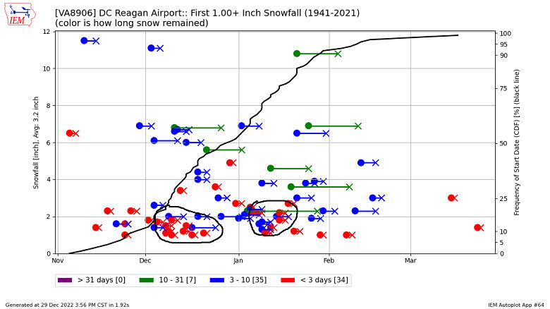
Speaking of our first inch of snow, we’re almost overdue! Historically, the first inch of snow happens between mid-December and mid-January. The latest recorded date for the first inch of snow in Washington is March 25, 2013. That year, only 3.1 inches were accumulated for the entire winter. The second-latest first inch was recorded in March 1950, when that season’s snowfall was only 3.4 inches. The average seasonal snowfall in Washington is 13.7 inches.


