WASHINGTON — A chilly forecast starts the week but spring — and even summer — sprouts later this week.
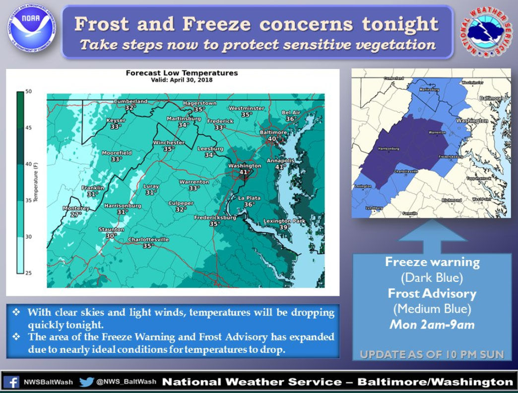
Counties south and west of D.C. are under a frost advisory until 9 a.m. Monday. These include Loudoun, Fairfax, Prince William and Fauquier, Stafford and Spotsylvania counties in Virginia; and parts of Montgomery, Howard and Prince George’s counties in Maryland. Parts of the Shenandoah Valley are under a freeze warning.
Storm Team4’s Somara Theodore said that temperatures will drop into the mid 30s, and it will be pretty breezy with gusts up to 30 to 35 mph.
The National Weather Service issued a fire weather watch for parts of the area, as well, from Monday 10 a.m. through the evening. Low relative humidity and gusty winds may contribute to the spread of fires.
But the chilly start will give way to a “nice taste of spring,” Theodore said. Highs for the rest of Monday will be around 70 degrees with sunny conditions.
Then a taste of summer on Tuesday, with temperatures expected to hit 80 degrees. And it gets warmer after that. Below is the forecast for the next few days.
- Monday: Sunny. Highs in the upper 60s near low 70s.
- Tuesday: Sunny. Near 80 degrees
- Wednesday: Sunny. Low to mid 80s.
Theodore said that Thursday’s forecast will be “flirting with 90 degrees.” We’ll swipe right on that.