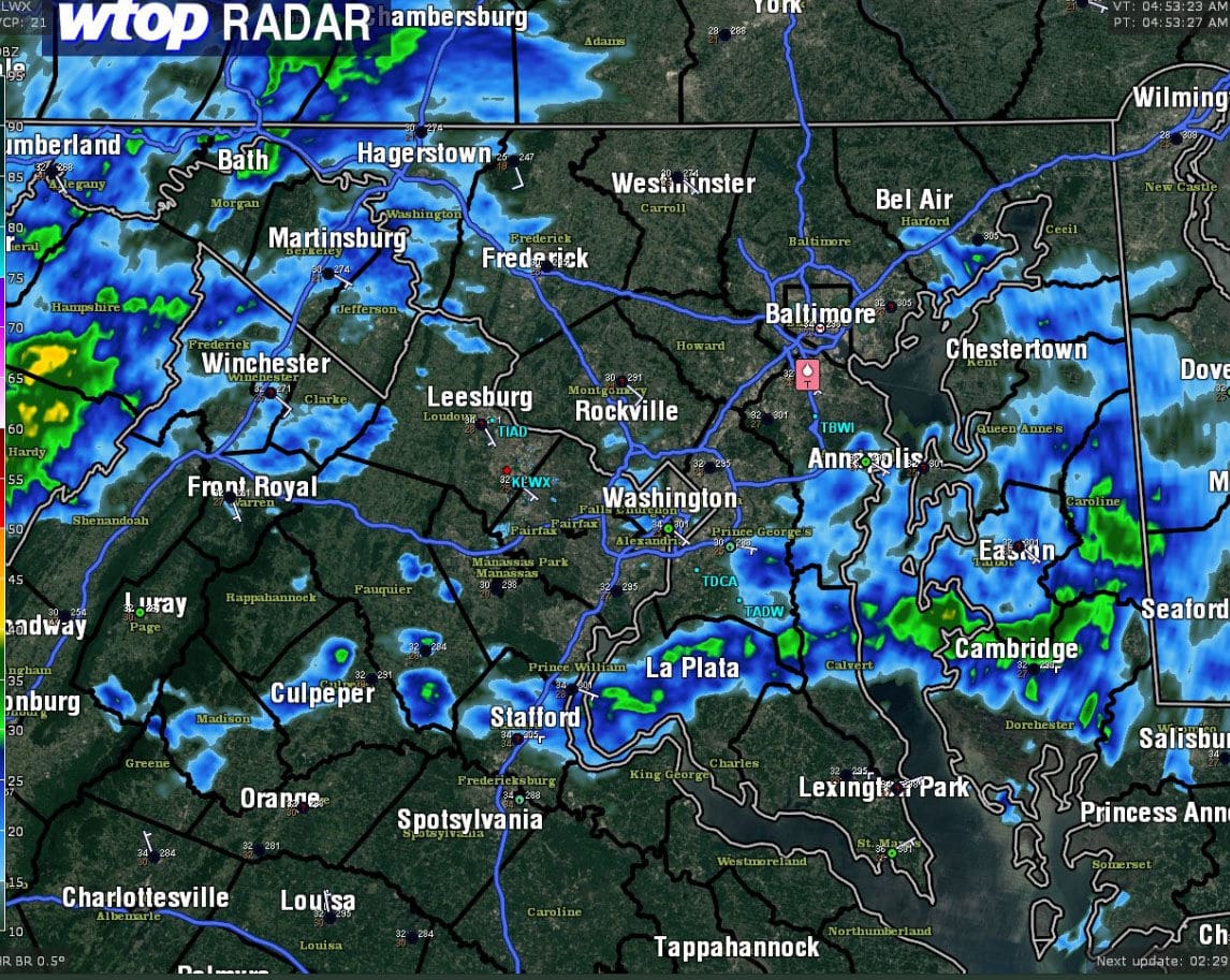
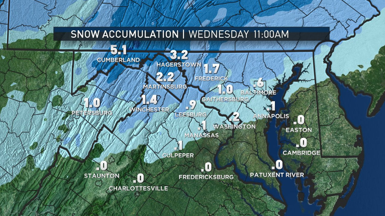
#WeatherAlert: Icing possible through noontime along the I-81 corridor. Fewer issues closer in towards DC Metro area. pic.twitter.com/0baer7oPwW
— Chuck Bell (@ChuckBell4) February 7, 2018
WASHINGTON — Wednesday’s wintry morning mix will segue into a wet afternoon drive.
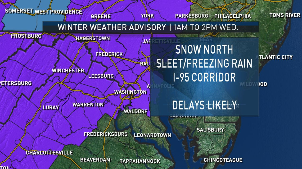
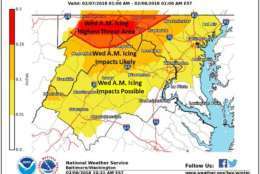
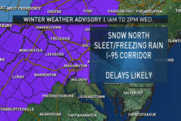
The National Weather Service issued a winter weather advisory for the region until 1 p.m.
A winter storm warning is also in effect for the eastern panhandle of West Virginia and Washington County, Maryland, through Wednesday, said Storm Team 4’s Lauryn Ricketts.
In Fredericksburg, Virginia, and southern Maryland, the precipitation finished by 6 a.m. and the winter weather advisories for the areas have been canceled.
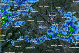
#WeatherAlert: Freezing Rain Threat continues. Here are the temperatures to go along with the radar image I just posted. A tenth to a quarter of an inch of ice accretion possible. Watch for falling branches, trees & power lines! pic.twitter.com/5jRoeEcvEa
— Chuck Bell (@ChuckBell4) February 7, 2018
Closings and Delays
WTOP’s Weather Center
WTOP’s Traffic Center
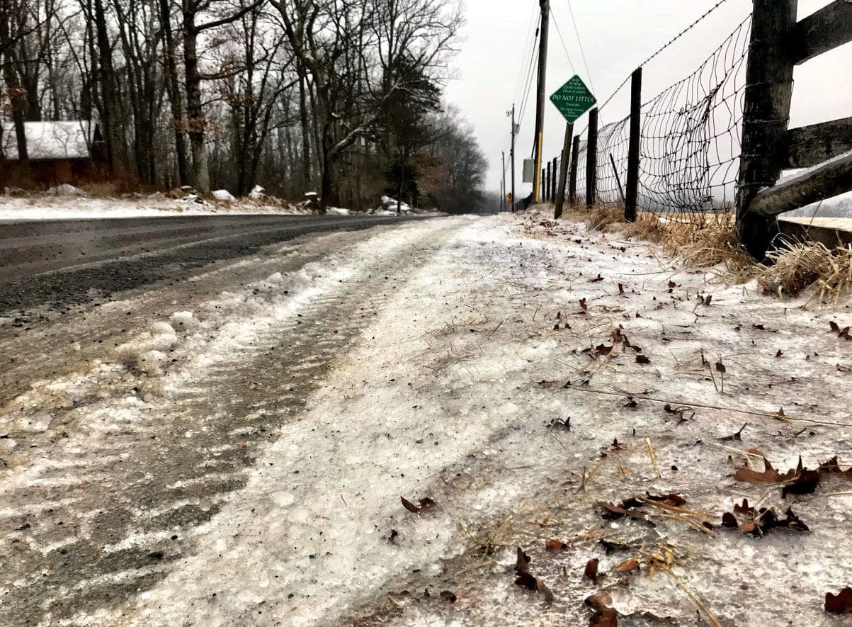
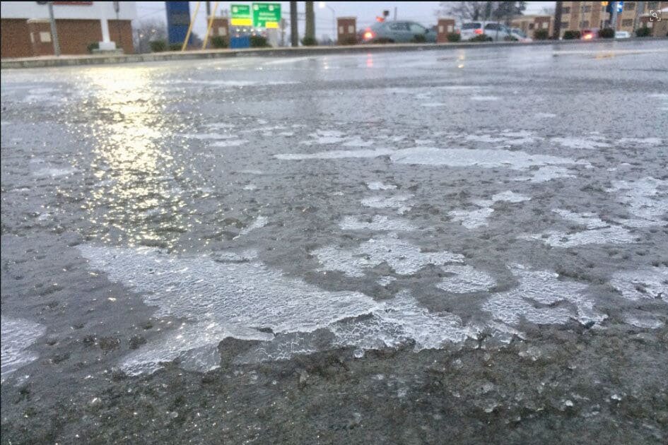
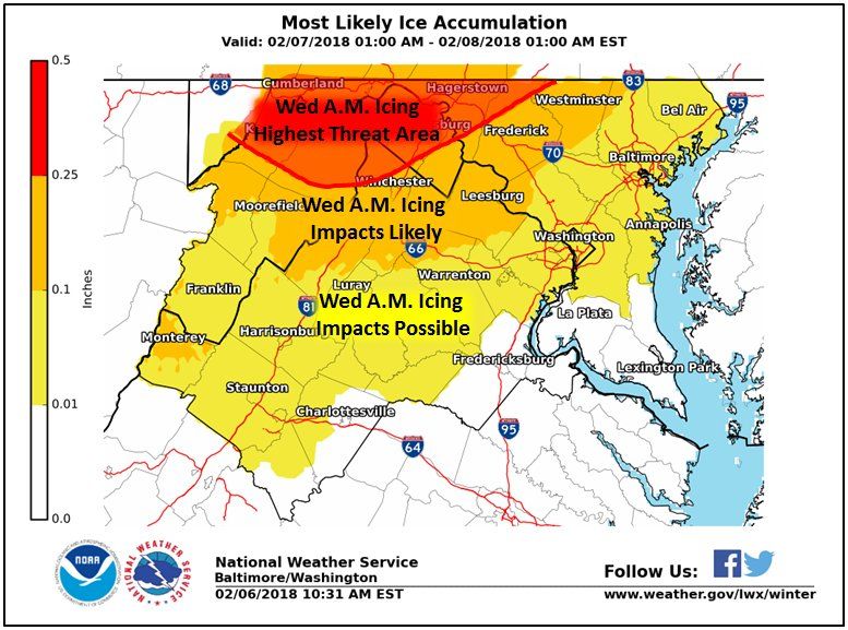
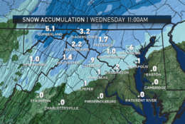
The D.C. region can expect ice accumulations up to a tenth of an inch, with the highest ice accumulations in the northern and western suburbs of D.C. and Baltimore.
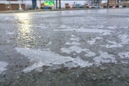
Temperatures for the entire area are below freezing, and there were many reports of icing this morning, Storm Team 4’s Chuck Bell said.
In Loudoun County, the small amount of precipitation seen in the morning did not enough to affect road surfaces that were pre-treated, said WTOP reporter Neal Augenstein. But by 6:30 a.m., there were more precipitation in Loudoun and Prince William counties.
In Montgomery County, only rain has fallen so far, said WTOP reporter Nick Iannelli.
Significant icing is possible along the Interstate 81 corridor and the northern end of I-270; however, closer to I-95 and the Beltway, there were no widespread issues, Bell said.
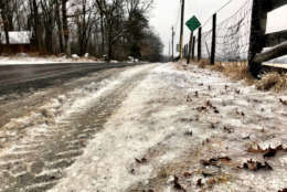
Some drivers encountered slippery roads and reduced visibility during the morning commute. Iannelli said that in Frederick, Maryland, local roads had icy spots where tires slipped around.
Maryland State Highway Administration spokesman Charlie Gischlar said drivers should “slow down and drive for the conditions.” He cautioned that bridges freeze before roadways and to “drive for the condition.”
Be careful when venturing outside. A glaze of #ice, or at least icy spots, may be outside your door this morning. Note – Some areas of freezing drizzle area being reported in spots where weather radar is not showing anything (drizzle drops are too small for the radar to see).
— NWS DC/Baltimore (@NWS_BaltWash) February 7, 2018
Most school systems in Maryland and Virginia were on a two-hour delay. Prince William County schools in Virginia are closed. And, Loudoun and Fairfax county school systems changed their status from a two-hour delay to closed. The federal government opened two hours late.
For a complete list of delays and closures, go to WTOP’s Closings and Delays page.
It will warm up quickly, with periods of heavy rain expected between noon and 6 p.m. Temperatures will be in the low to mid 40s. Any icing that may occur will not be an issue for the afternoon commute.
Gusty showers will continue through the evening and wrap up after the evening commute, but temperatures will fall into the 20s Wednesday into Thursday that could lead to a refreeze, Bell said. Black ice could be a serious concern and lead to another round of closings and delays.
Another chance for rain will arrive Saturday evening and continue through Sunday.
The forecast for the next few days:
- Thursday: Partly sunny and blustery through the morning. Watch for black ice. Highs in the mid to upper 30s.
- Friday: Partly sunny, warmer. Highs in the mid to upper 40s.
- Saturday: Cloudy, rain possible. Highs in the 50s.
- Sunday: Showers through the day. Highs in the upper 50s.