WASHINGTON — The WTOP listening area is about to get some needed rainfall.
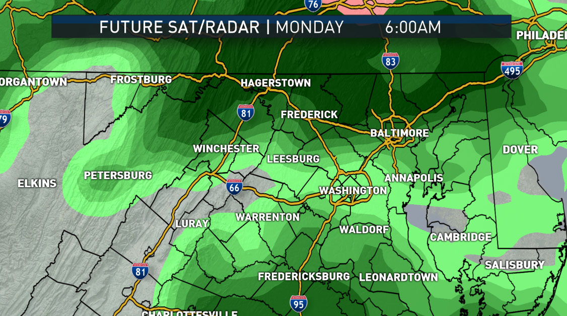
Two waves of low pressure riding a meandering, frontal boundary hung up in the Southeast will bring a couple of opportunities for rain, courtesy of the Gulf of Mexico and Atlantic moisture. Light rain will already be overspreading the area for the Monday morning rush, for those who don’t have the day off for the observed holiday.
Temperatures will end up much cooler than New Year’s Day since there won’t be any sun. It will be raining, and northeasterly winds will keep the cooler air wedged against the Appalachian Mountains. But because it got mild on Sunday before the clouds came in, the air temperatures and the ground temperatures will be above freezing.
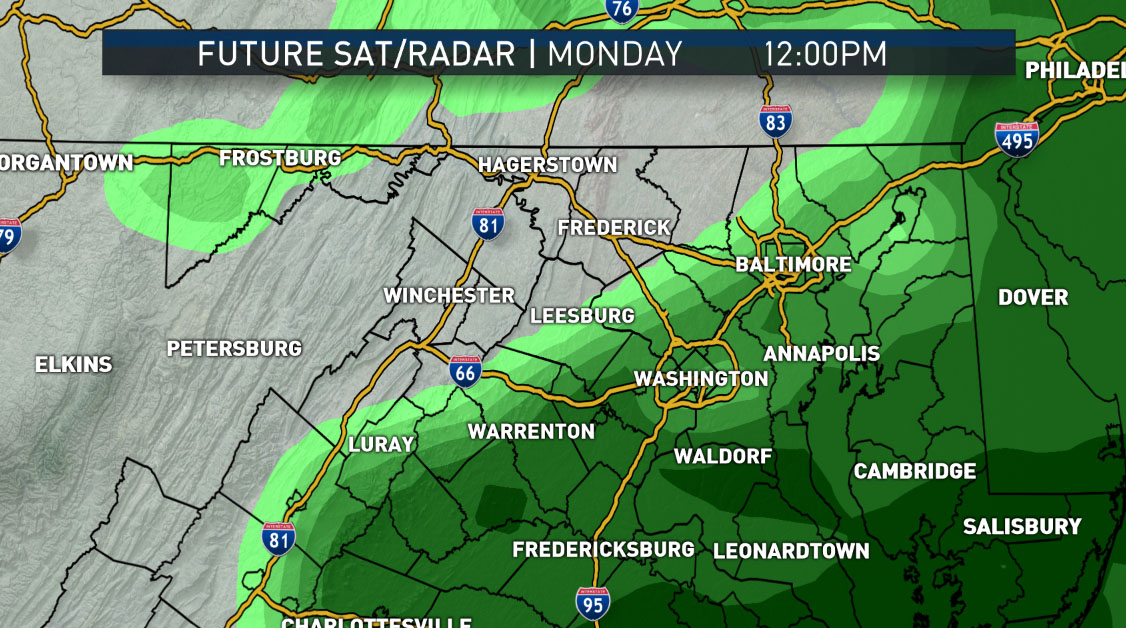
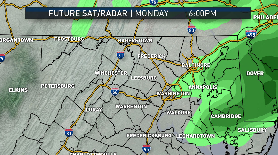
No wintry precipitation is expected south of the Mason-Dixon Line. This storm will be the weaker of the two and amounts look like they will only be around a few tenths of an inch. Considering the listening area ended 2016 over eight inches of rainfall/snowmelt, every drop will be beneficial. The first wave of rain will taper after the evening rush before picking up again Monday night.
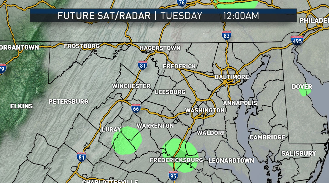
This system will definitely be the stronger of the two and looks like it could make Tuesday a good, old-fashioned, umbrella weather washout. Rainfall amounts will be much higher than Monday’s, contributing to an impressive two-day total. It’s still a fraction of what we need, but it will soak in. There’s plenty of room in the topsoil and the streams and creeks (and the Potomac, for that matter). Tuesday’s rainfall will also taper during the evening as a cold front sweeps through the area, drying us out.
This front is a strong one, but the coldest of the air mass will lag behind it a bit and will only gradually work in over the mountains during the day on Wednesday. Wednesday looks like it will have morning high temperatures then we’ll gradually cool down in the afternoon, rapidly cooling down at night. Wednesday’s low temperatures will be at midnight.
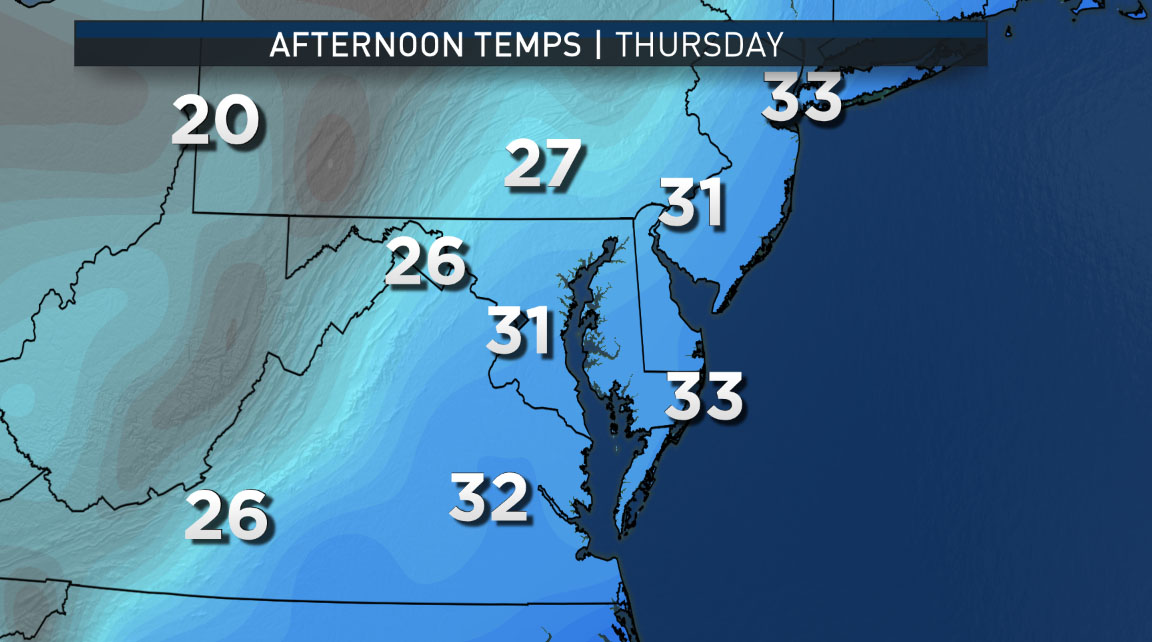
Thursday will be quiet, but cold and dry.
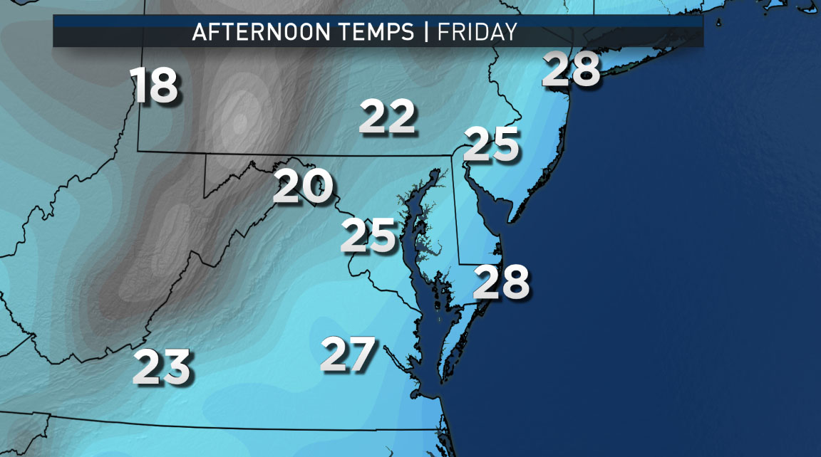
Friday may have some precipitation with it, as warmer air tries to “force” its way back north over and into the cold air at the surface. The possible scenario would be for rain that starts as a wintry mix. But there is a lot of computer model guidance that also suggests that moisture never makes it out of the Carolinas and the storm system may just intensify out to sea. At this point today, given the overall pattern recognition, the complexity of the pattern, the fact the computer models are going back-and-forth between wet and dry in their predictions, either possibility of a light mix and rainstorm or staying cold and dry have equal weight. Regardless, behind this storm or non-storm (for us), even more cold, modified Arctic air will come pouring into the area.
Snow lovers: Not saying any significant snowstorms are heading this way soon, but at least the ingredients are in motion around the globe.
Daily weather highlights
Monday
- Cloudy, damp, and cool, but above average
- Light rain and drizzle all day
- A brief respite from the rain in the evening
Tuesday
- Like Monday, but with even more rain and slightly higher temperatures
- Rain tapering off in the evening
Wednesday
- More clouds than sun
- Breezy and mild to start, then turning cold late afternoon and evening
Thursday
- High level clouds lowering during the day
- Temperatures slightly below average
Friday
Lots of uncertainty and the specific forecast details may change, but at this point it looks like:
- Cloudy and cold to start
- A wintry mix changing to a cold rain
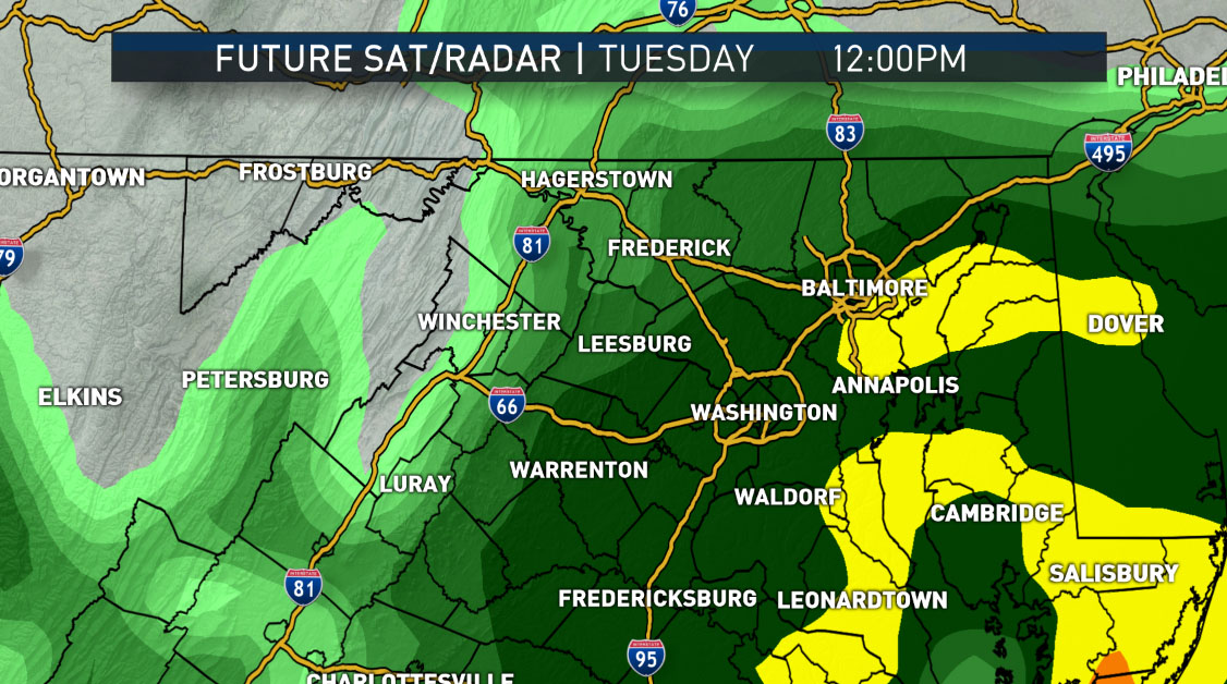
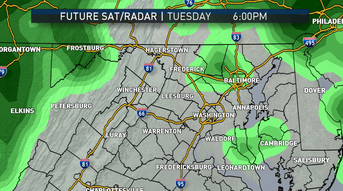
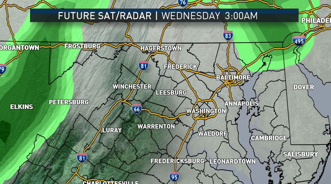
This progression of images shows the waves of rain moving through from Monday morning through Tuesday evening. The imagery is the future radar, so the latter images show Tuesday’s rainfall as being much more moderate. The computer model is the RPM run Sunday afternoon.
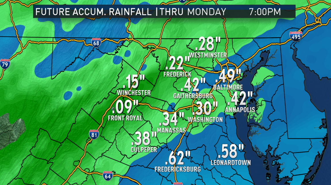
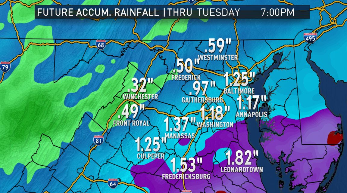
How does it all add up? Here’s the same model’s rainfall accumulation total for both storms. Note that they are running totals up to the time shown, and the second image is the total for both storms.
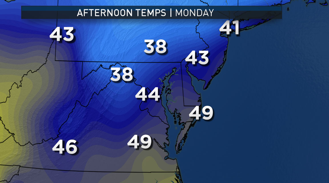
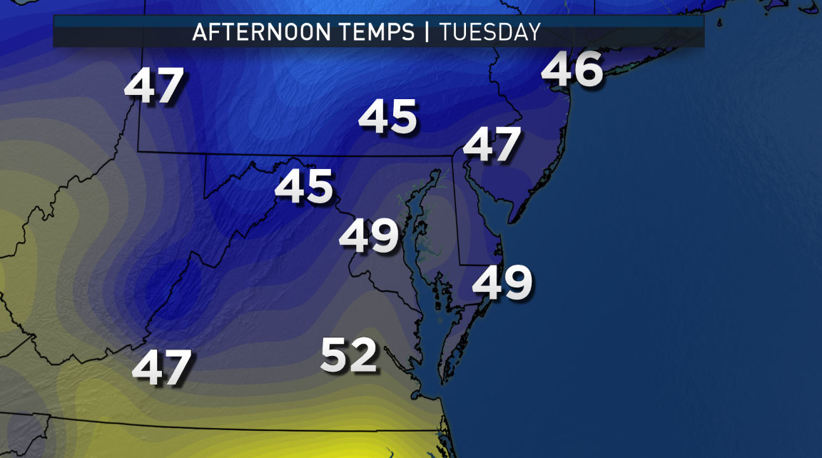
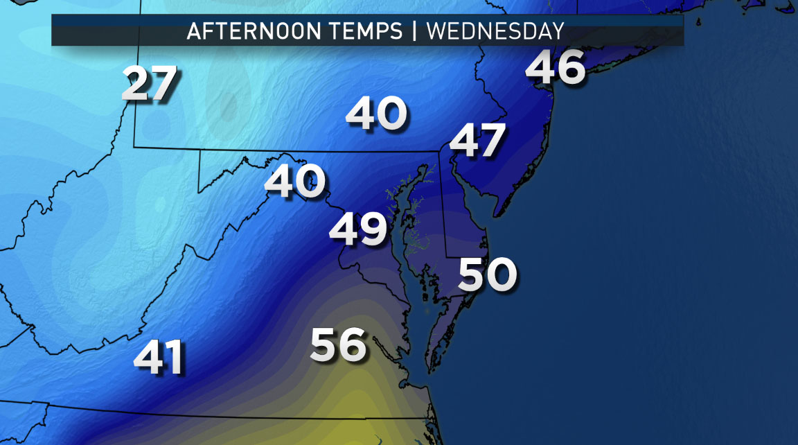
And once again, the temperature forecasts tell the tale: Mild to start and a cold end to the week with Wednesday as the transition day. Note the big contrast in temperatures Wednesday afternoon as the colder air is pooling in the Ohio Valley, ready to descend on us. The computer model is the GFS American model run Sunday morning. The temperatures for Friday are likely too cold. But if they turn out to be correct, it will argue for a storm track farther south and keeping us also dry on Friday.
Editor’s note: The WTOP Workweek Weather Blog is intended as an in-depth yet plain language summary of the business week’s weather potential in the D.C. area along with an explanation of the contingencies and uncertainties that exist at the time of publication. For the latest, actual Storm Team 4 Forecast, check out the WTOP Weather Page.


