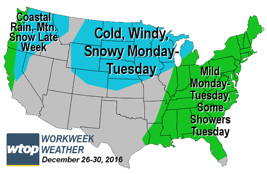
It was not a white Christmas and it’s not going to be a very cold workweek after Christmas, either.
It was not a white Christmas and it’s not going to be a very cold workweek after Christmas, either.
(WTOP/Storm Team 4)
WTOP/Storm Team 4
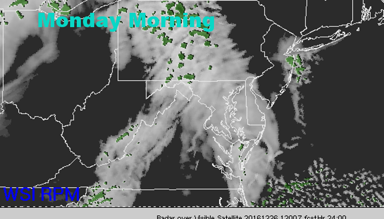
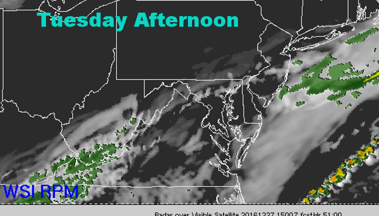
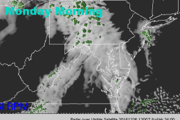
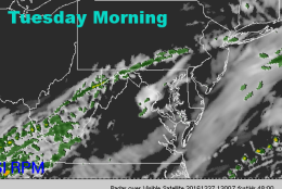
These four images are from the Sunday afternoon run of the Weather Company’s RPM computer model. It shows the low-level clouds, fog and patchy drizzle returning for Monday before thinning Monday evening. The clouds increase for Tuesday again along a cold front, which will bring some scattered showers, then drier and cooler weather Wednesday.
(The Weather Company)
The Weather Company
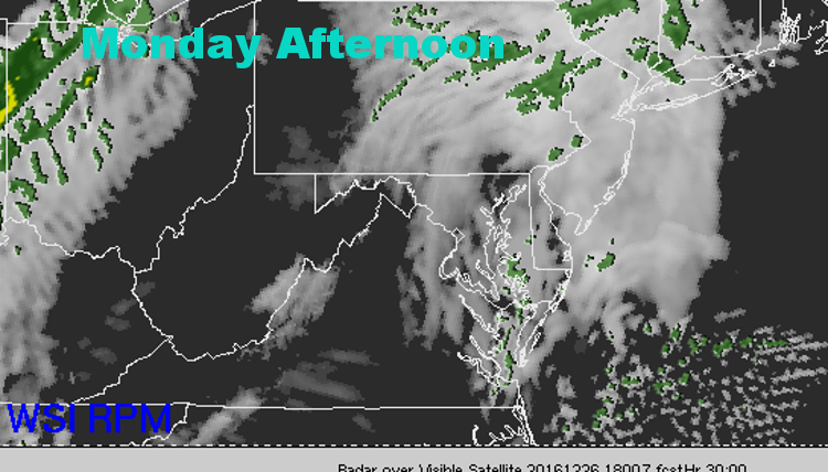
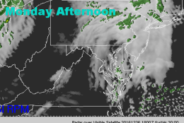
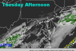
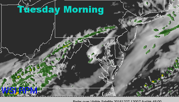
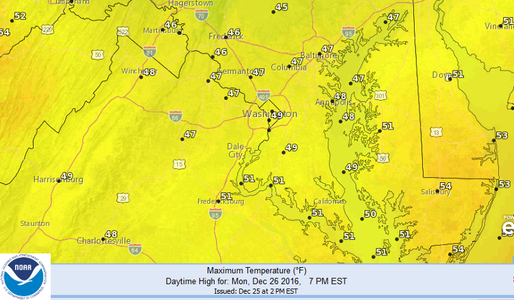
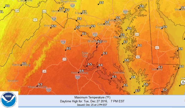
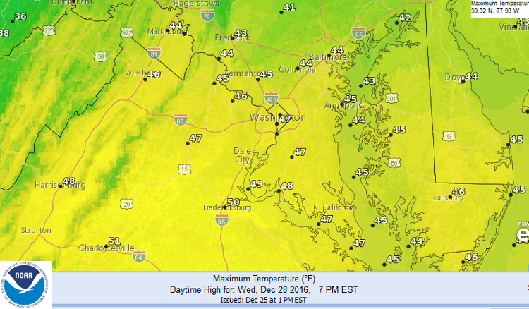
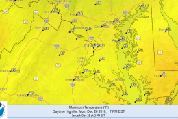
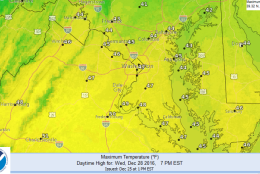
These three images show the National Weather Service forecast for high temperatures Monday, Tuesday and Wednesday. Monday and Wednesday will be close to average, but Tuesday could be quite warm.
(National Weather Service: Washington, D.C.)
National Weather Service: Washington, D.C.
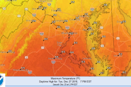
These three images show the National Weather Service forecast for high temperatures Monday, Tuesday and Wednesday. Monday and Wednesday will be close to average, but Tuesday could be quite warm.
(National Weather Service: Washington, D.C.)
National Weather Service: Washington, D.C.
These three images show the National Weather Service forecast for high temperatures Monday, Tuesday and Wednesday. Monday and Wednesday will be close to average, but Tuesday could be quite warm.
(National Weather Service: Washington, D.C.)
National Weather Service: Washington, D.C.
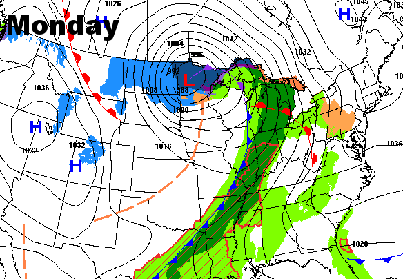
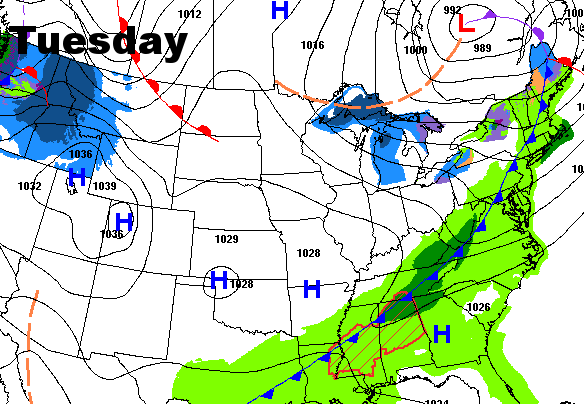
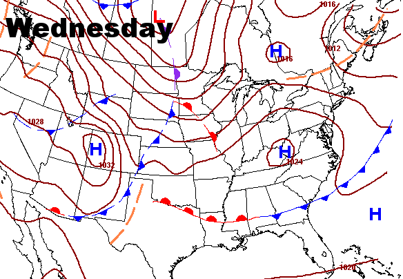
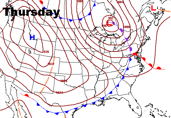
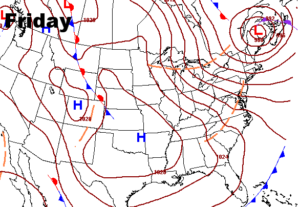
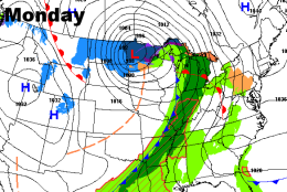
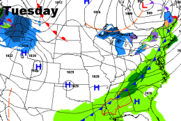
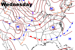
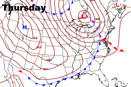
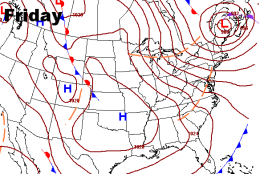
The pattern will be active as several systems will move through, but they will move quickly and there won’t be much precipitation. Temperatures will fluctuate ahead of cold fronts and behind cold fronts. The green shadings are showers and the blue shadings are snow. After Tuesday, they do not depict the precipitation, but there won’t be much for us, just another chance for showers on Thursday. After Friday, there appears to be another chance to tap some arctic air and colder temperatures could be on the way for the weekend or shortly thereafter.
(Weather Prediction Center, NOAA)
Weather Prediction Center, NOAA
The pattern will be active as several systems will move through, but they will move quickly and there won’t be much precipitation. Temperatures will fluctuate ahead of cold fronts and behind cold fronts. The green shadings are showers and the blue shadings are snow. After Tuesday, they do not depict the precipitation, but there won’t be much for us, just another chance for showers on Thursday. After Friday, there appears to be another chance to tap some arctic air and colder temperatures could be on the way for the weekend or shortly thereafter.
(Weather Prediction Center, NOAA)
WASHINGTON — It was not a white Christmas and it’s not going to be a very cold workweek after Christmas, either.
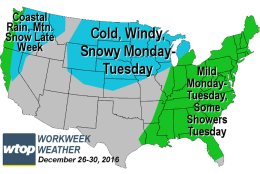
High pressure will be departing New England, allowing moisture to return in the low levels to our area, making Monday a fairly cloudy day with even some areas of drizzle here and there. Temperatures will be close to our averages for this time of year. Then the storm system that brought a lot of winter weather to the middle of the country on Christmas Day will send a warm front through our area Monday night.
Tuesday will start out with sunshine and with strong southerly breezes, temperatures will soar into the 60s. It will just be temporary, though, as a cold front brings a few showers and temperatures start falling late in the day.
High pressure will build in overhead for Wednesday, but will quickly depart and allow the next system to move in on Thursday with a chance for showers and temporarily milder temperatures. And then the process repeats again with high pressure building in for Friday with cooler temperatures.
The Arctic is still in the process of cooling back down to temperatures befitting the name. It looks like some of that colder air will be on the move again and could affect us for the start of next week.
DAILY WEATHER HIGHLIGHTS
MONDAY
Low-level clouds with only peeks of sun
Some fog
Some scattered areas of drizzle
Temperatures close to or slightly above average
TUESDAY
Springlike temperatures, especially the first half of the day
A few hours of clouds and scattered showers through the afternoon
Winds turn northwesterly with falling temperatures later in the day
WEDNESDAY
Mostly sunny
Much more seasonably cool
THURSDAY
Clouds with a slight chance of showers
Above-average temperatures, falling late in the day and evening
FRIDAY
Mostly sunny
Much more seasonably cool
Editor’s Note: The WTOP Workweek Weather Blog is intended as an in-depth yet plain language summary of the business week’s weather potential in the D.C. area along with an explanation of the contingencies and uncertainties that exist at the time of publication. For the latest actual Storm Team 4 forecast, check out the main WTOP Weather Page.