WASHINGTON — The first of two systems to affect you this workweek has been bringing a light rain and some drizzle.
Initially, there was some cold air in the low-lying areas near the mountains in the northern Shenandoah Valley up toward north-central Maryland, and there were some icing concerns, but warm air on southerly winds is scouring out any freezing temperatures and the ground is just too warm, so plain rain will affect the area the rest of the morning.
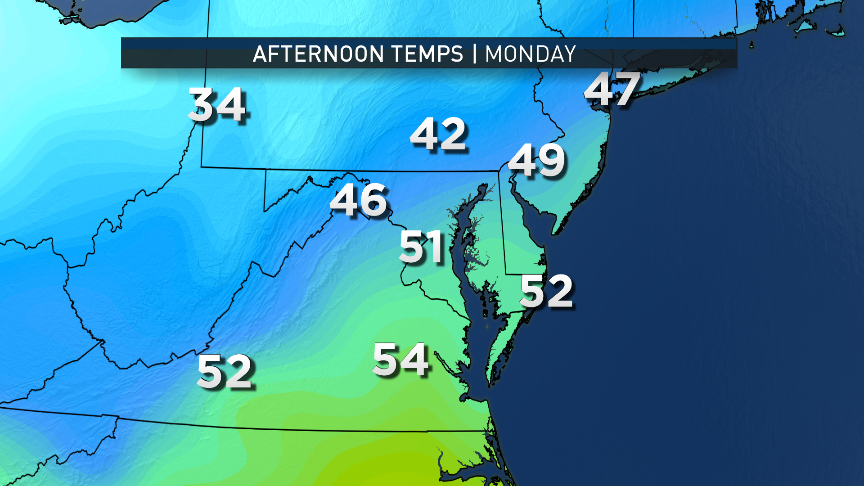
A warm front will then pass through. There will be some sunshine, and temperatures will soar into the mid-50s, which is above average for today. A cold front will pass through Monday evening, which will just reinforce the drying trend and keep skies mostly clear to partly cloudy overnight. Overnight lows will be in the seasonable low 30s.
From Tuesday into Wednesday, another piece of arctic air will head down the continent, overspreading much of the country, just like last week. And like last week, it’s also only going to do its worst here for a short period of time.
The leading edge of the arctic air mass will indeed be a cold front, and it will head through the Midwest into the Ohio Valley through late Tuesday. Ahead of the front here in the Washington area, strong southerly flow aloft will bring increasing cloud cover, and along the Interstate 81 corridor westward there could be a few small areas of sprinkles or light showers developing toward Tuesday evening. But most of the area will stay dry while this front goes through, just like last week.
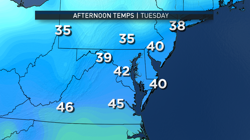
The clouds and the southerly winds will keep temperatures from dropping much Tuesday night, and Wednesday afternoon’s temperatures will go up only a bit more than that, with midday highs in the mid-40s. A slow shift in wind directions while the arctic front moves through around lunchtime will start ushering in the colder air. Temperatures will start falling all the way through Wednesday evening. Call this arctic front the second storm system, but it’s not going to be a big rainmaker or a snowmaker.
On Thursday, it’ll really start to feel the cold as the air mass’s core starts to head into the Ohio Valley, mid-Atlantic and Northeast. Thursday’s highs will likely come in the late morning, the result of sunshine and air sloping down the mountains and adding just a couple of degrees to the early morning temperatures. Then temperatures will fall again through the afternoon and evening. So Thursday’s “calendar day” low temperatures will be at midnight.
Friday will be the coldest day of the week, as the area loses the arctic supply of cold, and the air mass will start to shift to the east and continuing out to sea. The weather pattern across the continent will be “flattening out” and modifying. As warmer air tries to force its way back into the area, the result will be a storm system destined to bring rain, but there will be the potential for a wintry mix at the onset. It’s too soon for definitive details that far out, but it will all come into better focus closer to midweek.
So despite the lack of major precipitation from large storm systems, it’s going to be an active workweek on an hour-by-hour basis. Not every day’s high and low temperatures will occur at the usual times of day. Stay with WTOP, WTOP.com and Storm Team 4 for all the evolving weather details.
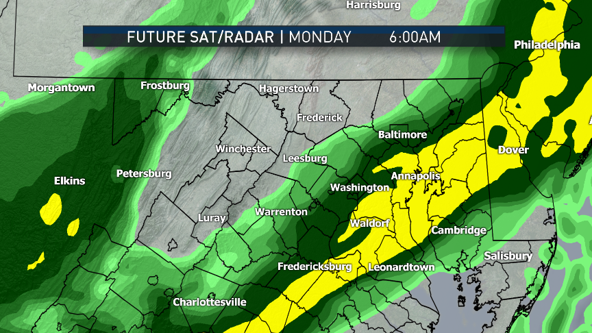
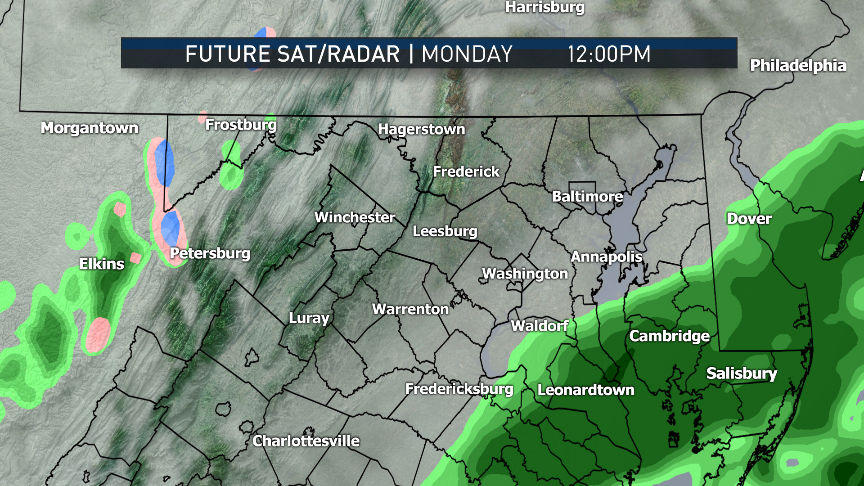
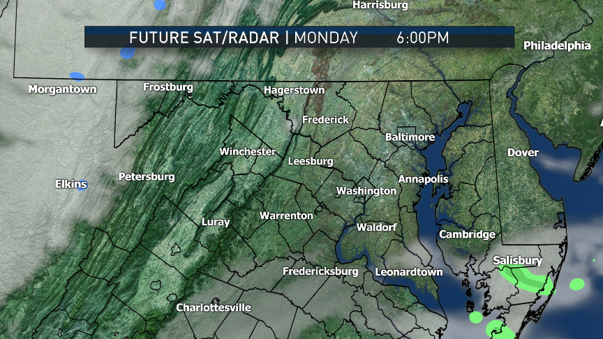
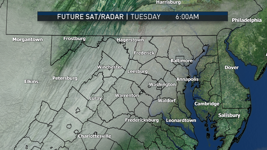
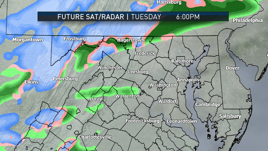
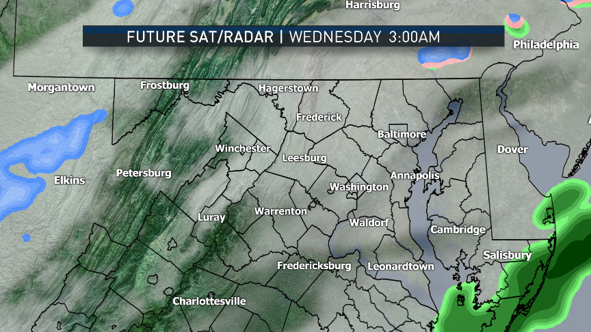
These images are a computer-model representation of the precipitation type radar and satellite imagery of the future. The model is the high resolution “RPM” run very early Monday morning. Note the 6 a.m. image is a very good representation of what was actually going on. The rain moves fairly quickly from west to east during the morning, followed by the clearing in the afternoon through the evening. On Tuesday, the surge of moisture ahead of the arctic front could bring some patchy precipitation, mainly west of D.C.
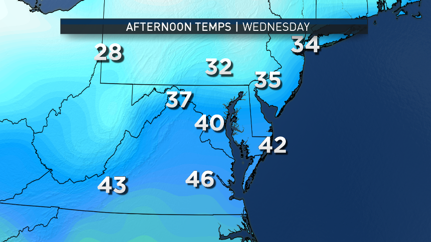
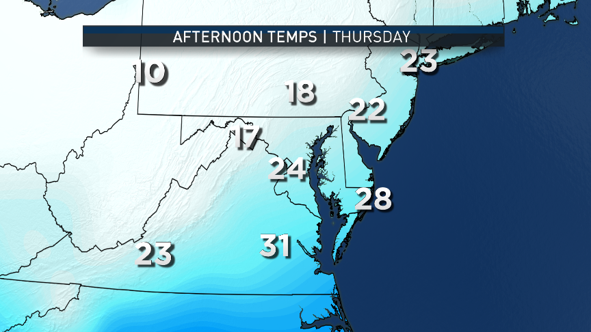
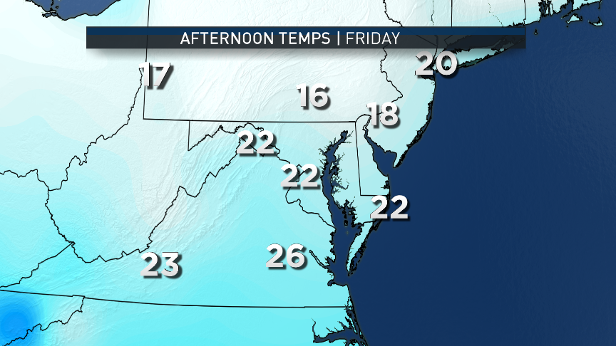
These images are very similar to last week’s weather scenario — mild in the beginning of the week, frigid by the end of the week — except this arctic blast will have even colder temperatures. The computer model is the American GFS. The feeling at Storm Team 4 is the numbers for Thursday and Friday are too cold considering the sunshine and the air sloping down the mountains, but only by a couple of degrees. That’s still very cold. And winds will make it feel even colder.
NOTE: The WTOP Workweek Weather Blog is intended as an in-depth yet plain-language summary of the business week’s weather potential in the D.C. area, along with an explanation of the contingencies and uncertainties that exist at the time of publication. For the latest actual Storm Team 4 Forecast, check out the Main WTOP Weather Page.