WASHINGTON — We continue to watch as Hurricane Matthew in real time churns up the eastern coast of Florida bringing winds, rain and power outages, and minimal indirect effects to the D.C. area.
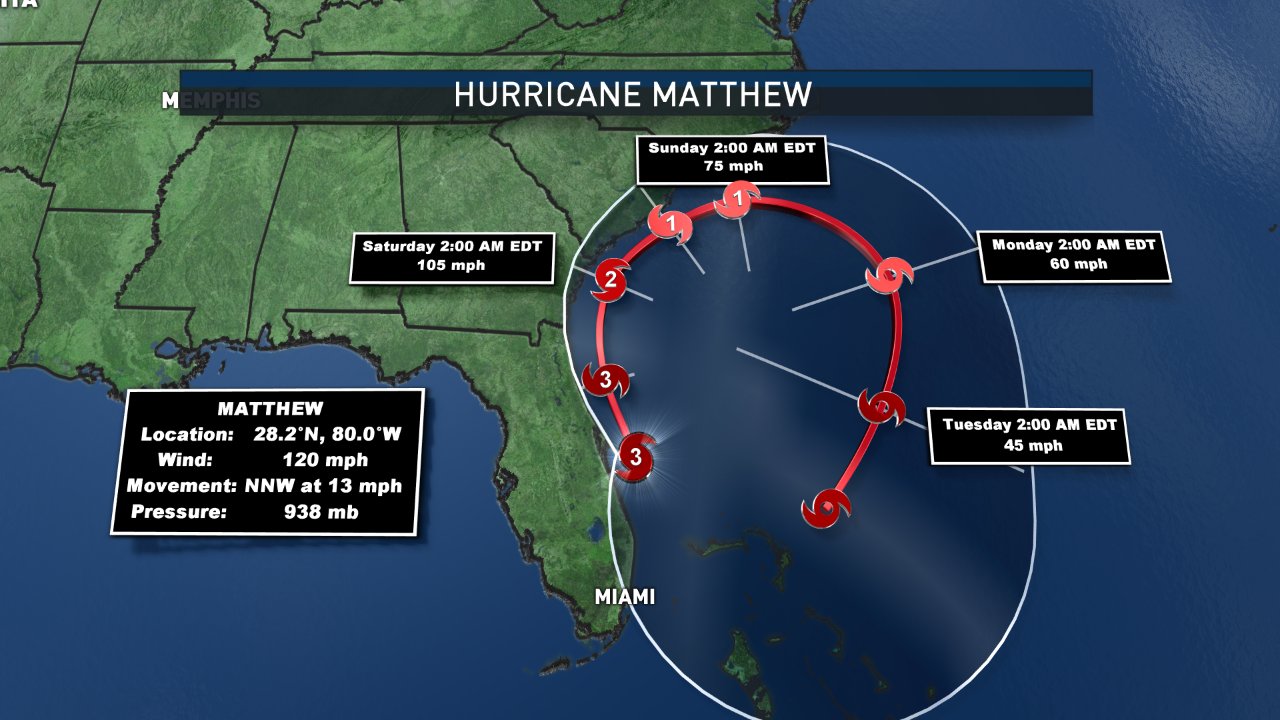
Overnight, Matthew weakened slightly to a Category 3 hurricane with winds around 120 mph. Air pressure is rising, so the intensity of the storm has weakened a bit in the predawn hours, but the storm surge and flooding will continue to be a concern. It will continue to move parallel and just offshore of the east coast of Florida through the day Friday moving to the north-northwest at 13 mph.
The D.C. area will just get some moisture feed into the region. Rain showers are possible Friday evening, increasing in coverage through the overnight and Saturday morning. Expect rain showers through much of the day on Saturday before they taper off Saturday evening. Sunday will feature sunshine but also be a tad windy — another indirect impact here from Matthew.
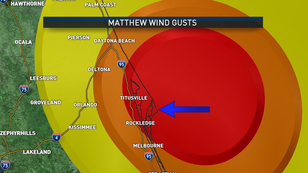
WHILE THE EYE of Hurricane Matthew has stayed offshore, the effects are still being felt. Wind gusts over Cape Canaveral have exceeded 100 mph at times through Friday morning. Tens of thousands of people are without power and that number will continue to grow as Matthew and its winds travel north up the Florida coast.
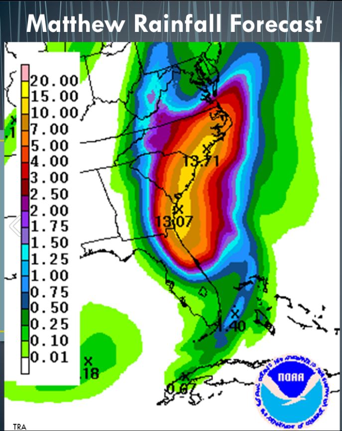
In addition to watching the track of the hurricane through the next several days, we are going to keep an eye on the storm surge that follows. This will most likely be the biggest threat that comes from Matthew, especially during high tide, with surges possibly reaching over 10 feet in spots along the southeastern coast. This could be the greatest threat to life and property in addition to flooding with massive rainfall totals.
All eyes turn to Jacksonville, Florida, Friday afternoon, as that area could bear the brunt of Matthew. After it passes through Jacksonville, geography will start to win out as Matthew turns along the southeast coast.
Matthew will weaken to a Category 2 and eventually a Category 1 by South Carolina. Winds and rain will continue to spread up through the Carolinas, making for some interesting college football games in North Carolina (Virginia Tech takes on UNC in Chapel Hill and Notre Dame heads to N.C. State on Saturday).