Workweek weather: Swings in heat, humidity

The week is already off to a very pleasant start, thanks to the cold front that passed through early Sunday morning, breaking last week’s heat wave. (WTOP/Storm Team 4)
(Data: RPM Model, The Weather Company/ Graphics: Storm Team 4)
These maps show some computer model projections for dew point temperatures first thing Monday morning through Tuesday afternoon. (Data: RPM Model, The Weather Company/ Graphics: Storm Team 4)
(Data: RPM Model, The Weather Company/ Graphics: Storm Team 4)
Monday is completely comfortable, but it will start to feel sticky again by the end of the day Tuesday.  (Data: RPM Model, The Weather Company/ Graphics: Storm Team 4)
(Data: RPM Model, The Weather Company/ Graphics: Storm Team 4)
The higher the dew point, the more moisture there is in the air. It will be a dramatic rise during the two-day period.  (Data: RPM Model, The Weather Company/ Graphics: Storm Team 4)
(Data: RPM Model, The Weather Company/ Graphics: Storm Team 4)
This map is the computer model future radar for midday Wednesday. The cold front will be marching across the country, but most of the thunderstorms along it will be concentrated north of our latitude. By the time the front gets here Wednesday night/Thursday morning, a lot of the storms may be falling apart and it may not rain here at all.  (Data: RPM Model, The Weather Company/ Graphics: Storm Team 4)
(WTOP/Storm Team 4)
A quick look at the feel of the week ahead. It’s interesting in that the temperatures and the humidity levels will basically be rising and falling hand-in-hand ahead of and behind the midweek cold front.  (WTOP/Storm Team 4)
(1/6)
The week is already off to a very pleasant start, thanks to the cold front that passed through early Sunday morning, breaking last week’s heat wave. (WTOP/Storm Team 4)
(Data: RPM Model, The Weather Company/ Graphics: Storm Team 4)
(WTOP/Storm Team 4)

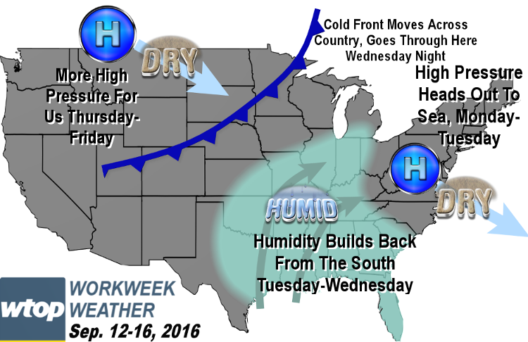
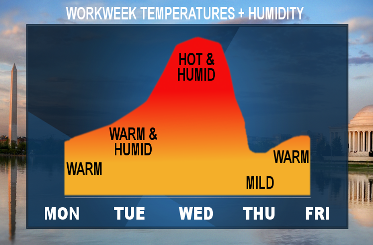
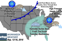
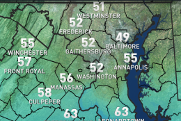
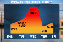
WASHINGTON — The workweek’s weather will be mostly dry and uneventful. The week is already off to a very pleasant start, thanks to the cold front that passed through early Sunday morning, breaking last week’s heat wave.

The weather looks perfect for the Washington Redskins’ home and season opener Monday evening. A sprawling area of high pressure dominating the better part of the eastern half of the country will provide dry, comfortable weather before sliding out to sea, allowing some warmer and more humid air to return.

But it won’t be another heat wave.

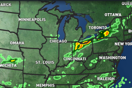
This pattern will be fairly progressive, and another strong, fall-like cold front will pass through in the Wednesday/Thursday time frame. It’s unclear at this point if that front will have any precipitation with its passage. But it will definitely be followed by some actual cooler-than-average temperatures and much less humidity for Thursday and Friday.

Daily weather highlights
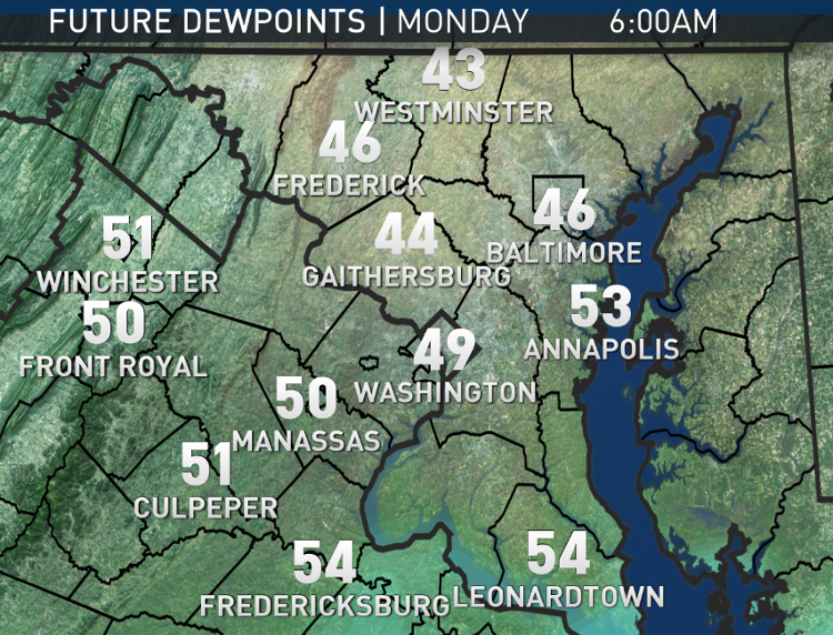
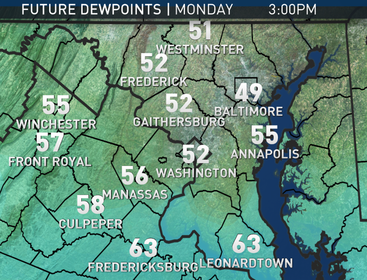
Monday
• Cool, comfortable start with abundant sun
• Low humidity; high temperatures right near our averages
• Very pleasant weather at FedEx Field for Redskins game
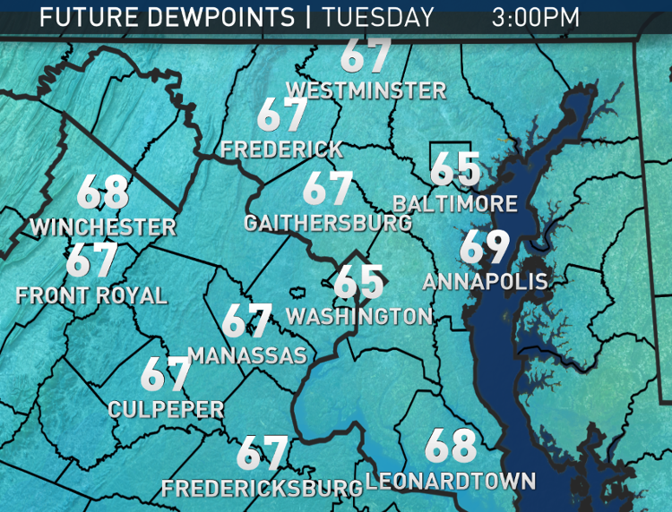
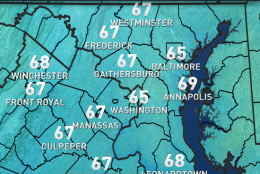
Tuesday
• Still a lot of sun
• Warmer
• Starting to feel sticky again

Wednesday
• Sun fading behind increasing cloud cover
• Feeling somewhat hot and humid
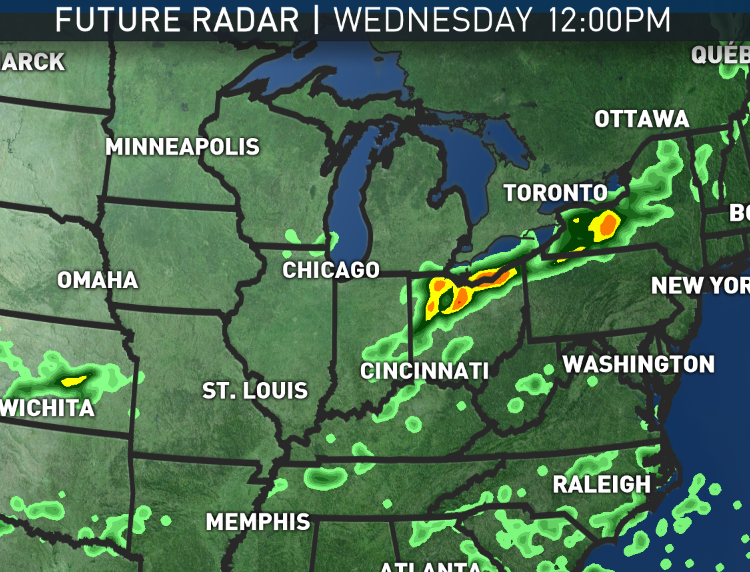
• Keeping an eye on a chance for a few showers toward evening or overnight

Thursday
• Morning clouds with clearing skies
• Dropping humidity
• High temperatures likely a little below average

Friday
• Still dry and comfortable
• Seasonably warm

Editor’s Note: The WTOP Workweek Weather Blog is intended as an in-depth yet plain language summary of the business week’s weather potential in the D.C. area along with an explanation of the contingencies and uncertainties that exist at the time of publication. For the latest actual Storm Team 4 forecast, check out the main WTOP Weather Page.

Federal News Network Logo
Log in to your WTOP account for notifications and alerts customized for you.

Sign up