WASHINGTON — For the New Jersey, Delaware, Maryland and Virginia beaches, Coastal Flood Advisories remain in effect through Tuesday morning for possible minor flooding along the shore at times of high tide, as there are still large waves coming off storm Hermine.
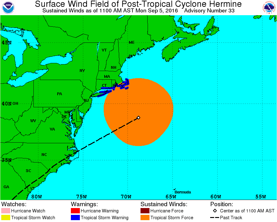
As of the 11 a.m. update from the National Hurricane Center, Post-Tropical Cyclone Hermine was about 230 miles southeast of the eastern tip of Long Island. Maximum sustained winds reached 70 mph, just shy of hurricane force. The storm is currently drifting northwest at 6 mph.
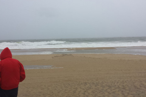
The waves are also causing minor beach erosion, rough surf, and riptides and dangerous conditions for swimmers and boaters.
Tropical Storm Warnings are in effect along Long Island and coastal New England. Tropical Storm Warnings remain in effect for coastal waters offshore from New Jersey for winds sometimes gusting over 40 mph.
Although the storm will not make another landfall, its circulation is so large that the beach locations are still getting windy conditions, and high level clouds will still make it back to the D.C. area during the day. Those clouds will be the only direct effects here. Rain bands will likely reach the New England coast later Monday.
Swimming was restricted on Monday in Ocean City, Maryland, but had been prohibited over the weekend because of the dangerous surf conditions. They said the sea gates were opened at the street ends and the boardwalk had to be cleared of significant amounts of sand. But damage was minimal and there were no storm related injuries.
The storm did not drift back toward the coast as quickly as was anticipated before the weekend began, so heavy rain bands did not add to the coastal flooding woes. But it was windy and the surf was relentless. The rough surf and breezy conditions will continue this Labor Day.
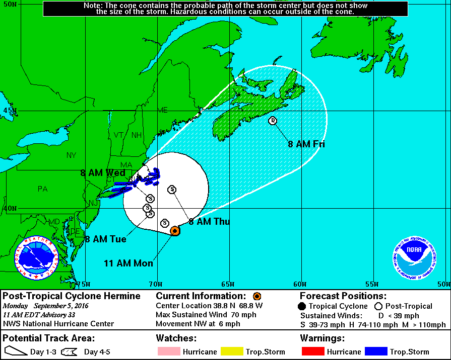
These two maps show the latest stats and track for Hermine from the National Hurricane Center. The 5 a.m. full update shows the huge area the tropical storm force winds cover. The winds and drifting speeds of the storm center are why the waves are slow to subside. The future track map shows the NHC no longer expects a re-intensification to hurricane strength, but the westward drift and then northward turn will deteriorate the conditions in New England before the storm ultimately weakens and dissipates heading out to sea.
Note how the “cone of uncertainty” works in the track map: The white shaded area indicates the center of the storm could pass anywhere within the area. That’s why even though it won’t make another landfall, wind and rain will still reach New England.
At Virginia Beach, the ocean roared with uncharacteristically large waves, drawing only a couple of surfers into the choppy white water. But hundreds, if not thousands of people, descended onto the beach for the traditional last weekend of summer. Umbrellas and canopies dotted the sand under partly sunny skies, according to The Associated Press.
Barb and Don Willis of Buffalo, New York, told The Associated Press that they braved the Chesapeake Bay Bridge Tunnel on Saturday as the wind whipped their car and the bay rose close to the bridge’s bottom.
“That was so scary,” Barb Willis said. “Oh my God. My hands were white knuckles, and the water was so high. It was horrible,” she said.
Hermine has caused two deaths, inflicted widespread property damage and knocked out power to hundreds of thousands of people from Florida to Virginia.