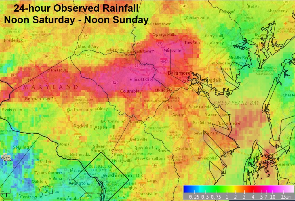
WASHINGTON — Not only was the flash flooding in Ellicott City deadly and damaging, it was also extremely unlikely. According to the National Weather Service office in Sterling, Virginia, the precipitation amounts that occurred have a “less than one tenth of 1 percent (less than 0.1 percent) chance of occurring in any year.”

The following is a table of rainfall amounts occurring within specific time frames of the worst of the thunderstorms. Note that this particular rain gauge reports in increments of 0.04 inch. These are incredible rainfall rates and simply overwhelmed the storm drainage infrastructure.
DURATION AMOUNT TIMEFRAME
—————————————-
1 minute 0.20 7:51pm-7:52pm
5 minutes 0.80 7:50pm-7:55pm
10 minutes 1.44 7:50pm-8:00pm
15 minutes 2.04 7:46pm-8:01pm
20 minutes 2.48 7:44pm-8:04pm
30 minutes 3.16 7:36pm-8:06pm
60 minutes 4.56 7:30pm-8:30pm
90 minutes 5.52 7:00pm-8:30pm
2 hours 5.92 6:45pm-8:45pm
“Duration” refers to elapsed time after the rain started. The “amount” is a running total, not total within the specific time frame.
The storm total for Ellicott City was recorded as 6.50 inches.
This data is preliminary and is subject to correction.
Source: NOAA/National Weather Service


