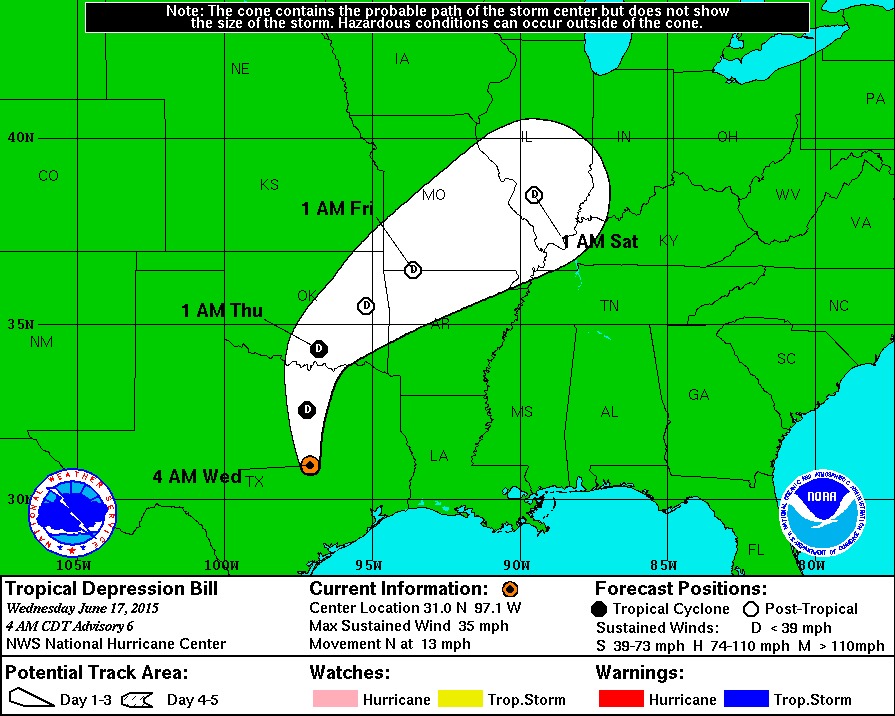
WASHINGTON — Tropical Storm Bill weakened to a tropical depression on Wednesday after it made landfall on Matagorda Island, Texas the day prior. It is spinning over northern Texas and headed to southeastern Oklahoma, moving along the western periphery of a Bermuda high anchored in the Atlantic Ocean.
Flash flood watches and warnings have been issued through Texas, Oklahoma, portions of Missouri and southern Illinois as Bill continues to push to the northeast.
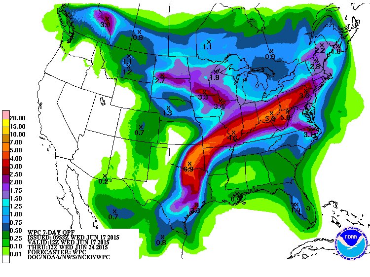
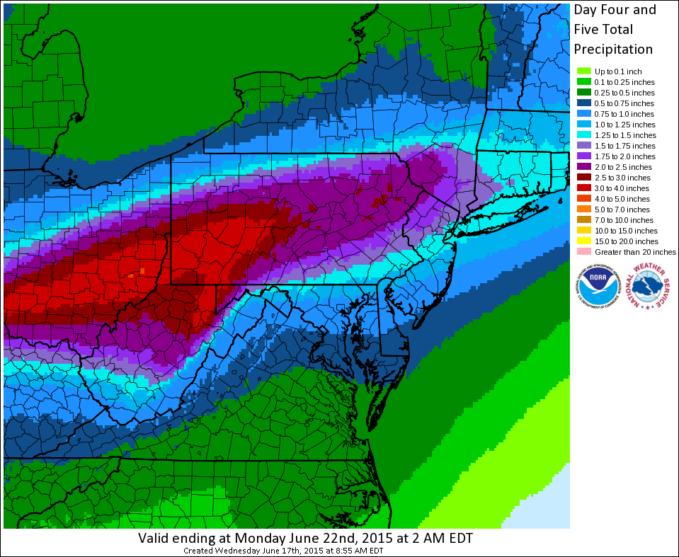
Areas in Texas along the coast saw about a foot of rain as Bill made landfall. Other areas in the state received up to 8 inches of rain. Bill will be long gone by this weekend, ending up as a trough of low pressure, but all that moisture will be swept up in the westerly winds through the mid-levels of the atmosphere, and move right into the Mid-Atlantic. Saturday will start with sunshine, as high pressure moves into the region. However, that high will slip off the East Coast, leaving us with increasing clouds and rain chances through the day on Saturday.
Here in the WTOP listening area, we’ll have to monitor the timing: There’s no telling when the rain could begin, or when it will finally move out of here. Right now, it looks like more of a Saturday late afternoon/nighttime rain event lasting through much of Sunday (reminder: Sunday is also Father’s Day). At any point, we could get some heavy down pours or steady heavy rain. This could be over a long time so we will also have to monitor any flooding concerns.
There could be thunderstorms in the mix as well. So if you have plans for this weekend, as always, keep an eye on our forecast. Whether you’re going to Nats Park, heading to Dover, Delaware for the FireFly music festival, or lounging by the pool with your father, it looks like a wet weekend. We will keep you updated with the very latest so you can plan your weekend festivities.