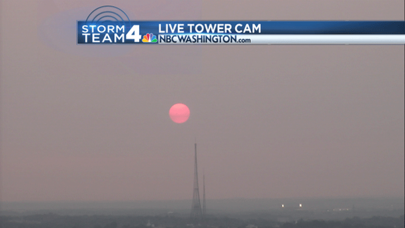
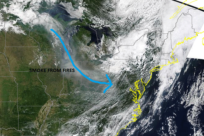
WASHINGTON — Did you notice the sunrise this morning? Did you notice the sunset Tuesday night? Well, take a look. It might look like the same murky haze you typically see around the sun throughout the summer months. However, the origin of the haze over the mid-Atlantic over the last few days is completely different.
@TomKierein Tom crazy sunset! pic.twitter.com/r2E3Y5KbuN
— Chad W (@dcfoodsafety) June 10, 2015
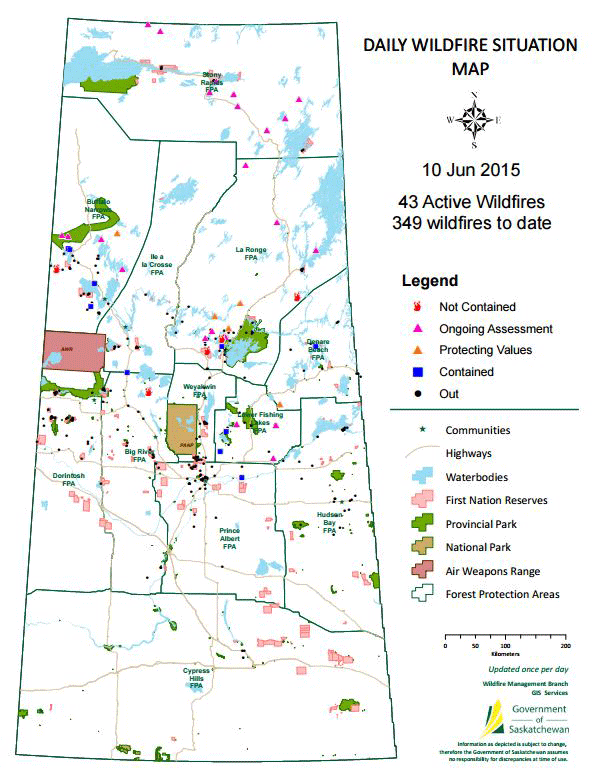
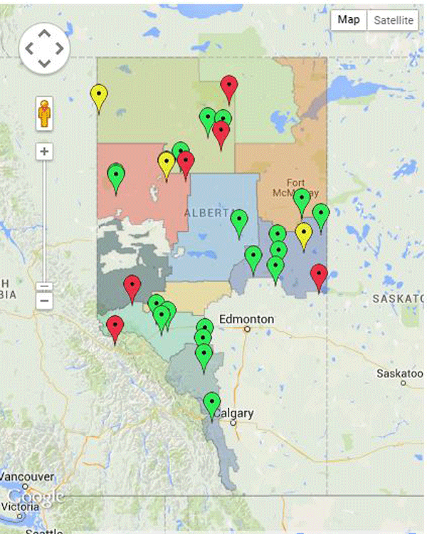
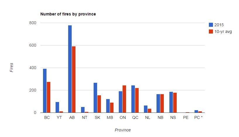
The wildfire season in Canada has been much more active than previous years. In Saskatchewan alone, there have been 334 fires so far. That number is much higher than this time last year when Saskatchewan had only reported 152 wildfires. Trevor Hadwen, an agroclimate specialist at the Agriculture and Agri-Food Canada, tells The Weather Network that “the lack of snowfall this past winter and an early spring and warm conditions very early, took away all the moisture that the snow would normally provide.”
Once the fires begin to burn, their heat lifts the ash into the atmosphere. Once there, the ash and smoke get caught aloft in the upper level winds. That is how it’s transported into our region. The haze has affected so much of the United States it’s inspired the hashtag #BlameCanada.
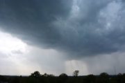
The bright blazing orange hue is due to the smoke that masks the sun. Remember the electromagnetic spectrum that you learned about oh so many years ago? Well, the light of the sun is affected by the smoke. Blue light is scattered due to the larger size of the smoke particles and red light is let through, making for a big bright ball of orange-red.
Of course, the fires have been dangerous for Canada and residents in the provinces.
For everyone else, the smoke is so far into the atmosphere you won’t even be able to smell it, but if you look you can see its impact. So take a peek at the sun Wednesday evening. It should still be infused by the wildfire smoke, making for another gorgeous sunset.