UPDATE: March 2, 2015 3:48 pm
WASHINGTON — A Winter Weather Advisory has been issued for the entire WTOP-listening area from 9 a.m. to 10 p.m. Tuesday, March 3 for snow, sleet and freezing rain.
EARLIER: March 2, 2015 11:37 am
WASHINGTON — Alright, March — stop it. This is where we should begin to look forward to spring: days are getting longer, next Sunday Daylight Saving Time begins, it is actually the beginning of meteorological spring. However, you give us one day this week that will feel like spring wedged between days that we have winter weather activity. C’mon, March!
This week will be a roller-coaster ride, so get ready. The forecast is subject to change (as always), but I want to give you an outline of what to expect. The reason for the change is that there are a lot of timing issues that we will have to watch.
For example — how much ice could we accumulate on Tuesday evening before warm air takes over? That is an example of just one of the questions we have this week, but bear with me and just keep an eye on the forecast.
Here is what you can expect, at the very least.
MONDAY
After some decent melting through the day on Monday as temperatures climb through the 40s, we will once again have some icy spots Monday night with overnight lows forecast to drop into the teens and 20s.
We will start off on the mostly clear side Monday night with high pressure slipping east from the Midwest. However, clouds will be on the increase toward daybreak Tuesday.
TUESDAY
Temperatures will move into the mid-30s through the day ahead of our next system. A warm front will slide in from the south and west through Tuesday night as high pressure scoots off the Mid-Atlantic coast.
There will be plenty of clouds around and cold air in place at the surface.
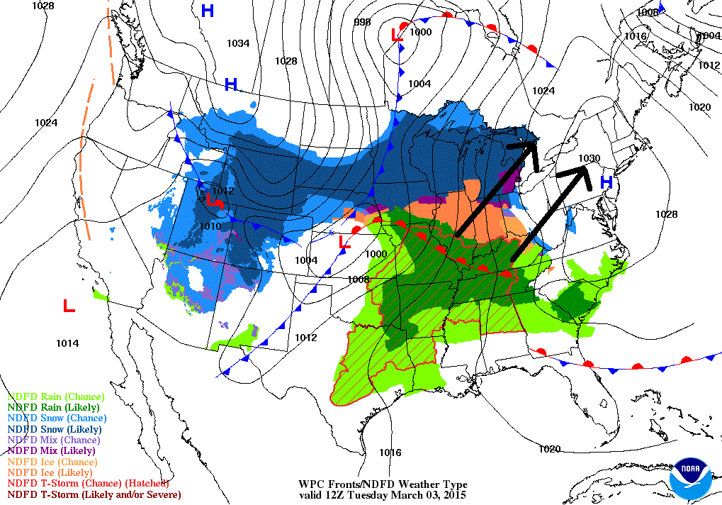
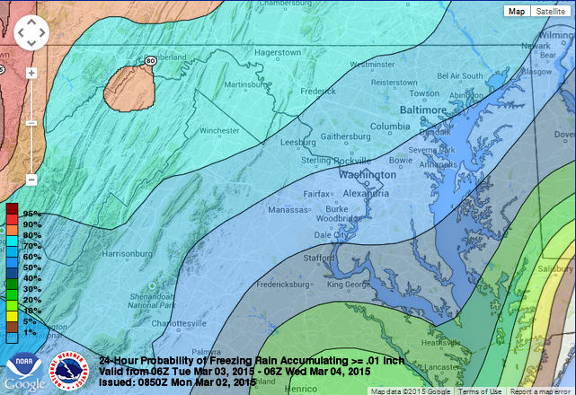
Precipitation will begin to fall from the southwest to the northeast after the lunch hour into the early afternoon. It looks to start off as maybe some snow but a quick transition to sleet and freezing rain.
Warm air will eventually filter in from the south and west but the question remains: when can that warm air win out at the surface?
At that point, we will begin to see a transition to rain as temperatures actually go up Tuesday night into Wednesday. However, at this point, expect some icy accumulation for the evening commute Tuesday.
WEDNESDAY
This is the most spring-like day we will experience this week. Temperatures will shoot into the 50s as the D.C. region will be in the warm sector. However, there will be some scattered rain showers around throughout the day.
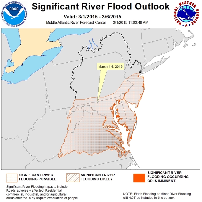
There could be a decent amount of rain coming down in areas, so we will have to watch for potential localized flooding throughout the region as the snow pack that is left begins to melt. I do not expect widespread flooding, but at least the potential for some more localized flooding.
WEDNESDAY NIGHT INTO THURSDAY
A strong cold front will then slowly move through the region and cold air will begin to move back in from the north and west. An area of low pressure will form and ride along the front after it sweeps through our region and sags to the south and east of the D.C. area. This will give us a chance of some wet snow Wednesday night into Thursday morning. In fact, there could be some accumulating snow around by Thursday morning.
Temperatures on Thursday will only rebound into the lower 30s, not far off from our overnight low on Wednesday night of around 30 degrees. Expect a breezy day on Thursday as winds pick up as an arctic pressure moves in.
High pressure will stick around Friday and Saturday giving us sunshine and gradually warming temperatures.
Plan ahead and keep it here for the latest forecast as we continue to tweak it!