WASHINGTON — While there wasn’t any snow for Super Bowl Sunday, expect a wet and gusty Monday morning.
A winter weather advisory is in effect until 8 a.m. Monday for Frederck, Carroll, northern Baltimore and northern Harford counties in Maryland. Patches of light rain or sleet are expected.
Also, a wind advisory is in effect in the area from noon Monday until midnight with wind gusts of up to 50 mph.
The rain could complicate commutes around the region Monday morning, but the precipitation will taper off by the early afternoon with clearing skies, gusty winds and falling temperatures.
Monday’s highs will be in the 40s. Temperatures will be in the 30s by the evening commute and overnight lows will be in the teens.
The Surface Details
An area of low pressure pushing out of Colorado shot through the Ohio valley, eventually shooting off the East Coast by Monday, bringing a swath of precipitation with it.
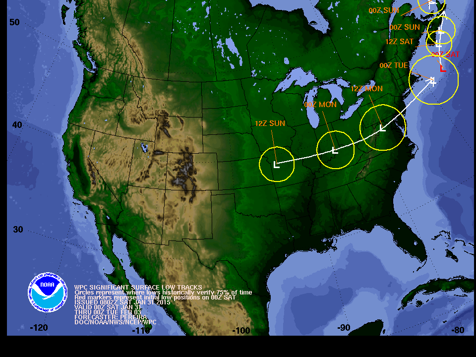
On Thursday, the track of the low was more to the south of the region, which would be a better scenario for all snow with cold air filtering in. But things changed over the next two days. The track of the low continued to trend north, and as the low pressure moved eastward, intensifying as it travels, warm air pulled into the region changing our precipitation to rain.
The cold front associated with the low will cross through the area on Monday morning, bringing colder air behind it. High pressure will then move quickly in from the Ohio Valley by Tuesday.
What To Expect
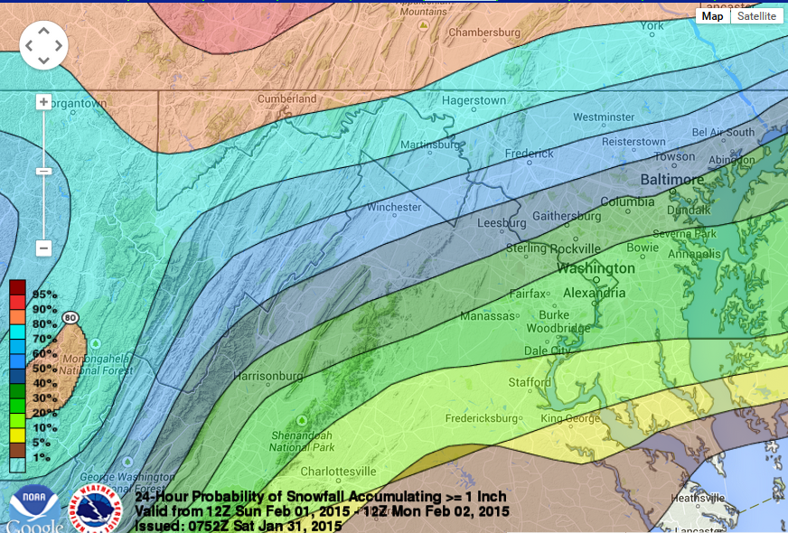
The bulk of the precipitation moved in Sunday night. I expect a mixed bag of precipitation for Monday morning: snow to the north, a line of sleet with some spotty freezing rain, and rain to the south.
As warm air continued into the region through the overnight, the mixed bag of precipitation turned to a cold rain.
The last of the area to see the changeover was north and west of D.C., which means these are the likely areas to see some minor snow accumulations.
We will hit our daytime high on Monday morning.
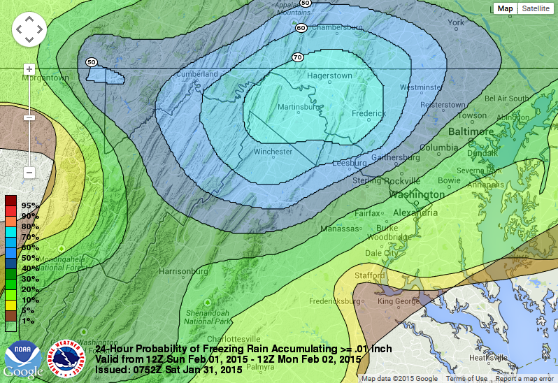
Once the cold front passes, temperatures will begin to fall. We will have to watch for a chance for some freezing rain by early Monday morning, mainly north and west. I do believe the commute will be messy anyway with rain coming through and freezing rain will only of course add headaches.
The precipitation should be out of there by around lunch time on Monday. However, if it lingers slightly longer, we could see a quick changeover to snow before it is all said and done. High pressure will quickly move in, so most of the moisture feed from the low moving off the coast should be cut off.
With that being said, the incoming high pressure and the exiting low pressure will create a tight pressure gradient, kicking up winds Monday afternoon. Temperatures will drop and wind chills will be present, most likely in the 20s. After that, we will get some sunshine by Tuesday.
So, sorry, snow lovers; this doesn’t look big for us. However, we have to get through February and March (remember the St. Patrick’s Day snowstorm last year?), we still have some chances of getting snow — just not very much with this storm.