WASHINGTON — Here we go!
A storm is headed our way. This looks to bring us a better chance of some snow overnight tonight and through Monday.
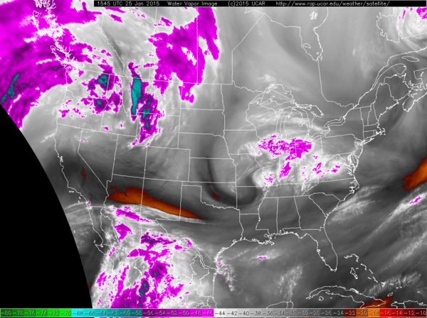
The storm is currently over the Midwest, moving through Iowa and now in Illinois/Indiana as seen by the water vapor imagery.

It will continue on a southeasterly track tonight through Monday moving through the Ohio Valley, tracking south of Pennsylvania and south of the D.C. metro area. Eventually it will redevelop off the east coast and strengthen through the day on Monday. The storm then travels up the eastern seaboard Monday night into Tuesday bringing blizzard conditions to much of the northern east coast. By the time we head into Wednesday, the storm will be moving to Nova Scotia and we will be awaiting possibly another clipper system for the end of the work week.
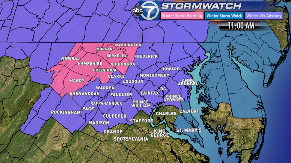
A slew of watches, warnings and advisories have been placed around the WTOP listening area beginning late tonight and continuing through 6 p.m. Monday evening.

Pink: Winter Storm Warning
Purple: Winter Weather Advisory
Blue: Winter Storm Watch
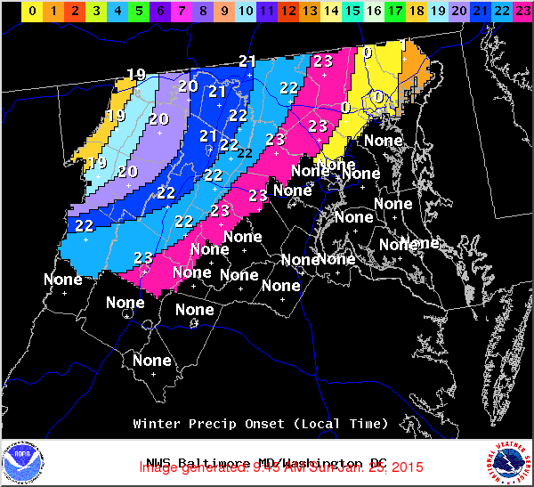
Temperatures will be fairly mild today, topping out in the 40s to around 50 in D.C. Overnight, temperatures north and west of D.C. will fall into the lower 30s while in D.C. we will have to wait for temperatures to fall to around freezing by Monday afternoon. Considering the warm temperatures, we could see a start of rain before a gradual turn to snow from the north and west to the east. Per usual, areas south and west of D.C. should remain as mostly rain with some wet snowflakes mixed in from time to time.

Expect snow showers to continue through the day tomorrow and even lingering into Tuesday morning. The heaviest snow totals will be north and west of D.C. where possibly 2″ – 5″ could set up. Around D.C. we are only expecting 1″ – 3″ of snow at the moment. (I’ll get you a snowmap as soon as StormWatch7 team issues one–in which point totals could change slightly). There will obviously be some problems for the Monday morning commute but not expecting too many problems inside the beltway. Winds will be blustery tomorrow as well which could bring visibilities down through the region. As temperatures fall through the day, the evening commute actually could be more problematic for D.C. then the morning commute with more slick spots around. Again, expect light snow to possibly just flurries to continue to fall overnight Monday and into Tuesday. Temperature through mid next week will stay well below normal, only topping out in the lower 30s/upper 20s! We will then be focusing on another potential snow maker for the end of the work week.
Follow @WTOP on Twitter and WTOP on Facebook.


