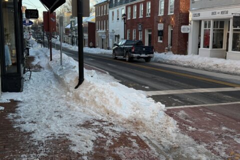
Tuesday is among the coldest days of winter so far, as D.C.-area residents woke up to wind chills near zero and are facing afternoon temperatures that aren’t climbing above freezing.
The chilly weather is here to stay Tuesday. Highs will reach only the upper 20s and evening lows will fall between 10 and 20, as winds back off.
During the day, the wind chill is making temperatures feel like they’re in the 10s.
Eventually, the temperatures will warm up a bit. Wednesday will start chilly with wind chills in the teens and 20s. Mostly sunny skies will help bring afternoon highs into the low 40s.
Thursday is forecast to be the warmest day of the week, with highs climbing into the middle to upper 40s, under partly cloudy skies.
“Not a long lasting cold this week, but once we get to this weekend upcoming and the weekend after that it will be certainly some weather we’re going to have to keep an eye on,” National Weather Service Meteorologist Chris Strong said.
This weekend will be the first chance of a double digit snowstorm in the D.C. region since January 2016, Strong said.
According to NWS, weather models that provide forecasts suggest that Saturday night into Sunday evening could bring several inches of snow, although nothing is certain.
- Listen to WTOP online and on the radio at 103.5 FM or 107.7 FM.
- Current traffic conditions
- Weather forecast
- Closings and Delays
- Sign up for WTOP email alerts
- Get custom alerts with the WTOP app for Apple and Android phones
FORECAST
TUESDAY: Sunny. Highs between 25 and 29, with wind chills in the single-digits and teens.
Winds: West 10-20 mph
TUESDAY NIGHT: COLD ALERT: Clear. Lows between 10 and 20.
Winds: Northwest 10 mph
WEDNESDAY: Mostly sunny. Highs between 38 and 44.
Winds: South 10-20 mph
THURSDAY: Partly cloudy. Highs between 42 and 46.
Winds: Northwest 10-20 mph
FRIDAY: Partly cloudy. Highs between 36 and 42.
Winds: South 5-10 mph
CURRENT CONDITIONS
Get breaking news and daily headlines delivered to your email inbox by signing up here.
© 2026 WTOP. All Rights Reserved. This website is not intended for users located within the European Economic Area.


