


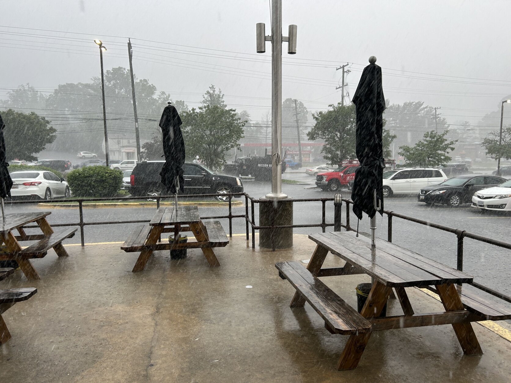


Severe weather battered the D.C. region and left two people dead Friday, with the heightened heat and humidity adding more fuel to the fire for storms packing up to 80 mph wind gusts, hail and heavy rain.
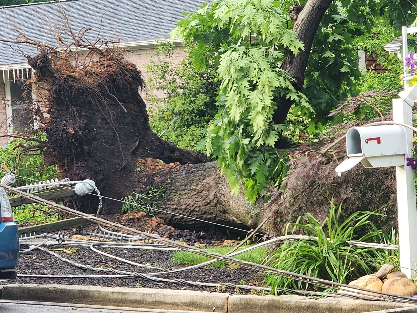
In Fairfax County, Virginia, a woman was killed during the storms around 5:30 p.m. after a tree fell onto her car on Frye Road in Woodlawn, police said.
Fairfax Police Det. Ingrid Palencia told WTOP the woman was the sole occupant of the vehicle and crews are working hard to restore the fallen powerlines.
“Given the weather, I would suggest that people just stay home. If you can avoid the area or the roads at this time, that would be great. But if you have anything to report, such as wires down, feel free to call us,” she said.
About half an hour later, another tree fell on a vehicle on the nearby George Washington Memorial Parkway, near Morningside Lane in Fort Hunt, killing an individual, U.S. Park Police told WTOP. Officials were not able to provide WTOP with further information.
Several trees also came down in Montgomery and Frederick counties in Maryland, including onto homes and power poles, as widespread wind damage was expected at the time.
The National Weather Service earlier canceled a severe thunderstorm watch that had covered the entire D.C. region. The main threats, according to the weather service, were damaging winds up to 80 mph and large hail up to the size of a golf ball.
Just before 6 p.m., law enforcement reported numerous down trees in Frederick County, Maryland, while a trained weather service spotter reported golf ball size hail in Westminster, Maryland. Just about 30 minutes earlier, a destructive storm with 80 mph wind gusts battered central Montgomery County in the Germantown and Gaithersburg areas.
Montgomery County Fire and Rescue spokesman Pete Piringer reported several trees and wires down in the county, including a tree that fell onto a house near Brinklow. In Fairfax County, Virginia, fire and rescue officials said there were 14 downed wires, two trees that fell onto houses and one house fire across the county associated with the storms.
Ground stops at major regional airports were in effect Friday — until 9 p.m. at Reagan National Airport and Baltimore Washington International Airport.
The severe weather reached D.C.’s far western suburbs just before 3:30 p.m. The weather service issued severe thunderstorm warnings at that time covering parts of Montgomery and Frederick counties in Maryland and Loudoun County in Virginia.
Winds intensified in Loudoun County and Western Maryland in the early evening. WTOP meteorologists said storms were packing gusts up to 70 mph from Thurmont, Maryland, to Leesburg, Virginia, and widespread wind damage was expected.
High temperatures Friday reached the upper 80s, with high humidity, which is providing more fuel for any storms that do hit the region to pack more of a punch.
An active weather day lies ahead with multiple rounds of showers & t’storms possible. There will be plenty of fuel to work with given the increasing heat & humidity. A Slight risk for severe t’storms covers the entire area, with damaging winds & large hail being the main threats pic.twitter.com/yTbbRZ4CnP
— NWS Baltimore-Washington (@NWS_BaltWash) May 16, 2025
Early Saturday, the risk for showers and storms remains, before skies finally brighten and give way to a pleasant end to the weekend.
Full forecast
FRIDAY EVENING: STORM ALERT
Showers and thunderstorms likely
Temperatures: 80s to 70s
Winds: Southwest 5-10 mph
Showers and thunderstorms are likely this evening, although not a guarantee for some neighborhoods. Forecast model trends continue to be iffy at best, with remaining uncertainty. Should storms develop, some may become strong to severe, with gusty winds, hail and moderate to heavy rain. While not at zero, a quick spin up is possible, but chances are extremely low.
FRIDAY NIGHT: Showers and storms
Lows: 65-70
Winds: Southwest 5-10 mph
Shower and storm chances continue overnight as temperatures settle to the middle 60s to around 70 degrees.
SATURDAY: Morning clouds with showers and storms possible, followed by sun
Highs: 85-89
Winds: Southwest 10-15, Gusts to 25 mph
Early morning clouds are expected with warm and muggy conditions during the morning. There’s a slight chance for showers and storms early in the morning, but skies will brighten through the day with falling humidity during the afternoon. It will be warm with highs in the mid to upper 80s and a nice breeze.
SUNDAY: Mostly sunny and less humid
Highs: Near 80
Winds: Northwest 5-10 mph
Great weather returns Sunday with less humidity and lot so sun.
MONDAY: Mostly sunny and breezy
Highs: 75-80
Winds: Northwest 10-20 mph
Nice weather continues to start the work and school week with plenty of sun and highs in the middle 70s to near 80 degrees.
Current conditions
Power outages
Get breaking news and daily headlines delivered to your email inbox by signing up here.
© 2025 WTOP. All Rights Reserved. This website is not intended for users located within the European Economic Area.