While Tuesday’s cloudy skies will clear in the evening, temperatures will drop from the 50s, reaching lows of 38 to 44 degrees overnight.
The chilly, below-normal temperatures have brought about some of the first frost advisories of the season in the area.
The National Weather Service announced frost advisories for a number of counties across Maryland and Virginia heading into Wednesday morning from 2 a.m. through 9 a.m.
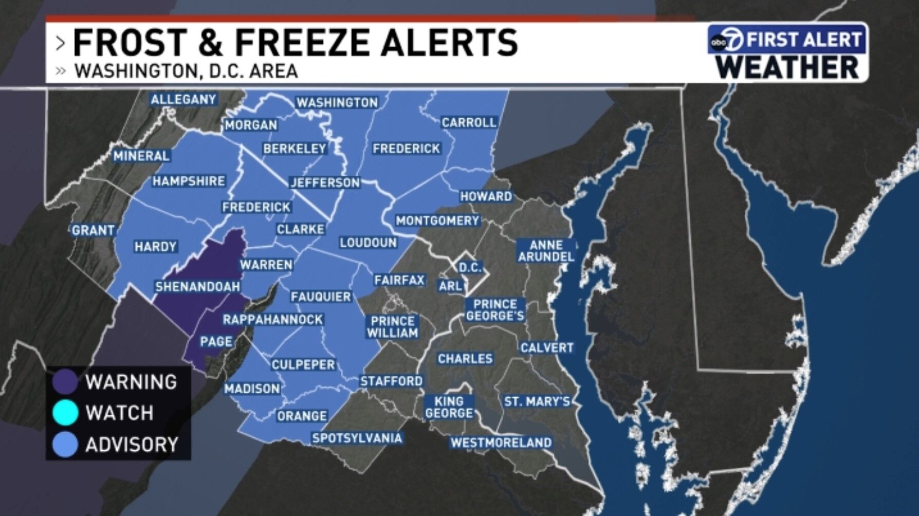
Maryland has frost advisories in Frederick, northwest Montgomery and northwest Howard counties.
Meanwhile, Virginia has frost advisories across Frederick; Rappahannock; Culpeper; northern Fauquier; southern Fauquier; western Loudoun; eastern Loudoun; and northwest Prince William counties.
Frost could harm or even kill sensitive outdoor plants — including vegetables and subtropical plants, such as tomatoes and hibiscus — if they are left outside unprotected.
Plants and vegetation low to the ground can be protected with an extra layer of mulch, while vegetables, crops and other plants should be covered with blankets or row covers, according to the Farmer’s Almanac. Potted plants should be brought indoors.
While Wednesday and Thursday will only reach highs in the low 60s to mid-50s, the area is forecast to warm up once again heading into next week.
- Listen to WTOP online and on the radio at 103.5 FM or 107.7 FM.
- Current traffic conditions
- Weather forecast
- Closings and Delays
- Sign up for WTOP alerts
Forecast
Brian van de Graaff, 7News First Alert Senior Meteorologist
Morning sun, afternoon clouds
Breezy
Highs: 55-60
Winds: Northwest 5-15, Gusts to 25 mph
Another chilly October day is ahead with northwest winds picking back up and highs ranging from the middle to upper 50s. The sunniest part of the day will be through the morning hours with cloudier skies expected by the afternoon and evening hours.
Clearing skies
Lows: 37-45
Winds: North 5-10 mph
Mostly cloudy skies are expected up until midnight and then skies will clear through the overnight hours. Low temperatures will once again fall into the upper 30s to mid 40s downtown. Additional frost and freeze alerts are possible. THURSDAY:
Sunny skies
Highs: 57-62
Winds: Northwest 5-15, Gusts 20 mph
After a cold start, temperatures will climb to either side of 60 degrees under mostly sunny skies. It will once again be a bit breezy, at times. Clear skies are expected Thursday evening to see the full Hunter’s moon.
FRIDAY:
Sunny
Highs: 65-70
Winds: Northwest 3-8 mph
After another cold start, a slow warm-up is on the way for the end of the work and school week with afternoon highs in the upper 60s. Skies will be clear for your Friday night plans with temperatures falling out of the 50s in the 40s.
THIS WEEKEND:
Fantastic fall weather is in store for the upcoming weekend. Chilly/cold mornings in the 30s and 40s will give way to sunny and warm afternoons with highs in the 70s.
Current weather
Get breaking news and daily headlines delivered to your email inbox by signing up here.
© 2024 WTOP. All Rights Reserved. This website is not intended for users located within the European Economic Area.