Tropical Depression Helene made landfall as a deadly Category 4 hurricane devastating Florida’s Big Bend as it travelled north Friday. Now the weakening storm has blown through the southern and eastern U.S., bringing tropical rain and potential flooding to the D.C. region.
7News First Alert Chief Meteorologist Veronica Johnson expected the storm to wane as it moved north toward the capital region Friday, bringing a larger risk of inland flooding and heavy winds that could knock down trees or electricity poles in the D.C. area.
2:24PM-A shield of moderate to heavy rain continues to push over the central VA Piedmont with light bands of showers further north. Rain activity will continue through this evening as Helene pushes further west of the area. Weather improves Saturday. #MDwx #VAwx #WVwx #DCwx pic.twitter.com/k2kH6TOjGM
— NWS Baltimore-Washington (@NWS_BaltWash) September 27, 2024
This is “the strongest hurricane since Ian back in 2022” — Helene was upgraded to a category four hurricane on Thursday night, she said. In a matter of hours, winds reached 140 miles per hours at times, with gusts at 160 mph as the hurricane first made landfall in Florida’s Big Bend region Thursday night.
Helene was downgraded to a tropical storm Friday morning as it rapidly moved north to southern Georgia and Tennessee. The National Hurricane Center said winds could top 110 miles per hour as the storm moves over Appalachian areas, bringing the chance for devastating storm surges and spin up tornados to our South.
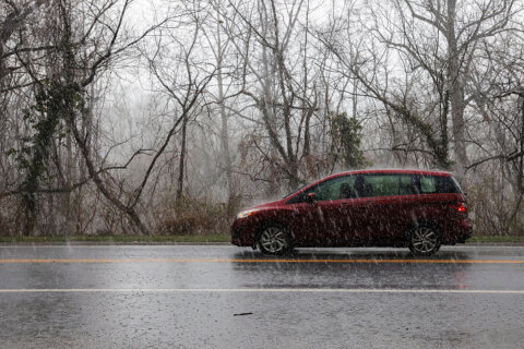
Meanwhile, in our region, the rain was expected to stick around for most of Friday’s forecast.
“We’ve got areas of rain with even rumbles of thunder in the forecast throughout much of the afternoon and evening,” 7News First Alert Meteorologist Mark Peña said, forecasting rainfall totals nearing 1.5 inches or higher. “And this is thanks to the outer edges of Helene that will start to move through central and northern Virginia, starting to clip areas of the DMV later this afternoon.”
The edges of Helene are likely to slowly fade over the coming hours, however, as scatter showers and isolated thunderstorms remain in the breezy-and-drizzly weekend forecast for D.C., Maryland and Virginia.
“Early morning clouds and a lingering rain chance Saturday will give way to some sunshine. It will be warm and humid with highs in the lower 80s,” 7News First Alert Meteorologist Steve Rudin said in his evening report.
By Sunday, clouds are likely to increase, according to Rudin, with plenty of wet weather expected into early next week.
Deadly storms pound southern Virginia
By 4 p.m., the National Hurricane Center dubbed Helene a tropical depression that, despite the downgrade, has continued “producing historic and catastrophic flooding over portions of the southeast and southern Appalachians.”
“Widespread significant river flooding is ongoing,” the agency said, “some of which will be major to record breaking.”
These strong winds and heavy rains were also quickly identified as the cause for one storm-related death in the state of Virginia, according to Governor Glenn Youngkin.
“We lift up the family of this victim in our prayers,” the governor said.
Virginia Gov. Glenn Youngkin declared a state of emergency Wednesday evening “in anticipation of impacts from Hurricane Helene later this week,” his office wrote in a release. The state of emergency allows Virginia “to mobilize resources and equipment needed for response and recovery efforts,” according to the governor’s office.
The executive also encouraged citizens of the state to “remain vigilant” and keep an eye out for larger weather impacts, given how quickly storm forecasts can change.
“As high winds and heavy rains are predicted for parts of Virginia, we urge everyone to stay informed through trusted resources and follow the direction of your local officials,” Youngkin said.
Despite Helene being nearly 600 miles away from the National Capital Region, the storm has already prompted the National Weather Service to issue Tornado Warnings and Flood Warnings for much closer to our area.
So far, officials across the United States say that at least 40 people in 4 states have died.
Parts of western and central Virginia are under a Flood Watch through Friday evening as the National Weather Service predicts excessive runoff from bodies of water, which could flood lowers areas with poor drainage. The weather service has also issued a Coastal Flood Warnings for D.C., Arlington, central Virginia and Charles County, Maryland.
Winds increase this afternoon & evening as Helene lifts across the southern Appalachians. Expect gusts up to 50 mph across the Alleghenies & Blue Ridge. Areas further east will see gusts between 20-30 mph. Downed trees & power outages are possible due to saturated ground. pic.twitter.com/Bwm7I2zg9V
— NWS Baltimore-Washington (@NWS_BaltWash) September 27, 2024
Meanwhile, Friday afternoon saw travelers heading along the Chesapeake Bay Bridge under significant delays through US-50 near Annapolis.
“The rainy weather is preventing authorities from using two-way operations, except for small periods of time,” WTOP Traffic Reporter Ian Crawford reported. “Expect lengthy delays driving through Annapolis and across the Severn River Bridge, as you head for the Bay Bridge and the Eastern Shore.”
The Maryland Transportation Authority announced an end to two-way operations due to inclement weather and heavy east bound delays on the Bay Bridge. Thankfully for drivers along the bridge, two way operations resumed just before 4:20 p.m. and ahead of evening rush hour travel.
Local first response teams give aide to states hurt by Helene
To help with the response to the tropical storm, search and rescue teams from Northern Virginia and suburban Maryland have been sent down to help.
Virginia’s State Police aviation units have travelled out of Abingdon to beg assisting with rescues in Tennessee, aiding dozens of patients who are reportedly trapped on roofs by flooding in the state.
#VirginiaStatePolice aviation units out of Abingdon are currently assisting with rescues at the Unicoi County Hospital in Erwin, TN. 58 patients and staff have been trapped on the roof by flooding. pic.twitter.com/zYwqJMwki7
— VA State Police (@VSPPIO) September 27, 2024
At 4:40 p.m., Virginia State Police Aviation officials said their ongoing work in flooded parts of Tennessee was beginning to see heartening results.
“Virginia State Police Aviation assets from Abingdon, Va., along with assets from Ballad Health and the Tennessee National Guard, have completed the rescue of approximately 54 people from the roof of the Unicoi County Hospital in Erwin, Tenn.,” the department wrote in a post on X Friday afternoon.
- Listen to WTOP online and on the radio at 103.5 FM or 107.7 FM.
- Current traffic conditions
- Weather forecast
- Live radar
- Closings and Delays
- Sign up for WTOP alerts
Officials in Montgomery County, Maryland, said Maryland Task Force 1 was also monitoring the hurricane from Macon, Georgia, through at least Friday, though fewer updates were publicly shared throughout the afternoon.
The 45-person and 4-canine crew stationed in the city through the overnight hours as staff awaited direction from federal and state emergency management officials, according to Montgomery County Fire and Rescue spokesperson Pete Piringer. The group, he said, was likely to shelter in place as life-threatening conditions impact the state.
Forecast
FRIDAY EVENING:
Showers, isolated thunderstorms. Breezy.
Sunset: 6:56 p.m.
Temperatures: 70s
Winds: East 5-15 mph, gusts up to 25 mph
Wet weather continues to pivot across the DMV, courtesy of what was once powerful Hurricane Helene. While it will be breezy at times across the D.C. area, gustier winds will be found across southwest Virginia and along the Interstate 81 corridor.
FRIDAY NIGHT:
Scattered showers, isolated thunderstorms. Thunderstorms possible. Breezy.
Lows: 65-72
Winds: East 5-15, Gusts to 20-30 mph
SATURDAY:
Early morning showers possible. Turning partly cloudy.
Highs: lower 80s
Winds: Southeast 5-10 mph
Early morning clouds and a lingering rain chance Saturday will give way to some sunshine. It will be warm and humid with highs in the lower 80s.
SUNDAY:
Mostly cloudy, more showers
Highs: around 75
Winds: East 5-10 mph
Clouds are set to increase with added shower chances Sunday. Wet weather will likely linger into early next week.
Current Conditions
WTOP’s Ian Crawford, Emily Venezky, Ivy Lyons and Ciara Wells contributed to this report.
Get breaking news and daily headlines delivered to your email inbox by signing up here.
© 2024 WTOP. All Rights Reserved. This website is not intended for users located within the European Economic Area.