A few lingering showers are wrapping up on this hot and humid Fourth of July after soaking rain and storms dampened some outdoor celebrations in the D.C. area earlier Thursday evening. Here’s what you need to know.
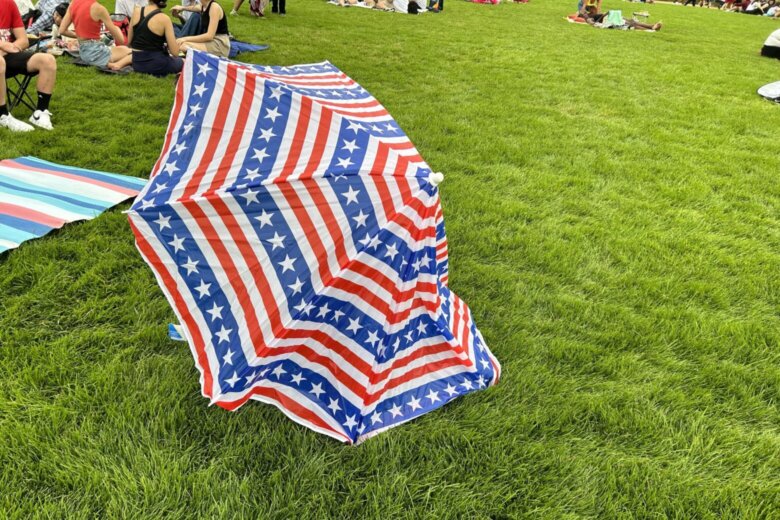
People dressed in patriotic outfits huddled under umbrellas on the National Mall as rain plummeted on the crowd earlier Thursday evening.
Any isolated showers and thunderstorms are expected to fall apart by sunset in time for the firework displays, according to 7News First Alert meteorologist Jordan Evans. Thousands of people are expected to gather on the mall to watch fireworks extravaganza in the nation’s capital.
After a short break in the wet weather, a couple of storms could form once again overnight.
The weather has cooled off and an earlier heat advisory across the region expired at 8 p.m. Temperatures are expected to be in the 70s overnight.
Showers, storms disrupt July Fourth festivities
The forecast prompted temporary adjustments ahead of “A Capitol Fourth,” according to a social media post from the U.S. Capitol Police. Police closed the entrance to the event for more than an hour Thursday. With the thunderstorms dissipating, police reopened the entrance and the concert is expected to start on time at 8 p.m. on CBS.
The Fourth of July in the District concert on Pennsylvania Avenue was paused due to the wet weather. Mayor Muriel Bowser said in a social media post the rain has stopped and concert will go on.
- Listen to WTOP online and on the radio at 103.5 FM or 107.7 FM.
- Current traffic conditions
- Weather forecast
- Closings and Delays
- Sign up for WTOP alerts
Those disruptions came after National Weather Service had forecast that some of the storms Thursday could produce strong, gusty winds, lightning and heavy rain.
Poor air quality ahead of fireworks
Earlier in the day, there was poor air quality in some areas. Northern Virginia and D.C. were under a Code Orange air quality alert, according to The Metropolitan Washington Council of Governments, while Maryland was only facing moderate air quality.
“It’s Code Orange, which is unhealthy for sensitive groups,” said 7News First Alert Chief Meteorologist Veronica Johnson. “If you suffer from lung or heart issues, limit your time outdoors for today.”
The Metropolitan Washington Council of Governments said those sensitive groups also include the elderly, people with asthma, pregnant people and children.
The poor air quality is due to particle pollutions, which the nonprofit Clean Air Partners said often occurs when fireworks meet hot weather.
D.C.’s Department of Energy and Environment said that temporary air pollution levels spike around Independence Day and recommend that sensitive groups limit their time outside before and during fireworks shows. The department also recommends wearing an N95 or K-N95 mask to limit exposure to pollution.
Looking ahead — Friday’s weather
A hot and humid pattern is expected to continue throughout the weekend, with a chance of storms revisiting the D.C. area.
“We are gonna be hot and humid Friday and Saturday with afternoon rain chances,” Whelan said. “Dry on Sunday with highs in the low 90s.”
There will be another heat advisory on Friday with highs in the mid- to upper 90s and feels-like temperatures as high as 109, according to the National Weather Service.
Current weather:
Forecast:
FOURTH OF JULY
Partly cloudy
Risk of showers, storms
Highs: 90-95
Heat Index: near 100-105
Winds: Southwest 5-10 mph
If thunder roars, head indoors. Fortunately, most of the rain and storm activity should be over by the time the fireworks go off in the 9 p.m. hour.
Thursday NIGHT
Mostly cloudy
Lows: 75-80
Winds: Southwest 5 mph
It will be a warm and muggy night with lows in the 70s.
FRIDAY
HEAT ALERT
Partly sunny
PM storms
Highs: 93-97
Heat Index: 100-105
Winds: Southwest 5-10 mph
Plan for an even hotter and more humid day to round out the week. High temperatures will soar into the mid-90s, but with the humidity, feels-like temperatures will near 105 degrees. Additional chance for showers and storms are possible during the afternoon and early evening hours.
SATURDAY
Partly sunny
Highs: 92-96
Winds: Southwest 5-10 mph
It will be another very hot and very humid day with feels like temperatures nearing 105 during the afternoon. An isolated shower or storm is possible.
SUNDAY
Partly to mostly sunny
Highs: 90-95
Winds: Northwest 5-10 mph
A drop in humidity is expected to round out the weekend, which will be a welcome change. It will still be hot with afternoon highs in the low to mid 90s.
Get breaking news and daily headlines delivered to your email inbox by signing up here.
© 2024 WTOP. All Rights Reserved. This website is not intended for users located within the European Economic Area.