Blustery winds, with gusts up to 55 mph, blew through the D.C. area Sunday and are expected to continue through the start of the workweek.
According to the National Weather Service, a wind advisory is in effect for the entire region from now through Monday at 5 p.m. Winds will start to calm Monday evening.
“It can make for some difficult driving and bumpy flights going in and out of the airports,” 7News First Alert meteorologist Jordan Evans told WTOP.
- Listen to WTOP online and on the radio at 103.5 FM or 107.7 FM.
- Current traffic conditions
- Weather forecast
- Sign up for WTOP alerts
Sunday night is already chilly as temperatures are expected to be in the low 30s. Some areas may even dip down to the 20s with the wind chill overnight.
“There could be sustained winds anywhere from 25 to 30 mph in parts of the area as a strong storm system out to the north and east is bringing in the gusty winds,” Evans said.
Strong winds have knocked down trees and caused power outages around the region, specifically in Tysons Corner and D.C.
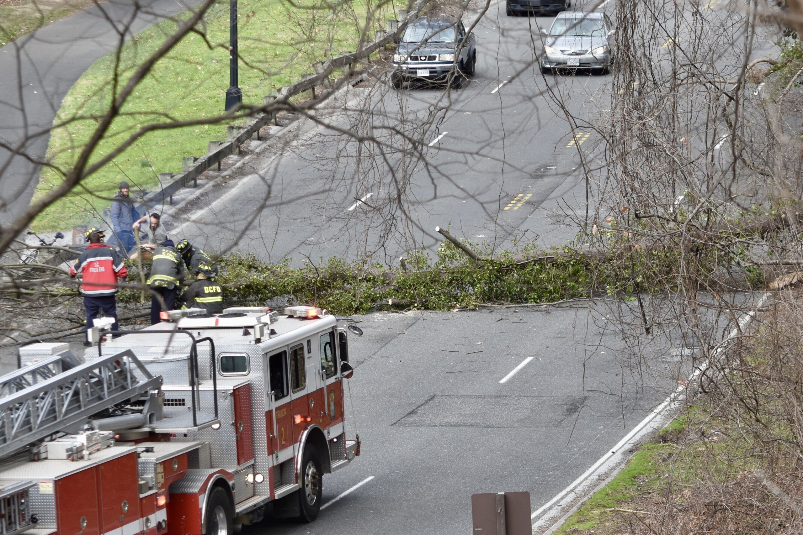
The National Weather Service warned those in the D.C. area that gusty winds could blow around unsecured objects and “tree limbs could be blown down and a few power outages may result.”
Winds knocking out more than trees
Transit around the D.C. area continues to be affected by whipping winds.
The Federal Aviation Administration reported that flights were delayed an average of two hours at Dulles International Airport on Sunday due to the wind. Meanwhile, the Chesapeake Bay Bridge advised that Phase 2 Limited Wind Restrictions were in effect, with officials finishing safety checks before drivers cross.
The NWS advised to use extra caution while driving in the D.C. area during the advisory, especially if “operating a high profile vehicle.”
High winds have damaged some areas and left some without power. As of 6:30 p.m., more than 4,000 customers across the D.C. area were without power due to downed power lines and similar challenges. Most of these outages impacted Dominion Energy customers in Fairfax County, Virginia, though Pepco customers in Montgomery and Prince George’s County, Maryland, also saw widespread outages.
Shortly after noon on Sunday, the National Park Service announced that the Washington Monument was closed for the rest of the day due to high winds.
Forecast
SUNDAY NIGHT: WIND ALERT. Mostly sunny and windy. Temps: 36-42. Winds: Northwest 20-30 mph, with gusts of 40-50 mph.
OVERNIGHT: WIND ALERT. Partly cloudy, windy and cold. Lows in the 30s, with wind chills in the 20s. Winds: Northwest 15-25 mph, with gusts of 30-40 mph.
MONDAY: WIND ALERT. Mostly sunny and breezy. Highs in the 50s. Winds: Northwest 15-25 mph, with gusts of 35-45 mph.
TUESDAY: Sunny and mild. Highs in the mid-60s to 70 degrees. Winds: West 10-15 mph.
WEDNESDAY: Partly cloudy and mild. Highs in the low 70s. Winds: South 5-10 mph.
Current weather
Power Outages Map
The map below contains current power outages in Virginia, Maryland and D.C. This map is updated every 10 minutes.
Get breaking news and daily headlines delivered to your email inbox by signing up here.
© 2024 WTOP. All Rights Reserved. This website is not intended for users located within the European Economic Area.