Listen live for the latest weather updates on the 8s on WTOP.
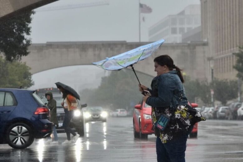
Tropical depression Ophelia is expected to pelt D.C.-area residents with heavy rain and strong winds through Saturday night, but should let up by Sunday afternoon. Here’s what you need to know.
Watches and warnings
The National Weather Service has issued the following alerts:
- A flood watch is in effect from 8 p.m. Saturday night into Sunday morning for urban areas including D.C. and counties in Maryland and Virginia — Anne Arundel, Howard, Montgomery, Charles, Prince George’s and Baltimore counties in Maryland. Arlington/Falls Church/Alexandria, Prince William/Manassas/Manassas Park, Fairfax, King George, Spotsylvania and Stafford counties/cities in Virginia.
- A coastal flood warning for the shoreline in D.C. is in effect until Sunday at 7 a.m., especially around the time of high tide. The unprotected area on the Southwest Waterfront at the D.C. Seafood Market is expected to flood, and water is expected to approach parts of the Hains Point Loop Road, but it will likely be closed.
- A coastal flood warning is in effect in Anne Arundel County for areas close to shore from 8 p.m. Saturday to 8 a.m. Sunday. Up to 2 feet of inundation from tidal flooding in certain areas is possible, according to the National Weather Service.
- A coastal flood warning is in effect for Arlington County and the city of Alexandria through Sunday at 7 a.m., with tides up to two and a half feet higher than normal. King Street in Alexandria is one area expected to see high water.
- A coastal flood advisory is in effect for Fairfax, Stafford and parts of Prince William counties from Saturday afternoon through Sunday morning, with the possibility of flooding of lots, parks and some roads.
Maryland and Virginia’s governors declared a state of emergency on Saturday as the National Weather Service projected two to five inches of rain and possible flooding throughout the region, especially in coastal spots like the Chesapeake Bay and lower Potomac.
- Listen to WTOP online and on the radio at 103.5 FM or 107.7 FM.
- Current traffic conditions
- Weather forecast
- Closings and Delays
- Sign up for WTOP alerts
Flooding, surge, tornadoes possible
For people who have to drive during the storm, Virginia State Police said take it slow, never drive through standing water, don’t tailgate and use your headlights.
A wind advisory was in effect for most of the D.C. area until 8 p.m., with gusts reaching 50 mph. Residents in affected areas are still encouraged to tie down any objects at risk of blowing away.
“Those winds, combined with saturated ground, will be a recipe for downed trees and power lines,” WTOP Meteorologist Mike Stinneford said.
Tides in areas close to the D.C. shoreline could rise as high as two and a half feet above normal — the next high tide is at 3:09 a.m.
8:30PM Radar: Rain and gusty winds from Tropical Depression Ophelia will continue to impact the area overnight along with Tidal Flooding. A Public Information Statement with precipitation totals and maximum wind gusts measured can be found at: https://t.co/deYsRTs9IH pic.twitter.com/nq8efXgNCg
— NWS Baltimore-Washington (@NWS_BaltWash) September 24, 2023
When does the risk of severe weather plummet?
The wet weather is expected to taper off overnight Saturday.
“Sunday morning’s weather will depend on the storm’s trajectory and may include lingering showers and scattered drizzle,” Evans said. “If the storm moves slower, wet weather may extend into the afternoon.”
For the most part, Sunday should be cloudy and breezy with gusts 20-30 mph and highs in the upper 60s.
Canceled events
The weekend weather has led to some event cancellations.
As a result of the tropical storm warning, the Montgomery County Friendship Picnic, Burtonsville Day Festival, Panafest, Hyattsville Arts Festival, Reston Multicultural Festival, Anne Arundel County’s River Day’s event at Fort Smallwood Park and the Kunta Kinte Heritage Festival in Annapolis have been canceled this year.
All activities scheduled for Saturday in Fairfax County Public Schools and Howard County Public Schools or on school grounds have also been canceled.
The Washington Nationals’ second Saturday game against the Atlanta Braves was also postponed and is now taking place on Sunday, Sept. 24, at 6:35 p.m.
Forecast
SATURDAY NIGHT: FLOOD ALERT
Rain and wind
Scattered to widespread overnight
Rain Accumulation: Additional 1 to 2 inches
Wind Gusts: 30-40 mph
Lows: 60s
SUNDAY:
Leftover showers, cloudy all day and breezy
Wind Gusts: 20-30 mph
Highs: Upper 60s
Current weather
WTOP’s Jessica Kronzer and Thomas Robertson contributed to this report.